
A pictorial look at the 1999 Gympie floods
Take a walk down memory land with this pictorial tribute to the 1999 floods in Gympie
Gympie
Don't miss out on the headlines from Gympie. Followed categories will be added to My News.
THE Mary River is the beating heart of the Gympie region, originating in the Conondale Range and following a winding course, mainly north, for 305km before emptying into the Great Sandy Strait, the narrow stretch of ocean between Fraser Island and the mainland.
The river is navigable to Maryborough, 37km from its mouth.
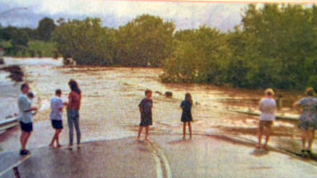
Every now and then, the Mary breaches her vertical banks and sends her muddy floodwaters into the Gympie CBD and many properties that line her throughout the region.
February floods have been common through history, though plenty of floods have also occurred in almost every other month of the year.
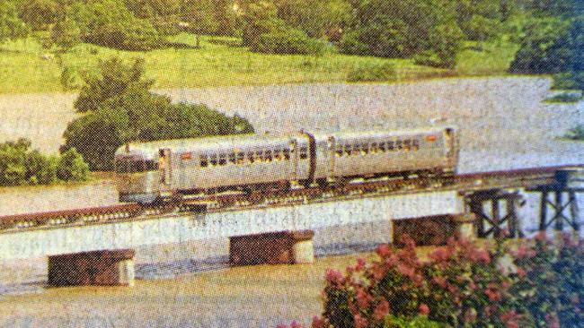
In February, 1999, the region received 478mm of rain and the Mary reached 21.95m.

Pedo films, bestiality, rape: Father’s vile sexual abuse of 4yo daughter
A former public servant who ‘deprived’ his daughter of her childhood by years of shocking sexual abuse including raping her, has been handed one of the harshest sentences possible. WARNING: DISTRESSING CONTENT

New details in freak Bruce Highway crash which left one seriously injured
Police are seeking public help in their investigations into a shocking crash on the Bruce Highway between Gympie and Maryborough which left a driver with life-threatening injuries.