
Cold snap coming to southeast Queensland this weekend
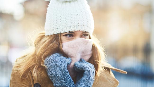
Frost, thunderstorms and zero degree temperatures are predicted in southeast Queensland this weekend as a cold blast - dubbed an ‘icy blanket’ - hits the state sending the mercury plummeting.

QLD News
Don't miss out on the headlines from QLD News. Followed categories will be added to My News.
An ‘icy blanket’ cold blast is set to see the mercury in southeast Queensland plummet to near zero degrees this weekend.
A powerful and complex low pressure system - dubbed an ‘icy blanket’ - is moving across the southeast of Australia, with the trough extending that will bring freezing cold air to Queensland through the weekend.
Brisbane will feel chilly temperatures as low as 9 degrees and parts of the Darling Downs could drop to 0 degrees, as a cold front moves across Queensland.
A southern cold snap is heading for #Queensland late this week with cooler temps for most of the State, rainfall in the south and raised dust in the west. Single digit minimums & frost forecast for some areas. Stay up to date w/ #QldWeather forecasts: https://t.co/b4Mpsop7GR ðŸŒ¡ï¸ pic.twitter.com/huLoEWJKjK
— Bureau of Meteorology, Queensland (@BOM_Qld) April 27, 2020
Bureau of Meteorology forecaster Peter Markworth said the southeast will experience minimum temperatures 6-10 degrees below average on Saturday for this time of the year.
The minimum temperature forecast in Brisbane for Saturday is 9 degrees, with a maximum of 24.
“Saturday is likely to be the coldest day,” Mr Markworth said.
NO NEW COVID CASES: QUEENSLAND’S LATEST CORONAVIRUS NEWS
“There is a chance of frost across the southern interior from Friday onwards where temperatures get below 5 degrees; the most likely region for that is around the southern Darling Downs and Granite Belt.”
Weatherzone meteorologist Joel Pippard said mornings in the southeast are going to be “very chilly” and winds will make weather during the day feel up to 3 degrees colder than it is.
“We’re going to see cooler temperatures that we haven’t really seen so far this year and the winds are going to be the biggest thing that’s going to make people think that it’s colder,” Mr Pippard said.

“Even though there is going to be sunny skies, winds will be a little bit gusty, so it might feel about 3 or so degrees below the actual temperature, which means it will feel (at maximum temperature) about 20-21 degrees over those three days.”
The trough will also bring the possibility of severe thunderstorms with damaging winds and large hail in southeast Queensland from Thursday night.
Mr Markworth sai the cold air will persist over the weekend and the start of next week.
“Things will gradually start to warm up again, eventually,” he said.
“The dry air will move across, that allows things to cool down as they will in the coming days and in the weekend.
“From there, it’ll just be a slow, gradual warming over time. It’ll last into probably mid next week, those cooler than average temperatures.”
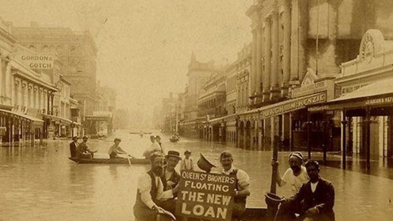
‘Wall of water 50ft high’: Great Brisbane floods of 1893
In a freakish turn of weather Brisbane flooded three times in February 1893, leaving a third of the population homeless and claiming the lives of 35.
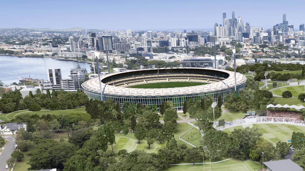
The Olympic stadium Palaszczuk didn’t want is back
An Olympic stadium rejected by the Palaszczuk government is back and being spruiked as a cheaper, quicker and “vastly superior” alternative to Victoria Park.