
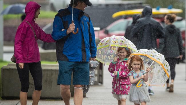
NSW weather: Heavy rain continues as flood warnings issued
Police and SES have had to call off a search for a man who is feared to have drowned in Lismore as flood waters reached dangerous levels.
NSW
Don't miss out on the headlines from NSW. Followed categories will be added to My News.
A major search will resume on Monday morning for a man who is feared to have drowned in Lismore’s rising flood waters.
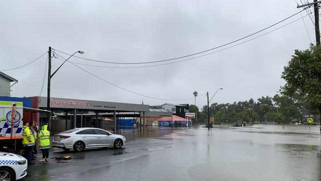
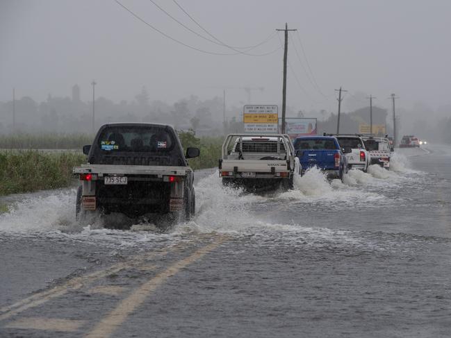
Police arrived near Brewster and Uralba Street in Lismore on Sunday and spotted a man calling out for help but lost sight of him shortly after.
Police and SES searched the water and surrounding areas but had to stop their search as flood waters reached dangerous levels.
It comes as the SES undertook a major doorknocking operation in Lismore on Sunday night alerting residents and businesses to watch and act.
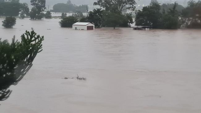
The Wilson River is expected to reach 11m on Sunday night and into Monday morning -- 80cms above the height of the levy.
The rising river level is likely to overwhelm the town’s CBD where businesses spent the weekend packing stock and preparing to flee.
PREMIER’S PLEA AS NSW BRACES FOR FLOODS
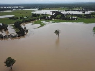
Adeadly weather event that has claimed the lives of six people in Queensland is moving down into NSW, with the state’s northeast preparing for torrential rains and serious flooding.
Heavy rain and thunderstorms have smashed Queensland in what is believed to be the worst flooding since 2011. One of the victims was an SES volunteer.
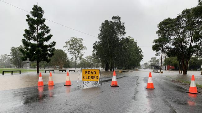
Authorities are expecting more evacuation warnings as rain continued to pound NSW‘s north coast.
SES spokesman David Rankin said Lismore, Grafton, Nambucca and Bellingen were some of the areas to watch while an evacuation order was in place in Tumbulgum and an evacuation warning was sent out to the low lying island near the Clarence River at Maclean.
“At the moment Lismore is currently at 6.10 metres, it‘s at the minor level at the moment but it is rising quite rapidly. There is an expectation with the Wilson’s River that Lismore could get into major flood level tonight and into tomorrow,” he said.
“That is the worst case scenario from our perspective based on the predicted rainfall.”
Tumbulgum residents were ordered to evacuate at 9am on Sunday morning after the river was expected to potentially reach two metres.
An evacuation centre has been set up at Nambucca and Bellingen were some of the areas to watch while an evacuation order was in place in Tumbulgum.
“At that level the evacuation route is covered by the flood water. Most people in that community are quite familiar with flooding unfortunately.”
Rivers in Nambucca and Bellinger are also being closely monitored with the Lavender Bridge at Bellingen highly susceptible to flooding.
“Any more flood water rising in that area could see that bridge go underwater,” he said.
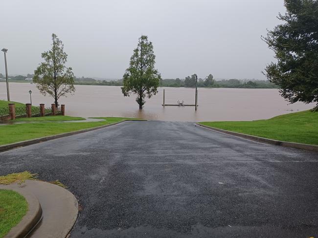
Grafton‘s Clarence River sat at 3.88 metres on Sunday afternoon and Mr Rankin said it was “rising very very slowly” making it unlikely that an evacuation order would be needed on Monday.
“At the moment the Bureau (of Meteorology) is suggesting that the river could get to 5.4 metres tomorrow at Grafton which is a major flood but not beyond the flood barriers in town,” he said.
Mr Rankin said “a hell of a lot of rain” is expected on Sunday with the bureau predicting between 80 and 100ml across all river catchments along with isolated thunderstorms with the potential to drop up to 250ml in isolated areas that BOM cannot predict.
Authorities in Queensland have warned the horror weather could match the devastation seen in 2011, when freak storms claimed dozens of lives and caused millions of dollars worth of damage.
“For many parts of southeast Queensland this is the biggest event they will see in a number of decades,” Queensland Police Minister Mark Ryan said.
“There are some parts where it is intensifying and the impact on the community could be significant.”
Residents in nearly 100 suburbs on Brisbane’s southside have been scrambling in the early hours of Sunday morning as rising water puts homes under threat, with the 7.30am high tide delivering a “perfect storm” of conditions.
The Brisbane River reached 3.1m this morning with 1,430 homes in Brisbane impacted above the floorboards.
Authorities have warned river levels across the southeast will continue to peak with Maryborough expected to experience worse inundation than the January floods and Beaudesert set for major flooding.
The “rain bomb”, an intense storm system, that dumped more than 220mm of rainfall over Brisbane in the 24 hours to Saturday morning is set to make its way into NSW before Monday.
The NSW Bureau of Meteorology (BOM) issued a severe weather warning for heavy rain all the way from the Queensland border to Port Macquarie.
Authorities are preparing for flash flooding, with six-hourly rainfall totals of up to 250mm possible around Lismore, Grafton, Coffs Harbour, Byron Bay, Ballina, Casino, Kyogle, Yamba, Maclean, Woolgoolga, Sawtell and Dorrigo.
“The focus over the next 24 to 48 hours is the far northeast corner of NSW, with all that rain coming down from north of the border,” BOM’s Jonathan How said.
“Most of those areas have already received their monthly rainfall totals two or three times over so the ground will flood straight away.”
On Sunday morning Premier Dominic Perrottet pleaded with residents in Northern NSW to avoid driving in flood waters and to follow instructions from the State Emergency Service.
Mr Perrottet said flood warnings are in place in the state’s northern regions but are expected to be issued for the south in coming days.
“Please follow the instructions from our SES volunteers. We know there are substantial issues in the north,” he said.
“Please don’t drive through flood waters. You are putting your lives at risk.”
Emergencies Services Minister Steph Cook said the SES had support from the Rural Fire Service and Fire and Rescue NSW to prepare for more flooding.
“We have pre-positioned aircraft up on the far north coast and they are able to respond to any incidents that arise out there,” she said.
Bureau of Meteorology Senior Hydrologist Ailsa Schofield told people to remain alert and vigilant as Queensland’s chaotic weather makes its way to NSW.
“There is some very serious weather on its way … we have already seen some very heavy rainfall totals
She said Sunday was the “primary rainfall day”
“We won’t start to see the rainfall ease until tomorrow … we have five catchments where major flood warnings are (currently in place).”
Ms Schofield said Wednesday could see a renewed “rainfall day” for the southern parts of NSW.
SES Commissioner Carleen York said the weather would put major demands on the communities.
“Preparation is the key. There is a lot of damage that is done to homes because people aren’t prepared,” she said.
Ms Schofield said Lismore will be among the worst hit areas but rainfall levels are expected to be lower than those seen during the devastating 2017 floods.
She added that the low pressure system will travel down to the south coast area.
“At this stage as the system is broadly moving south you can expect to see the impact. Right now we are assessing the risk … in many of the areas the land is already saturated and very wet. It means we don’t need an enormous amount of water before the river rises.
Ms York said 550 SES volunteers were in the Central Coast and northern NSW but the agency would ensure there were volunteers reserved for the south.
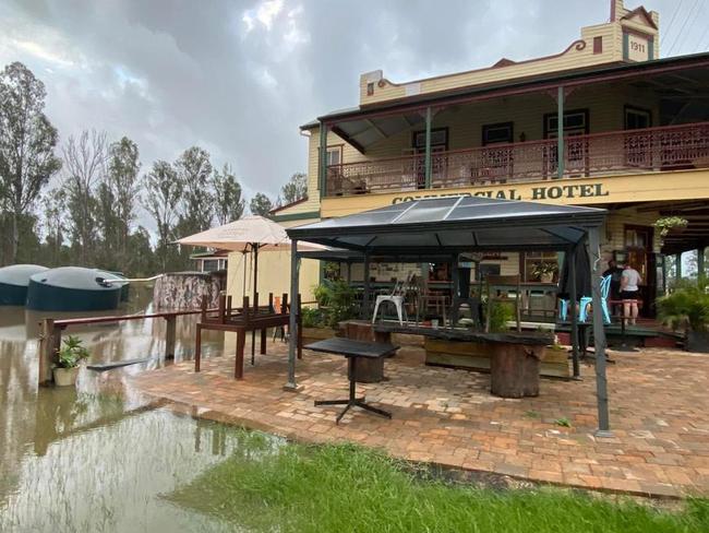
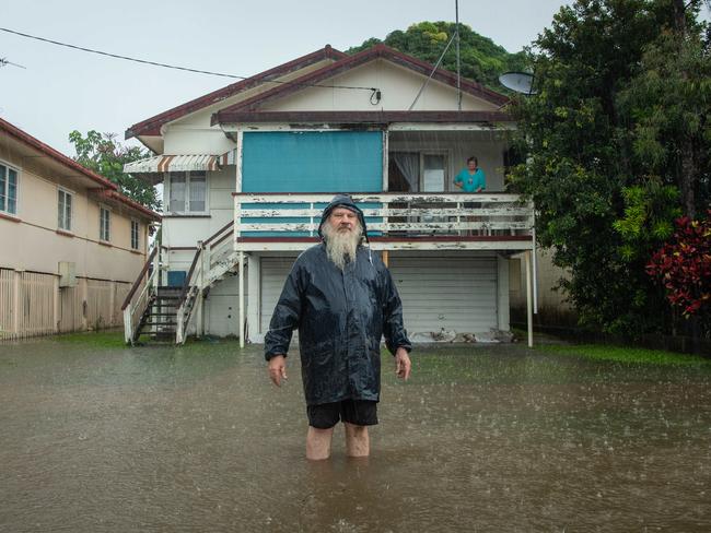
Parts of northern NSW have already been battling against rising flood waters for days, with the Commercial Hotel at Rappville having started to flood on Thursday. On Friday night, the pub’s owners Lisa and Colin labelled the rising water levels as “bloody disastrous”.
“Locals say this may be worse than last year’s March floods,” a Facebook post from the pub read.
“This flood is already deeper than the March floods and now thigh high in areas outside the front of the pub … a lot of damage has occurred, there will be a massive clean-up.”
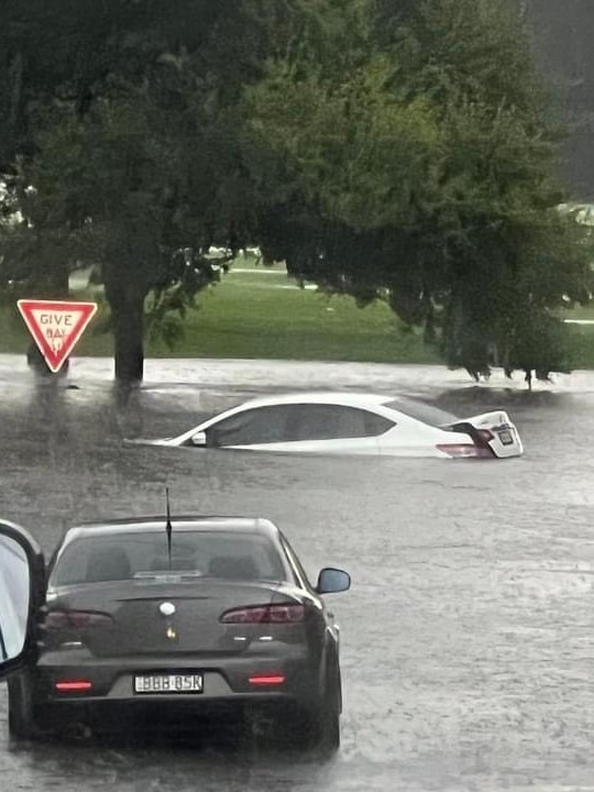
The Central Coast has also been impacted – a man drowned as his car was swept away by floods and the SES Unit has responded to 180 call-outs around the Gosford area.
MORE RAIN
The torrential rain smashing the state is expected to stick around for days to come, with flood warnings issued for parts of northern NSW.
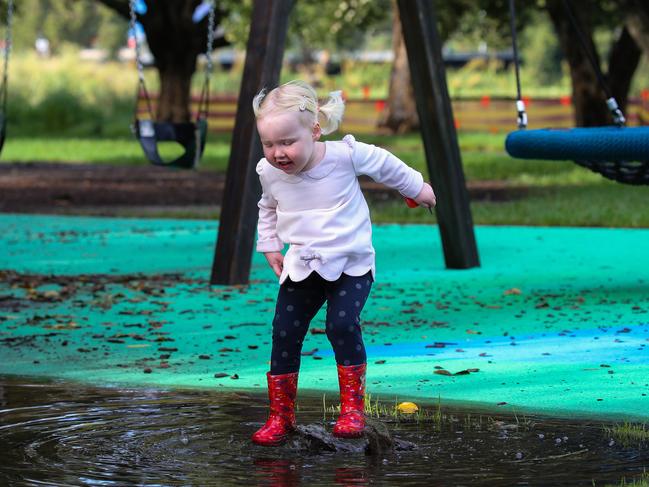
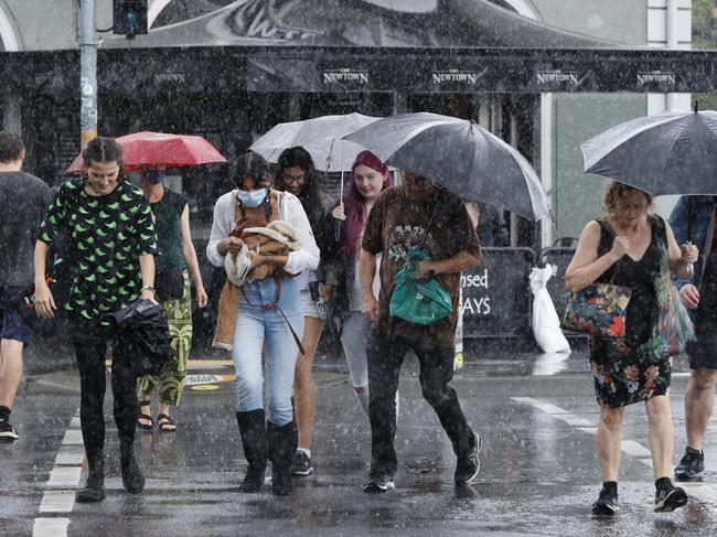
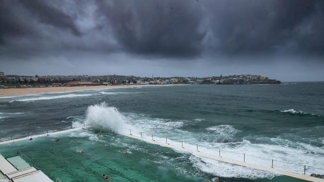
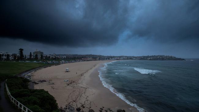
Sydney has recorded its wettest summer since 1991, according to experts, as torrential rains blanket much of NSW – proving fatal on the Central Coast when a man died after his car became trapped in floodwater in the early hours of Friday morning.
Police found the body of a local 54-year-old man in a submerged Toyota Land Cruiser on Oak Rd in Matcham on Friday night, with authorities warning of more dangerous conditions over the next week.
In Sydney, Allambie copped 80mm of rain in the past 24 hours, while Terrey Hills recorded 73mm.
Olympic Park Rye and Mosman all saw rainfall of more than 50mm overnight.
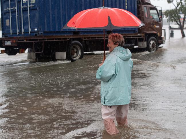
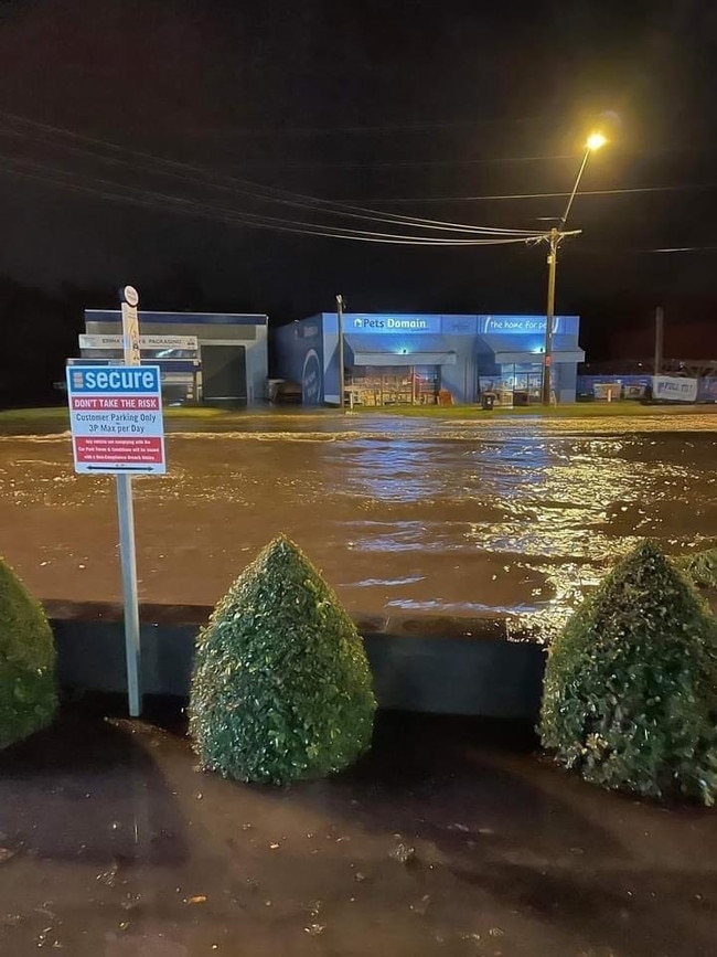
On the Central Coast, Gosford recorded 38mm, while Koolewong copped 34mm. SES volunteers at Gosford have been kept busy over the past few days, as flood waters wrecked havoc across the town and into Woy Woy.
On the Mid North Coast, the Bureau of Meteorology has issued a severe weather warning for heavy rainfall. Flash flooding is expected, with six-hourly rainfall totals of up to 250mm.
Brisbane copped more than 220mm of rainfall overnight, with the weather system expected to bring flash flooding to the northern parts of NSW.
Mr How said Sydney would experience another few soggy days, with the rain expected to continue up until next Thursday.
“It’s definitely not beach weather with plenty of showers still around,” he said.
Got a news tip? Email weekendtele@news.com.au


Originally published as NSW weather: Heavy rain continues as flood warnings issued
Join the conversation

Probe after Sydney dancer dies suddenly
A coroner will investigate the shocking death of a talented 18-year-old Sydney dancer who died suddenly in her home.
Read more

Why kids shouldn’t do what I did
Original teen influencer Brittney Saunders, who has more social media followers than NRL star Nathan Cleary, says social media must be off limits to under-16s.
Read more