SES crews prepare for major rain event in northern Tasmania
Tasmania’s hundreds of State Emergency Service volunteers received high praise on Saturday after working through the night to deal with roof damage and other chaos caused by heavy downpours. VIDEO, WHO GOT THE MOST RAIN>>>
Tasmania
Don't miss out on the headlines from Tasmania. Followed categories will be added to My News.
This article is unlocked and free to read in the interest of community safety. Click here for full digital access to trusted news from the Mercury for just $1 for the first 28 days.
LATEST LOCAL NEWS:
- Eight new Victorian hot spots now high-risk to Tassie
- Exposed: Tassie’s drink and drug drivers revealed
- Aged care provider issues apology over handling of welfare concerns
LATEST ADVICE
4.30pm Saturday: Praise for volunteers after chaotic night
TASMANIA’S hundreds of State Emergency Service volunteers received high praise on Saturday after working through the night to deal with roof damage and other chaos caused by heavy downpours.
Just under 100 volunteers put in a total of 600 hours on Friday night and Saturday morning, responding to nearly 80 requests for assistance, predominantly in the North-West.
SES acting assistant director of operations and resources Nick Connolly said the state’s 650 SES volunteers were an incredible asset for the state.

“The time they give to SES and to the community at these times is absolutely vital to people’s safety and wellbeing,” Mr Connolly said.
“The commitment they and their families make, and also their employers who let them volunteer, is just a fabulous resource to Tasmania.”

Most of the call-outs related to flash flooding, which caused water to inundate some homes and properties, as well as leaking roofs, gutters and drains.
There were 54 requests for help in the North-West, 13 in the South, nine in the North and two in the East relating to high winds.
Mr Connolly said emergency services would continue to monitor elevated river flows, including with a helicopter based in Launceston.
“We ask road users to be aware of the increased hazards, including water and debris across roads,” he said.
Meteorologist Michael Conway from the Bureau of Meteorology said some North West towns experienced their highest daily rainfall recorded in February, including Wynyard (100mm), Devonport (67mm), Low Head (74mm) and Scottsdale (59mm).
Other parts of the state also received heavy localised deluges, including Longley (68mm) and Woodbridge (56mm).
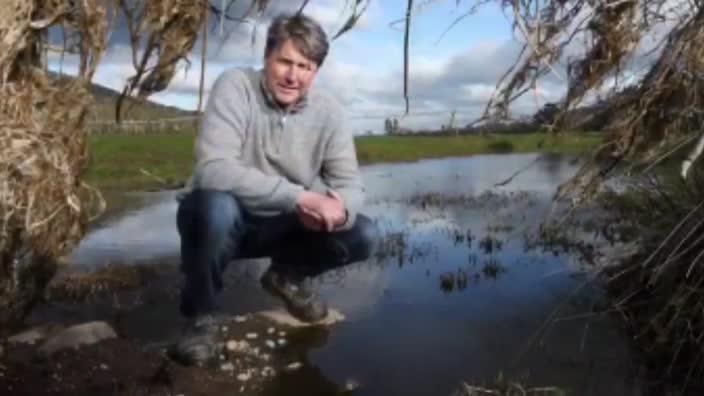
Winemaker Johnny Hughes of Mewstone Wines was thrilled with the 45mm that fell at his vineyard at Flowerpot, particularly for the sake of his younger vines that will produce their first small crop this coming vintage.
“It was our first significant rainfall for some time down south. We’ve had a lot of predictions of 10 to 20mm but it hasn’t eventuated, so for us the rain was a real positive, seeing it running into the dam,” Mr Hughes said.
“We haven’t had much disease pressure and I think, as long as people are on top of their vineyards, the rain will be very welcome.”
11am Saturday | Debris and other hazards around rivers and flooded roadways
Tasmanians are being warned to take care around rivers and flooded roadways due to the risk of debris and other hazards after heavy rain overnight.
Torrential downpours caused flash flooding, particularly in the North West, and some homes were also damaged.
A popular camp ground at a wildlife park in the North West was inundated on Saturday morning, but staff had prepared for the forecast flooding.
Wings Wildlife Park manager Gena Cantwell, who grew up on the Gunns Plains property and is used to annual flooding, said all animals had been moved to higher ground.
“We have had to deal with a few floods now and we rang the campers last night and advised them to tow to higher ground, but in the early hours of the morning Dad was down helping a few of them who had decided to ride it out,” Mrs Cantwell said.
She said that the water over roadways was subsiding quickly and the park’s café would be open for light meals this afternoon.
“Anyone driving past is more than welcome to come in. The water tends to drop as quickly as it comes up,” she said.
Meteorologist Michael Conway from the Bureau of Meteorology said that while more showers and possible thunderstorms were expected across the state, no heavy downpours were forecast.
“We’re looking at about another 5 to 15mm in the North and North West and up to 5mm elsewhere, but little n the East,” Mr Conway said.
9.45am Saturday | Highest rainfall totals in almost 5 years as conditions ease
A drenching weather system which crossed Tasmania overnight has moved to the east of the state, as areas recorded their highest daily rainfall totals in almost five years.
While the severe weather has passed, the situation will continue to be monitored and further warnings will be issued if necessary.
Ailsa Bonell’s backyard at Blackwood Creek turned into a raging river.
Several locations in the north reported their highest daily rainfall since June 2016, including Wynyard (99.8mm), Devonport (67.4mm) and Liawenee (75.2mm).
Several locations in the north have reported their highest daily rainfall since June 2016, including Wynyard (99.8mm), Devonport (67.4mm) and Liawenee (75.2mm). These are also the highest daily rainfall recorded in February at these siteshttps://t.co/SRi8CSQclW pic.twitter.com/BeLB2NQv6A
— Bureau of Meteorology, Tasmania (@BOM_Tas) February 5, 2021
Since 9am on Friday, the highest rainfall totals reported were Fisher River 134mm, Great Lake East 116mm Cradle Valley 102mm, Wynyard 100mm, Meander 86mm, Deloraine 77mm, Liawenee 75mm, Mt Barrow 68mm.
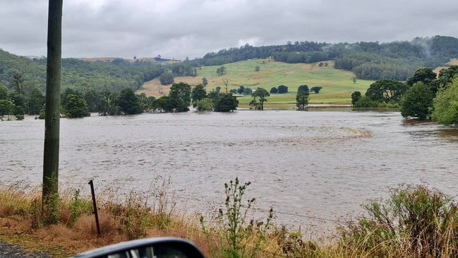
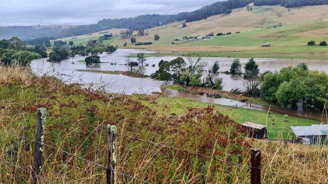
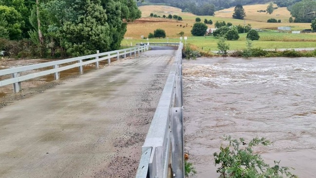
Since Friday night, 80 SES crews have responded to 76 requests for assistance.
Most requests were in the North West region, particularly around Wynyard and Devonport. The requests related to flash flooding causing water inundation into properties, and leaking roofs, gutters and drains.
The following Watches/Warnings are current:
- Moderate Flood Warning for the Mersey River
- Minor Flood Warning for the Macquarie River
- Minor Flood Warning for the Meander River
- Flood Watch for North West, North and North East catchments
- Initial Minor Flood Warning for the North Esk River
- Initial Minor Flood Warning for the South Esk River
Experts on Thursday warned of “one of the most significant rainfall events to hit northern Tasmania” since the 2016 floods was on the way.

9pm Friday | Gauges fill and thunderstorms lash the North West
Waratah Wynyard mayor Robby Walsh said the rain was absolutely torrential.
“I’m looking out the lounge room window and the rain is just bouncing off the ground,” he said.
“And we’ve had thunder like I’ve never heard before.
“I just went and let the horses out of their little paddock into a bigger one, so they don’t get freaked and can be a bit more at ease.”
Cr Walsh said their farm was on the edge of the creek that runs into Wynyard, and he could see the water rising.
“The cars on the road are going by very slowly, it’s that heavy that it’s stopped a lot of the traffic.”
Very Heavy rain is currently falling over Burnie and Wynyard, with over 50mm recorded since 9am. This burst of heavy rain is expected to continue for a few hours as a line of storms 'trains' over the area. You can monitor the rain and storms on the radar: https://t.co/S0EE3csalf pic.twitter.com/vRRJV6EINA
— Bureau of Meteorology, Tasmania (@BOM_Tas) February 5, 2021
He said their land hadn’t dried off all summer.
“It’s remained green. It’s been a great year for farmers - not such much for the tourists.”
BoM data shows Wynyard has copped a whopping 90mm of rain since 9am this morning while widespread thunderstorm activity batters northern Tasmania.
A Tasmanian spokesman for the bureau said a flash flooding risk across the state is expected to ease early tomorrow morning
The wild weather at this stage is mainly contained to the north, but Hobart might get a “bit of a rumble” of a thunderstorm early tomorrow morning alongside a short sharp shower according to forecasters.
Regular updates on this weather event will continue here tomorrow morning
7pm Friday| Emergency services brace for storm
Emergency services are braced for havoc as the Bureau of Meteorology warns widespread minor and moderate flooding may occur across numerous catchments in Tasmania’s north from early Saturday morning, with isolated major flooding possible.
The high rainfall totals come as a complex low pressure system brings a band of tropical moisture over Tasmania during Friday and early Saturday.

The Bureau warns Isolated thunderstorms are likely as well as the risk of “intense rainfall”.
Widespread rainfall totals of 40-80 mm are forecast in the north of Tasmania overnight, with isolated falls of 100-200 mm possible about elevated parts, including the Western Tiers and Northeast highlands. The heavy rain is expected to ease during Saturday morning, According to the BOM.
“Rapid river rises are expected in response to forecast rainfall,” a statement said.
The rain radar is showing bands of thunderstorms forming over Bass Strait and moving over northern Tasmania. This is expected to continue overnight. The storms will bring gusty winds and waves of heavy rain that may lead to flash flooding over much of northern Tasmania. pic.twitter.com/wj2EpeTiwQ
— Bureau of Meteorology, Tasmania (@BOM_Tas) February 5, 2021
“Widespread minor to moderate riverine flooding is expected to develop in the flood watch catchments from early Saturday morning, with isolated major flooding possible.”
The SES has advised people across the northern half of the state to make preparations for heavy rainfall overnight.
“People planning on camping or caravanning in low lying areas which are close to rivers, creeks and streams in the northern half of the state need to take preventative action today (Friday),” an SES statement read.
“This includes camping areas along the Lower Mersey, Forth and Leven Rivers, and areas such as Deloraine, Derby, Longford, Ross, including national parks.”
“They need to be aware with this current weather forecast that river and stream levels can rise very quickly.
“Emergency services recommend moving to higher ground this afternoon.”
Tasmanian River systems likely to be affected include:
- North Esk River
- South Esk River
- Meander River
- Macquarie River
- East Coastal Rivers (north of Bicheno)
- Ringarooma River
- North Coastal Rivers
- Tamar (Launceston)
- Mersey River
- Forth River
- Northwest and Central Coastal Rivers
- Arthur River
SES advises people to do the following to prepare:
- Check bom.gov.au for the latest weather forecast and warnings.
- Check that family and neighbours, especially those who are vulnerable, are aware of warnings and have a plan in place.
- Be prepared for flash-flooding.
- Clear drains and gutters of debris so they flow freely.
- Have a plan for managing pets and livestock.
- Be prepared for power outages.
In the event of heavy rainfall and flooding:
- Supervise children closely.
- Manage pets and livestock.
- Never enter or drive through floodwaters, and when driving look out for debris on roads including fallen trees and power lines.
- Report power outages to TasNetworks on 132 004.
- Listen to the ABC local radio or check www.ses.tas.gov.au for further advice.
- Call SES on 132 500 for flood and storm-related emergency assistance.
- Dial triple-0 (000) in a life-threatening emergency.
2.30pm Friday | Heavy rainfall and damaging winds on the way
The Bureau of Meteorology’s Tasmanian office has issued an updated warning on the significant rainfall event expected to lash the state this weekend.
Rainfall totals of 40-80 mm are possible across much of northern Tasmania during Friday and Saturday.
Around 100-200mm are possible across elevated areas, including Western Tiers and Northeast Highlands.
Thunderstorms may bring additional rain and heavier falls.
Damaging winds up to 80-90 km/h are possible along the East Coast from Friday evening to Saturday morning.
Multiple warnings are current, including a flood watch as catchments are already wet and rivers will be responsive to forecast rainfall.
8am Friday | Severe weather warning for damaging winds
Damaging north to north-easterly winds, averaging 50 to 60km/hr with peak gusts around 80 to 90km/hr, are expected to develop along the east Tasmanian coast this evening, including the Furneaux Islands and parts of the northeast.
Locations which may be affected include Whitemark, St Helens, Swansea, Bicheno, Orford and Fingal.
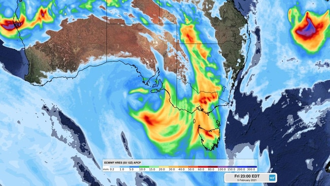
Weatherzone is reporting the atmosphere “will have all of the ingredients for severe thunderstorms” today, particularly over northern Tasmania, central and eastern Victoria and southern and western NSW.
“Some areas could even see supercell thunderstorms, which are very dangerous rotating storms that can produce flash flooding, destructive winds and giant hail. Supercells aren’t guaranteed on Friday, but they are an elevated risk.”
4.06am Friday, February 5 | Severe weather warning for heavy rainfall
Rain across the northern half of Tasmania will increase as a very humid north to north-easterly airstream develops over the state. The rain is expected to become heavy during the afternoon as the airstream strengthens and interacts with the mountains.
Thunderstorms are also expected within the rainband and may deliver isolated, heavier rainfall. The heavy rain is expected to ease during Saturday morning as a trough crosses, bringing north-westerly winds to the area.
Heavy rainfall which may lead to flash flooding is expected across parts of the northern half of Tasmania from this afternoon to Saturday morning, with more intense rainfall possible across elevated areas across the north west and Central Plateau.
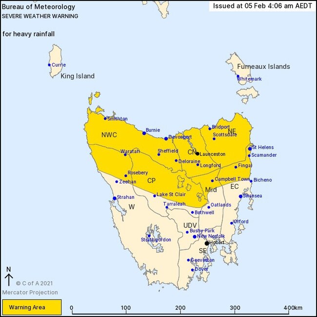
During Friday evening to Saturday morning, 40mm to 80mm of rainfall is possible across much of the northern half of Tasmania. However much higher rainfall of around 100mm to 200mm is possible across elevated areas, including the Western Tiers and Northeast Highlands. thunderstorms are also expected with the rain and may bring isolated heavier rainfall across the whole area.
The heavy rain is expected to ease during Saturday morning.
Recent rainfall has left catchments across the north relatively wet, so rapid river and rivulet rises are likely late Friday and during Saturday — check the riverine flood watch and flood warnings at www.bom.gov.au/tas/warnings
Locations which may be affected include Devonport, Burnie, Smithton, Launceston, Scottsdale and St Helens.
A road weather alert is also current.
FROM THE EXPERTS …
Manager of Hazard Preparedness and Response Tasmania Simon Louis explained a “very tropical” band of rain will move across Tasmania, leading to very heavy rainfall starting in the northwest Friday morning.
“We’re expecting to see 40-80mm of rain widespread (in the warning area) with the potential for much higher totals in the 100-200mm range in elevated areas including the Western Tiers and Northeast Highlands,” Mr Louis said.
“We could see a lot of thunderstorm activity with this rainband which could enhance the amount of rainfall we get so all of these things together means there’s quite a high risk of flash flooding, rivulets coming up quite rapidly and even flooding in the major rivers.
“With the very tropical and humid air mass and the potential for thunderstorms this could very well be one of the most significant rainfall events in the north of Tasmania (since 2016).”
The June 2016 event saw more than 100 properties flooded, more than 100 people rescued from floodwater and many towns including Latrobe inundated and damaged.
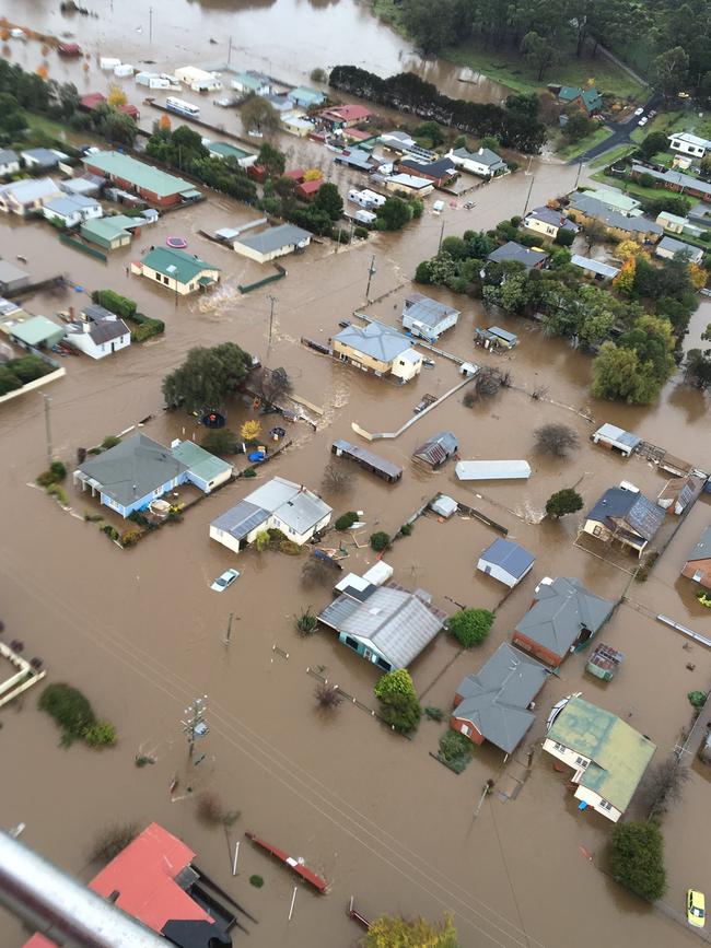
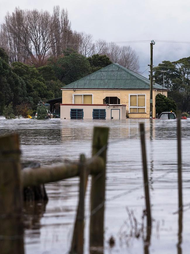
Tasmania SES Acting Assistant Director Operations and Resources Nick Connelly warned residents to prepare their homes and limit travel to avoid risking their lives if flash flooding occurred.
“We’re asking people (to be) prepared for the possibility of being cut off in remote areas,” Mr Connelly said.
“Look out for pets, stock on the rural properties and make sure children are supervised and vulnerable people in their community (are looked after).”
Mr Connelly said they have alerted all SES units that may be impacted by the weather event to be on standby, as well as preparing sandbags.
“We’re standing up most of the units across the north, northwest and east coast to make sure we can support any units that have too many tasks to undertake,” he said.
“We do have concerns with flash flooding event and what that could lead to, so asking residents to be prepared or not out in it at all.”
If residents require SES assistance, phone 132 500. For life-threatening emergencies, phone triple-0.
Originally published as SES crews prepare for major rain event in northern Tasmania


