Explosive new report virtually pinpoints location of missing flight MH370
DESPITE an explosive report virtually pinpointing the location of MH370, the government says it won’t restart its recovery mission yet.
STARTLING new evidence has virtually pinpointed the location of MH370 — 1258 days since it disappeared.
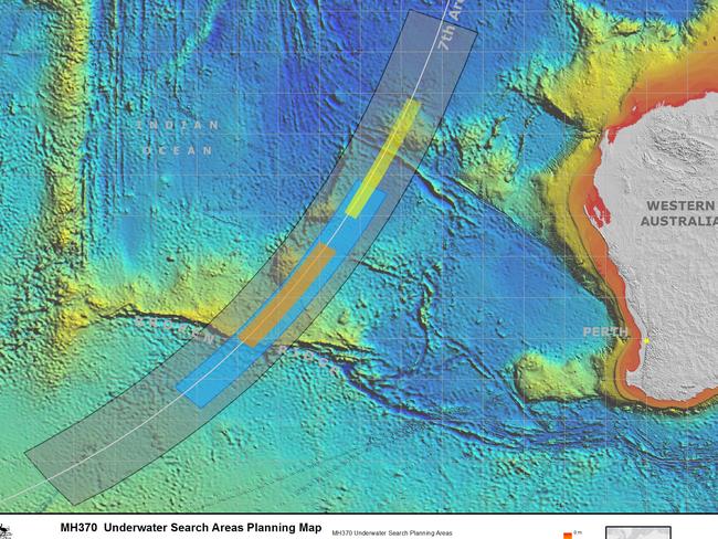
The Australian Transport Safety Bureau has today released an explosive new report that effectively narrows the search zone for the missing plane down to an area half the size of Melbourne.
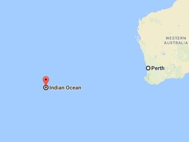
The report places the most likely location of the aircraft “with unprecedented precision and certainty” at 35.6°S, 92.8°E — in between Western Australia and Madagascar.
However the Australian Government, which led the search effort until it was suspended in January, is unlikely to resume the mission based on this new information.
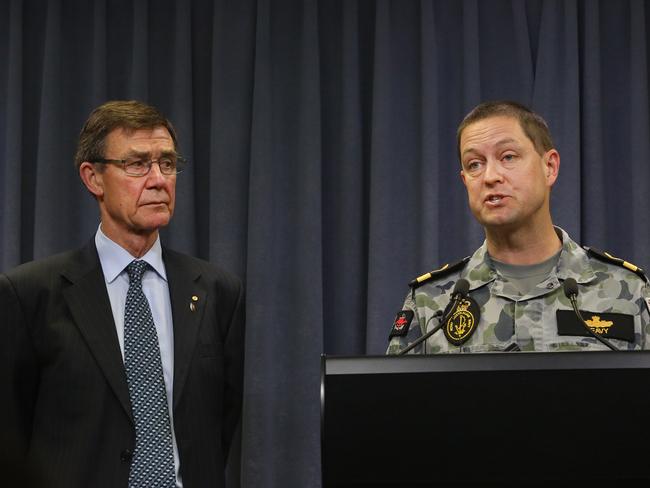
ATSB chief Greg Hood said he would have liked to see the search continue but admitted it would require more conclusive evidence to convince the government.
“Clearly we must be cautious. These objects have not been definitely identified as MH370 debris,” Mr Hood said.
Malaysian transport minister Dato Sri Liow Tiong said the newly defined area was not enough to go on and it was hoped debris drift modelling would help narrow the location further.
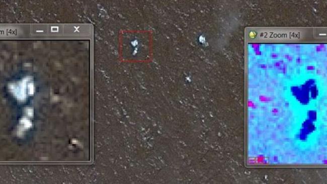
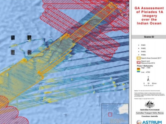
GeoScience Australia has been examining four satellite images of objects floating on the southern Indian Ocean taken two weeks after the plane went missing in the area identified late last year as MH370’s likely resting spot.
They found 12 objects in those images that they deemed man-made and 28 that they regard as possibly man-made.
The images were taken by a French Military satellite in late March 2014 but were discarded by authorities. The ATSB was not involved in the search at that time.
The drift modelling initially released late last year identified an area of 25,000sq km just outside the original search area.
Today’s report combines a refinement of that drift modelling as well as the discarded satellite images to narrow the likely search zone down to an area of just 5000sq km.
As part of the latest report, all satellite imagery of the relevant new area came up for review.
MORE: How MH370 crash unfolded
Australia’s Transport Minister Darren Chester hasn’t ruled out a future search for MH370 but has not indicated the latest report will spark a new operation.
“As always, my thoughts are with the family and friends of the passengers and crew,” Mr Chester said.
“I welcome the CSIRO and Geoscience reports but it is important to note that it does not provide new evidence leading to a specific location of MH370.
“Malaysia is the lead investigator and any future requests in relation to searching for MH370 would be considered by Australia, at that time.”
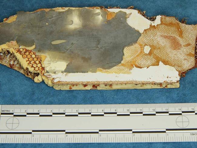
The dimensions of the objects found in the satellite images are comparable with some of the debris items that washed up on African beaches.
Their location near the “7th arc” of the search zone makes them impossible to ignore, the report states.
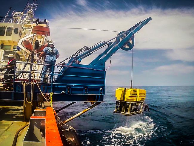
The new plot is based on comprehensive drift modelling and testing — including the release of a real Boeing 777 flaperon to test the floating characteristics of the one belonging to MH370 recovered off the coast of Africa.
“We measured its drift characteristics after modifying it to match the damaged one retrieved from Ile de la Reunion,” the report says. “This work did not change our estimate of the most likely location of the impact — it just increased confidence in the modelling by explaining more easily the 29 July 2015 Ile de la Reunion flaperon discovery.”
Researchers made the assumption that the debris identified in the satellite photographs — positioned outside the official search area — were from MH370. If so, where would they have gone? And how far had they travelled before they were photographed?
The researchers combined ocean current modelling with the satellite images, assessing the motion of wind and water in the Indian Ocean between March 8 and 24.
They’ve come up with a ‘bracket’ of locations based on these tested drift patterns, naming them West 1, West 2, East 1 and East 2. These locations straddle the arc from which MH370’s transmitters were last detected.
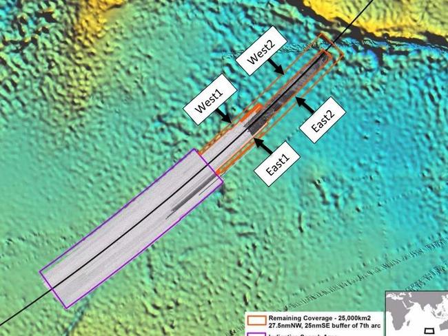
Researchers “consider the location in East1 to be the more likely” because it is the only one indicated by both drift models, the report reads.
It goes on to add that it cannot rule out all possible man-made debris came from the same impact location on March 8.
SEARCH SUSPENDED
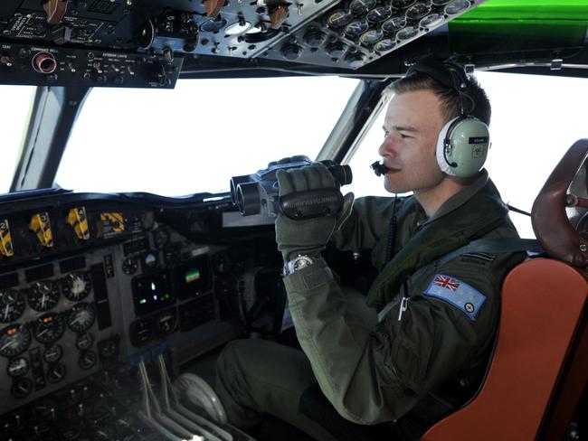
After nearly three years, the hunt for Malaysia Airlines Flight 370 ended in futility and frustration, as crews completed their deep-sea search of a desolate stretch of the Indian Ocean without finding a trace of the plane.
The Joint Agency Coordination Center in Australia, which has helped lead the $160 million hunt for the Boeing 777 in remote waters west of Australia, said the search had officially been suspended after crews finished their fruitless sweep of the 120,000-square kilometre search zone.
“Despite every effort using the best science available, cutting-edge technology, as well as modelling and advice from highly skilled professionals who are the best in their field, unfortunately, the search has not been able to locate the aircraft,” the agency said in a statement, which was a joint communique between the transport ministers of Malaysia, Australia and China.
“Accordingly, the underwater search for MH370 has been suspended. The decision to suspend the underwater search has not been taken lightly nor without sadness.”
Officials investigating the plane’s disappearance have recommended search crews head north to a new area identified in a recent analysis as a possible crash site.
But the Australian government nixed the idea.
PRIVATE HELP ON OFFER
Malaysia, China and Australia have decided that the search will remain suspended unless new evidence pinpoints the wreckage’s whereabouts.
But seabed exploration company Ocean Infinity, based in Houston, Texas, said last week it has offered to launch a private search for the Malaysian-registered airliner.
Voice370, a support group for victim’s families, said under the terms of the offer made to Malaysia in April, Ocean Infinity “would like to be paid a reward if and only if it finds the main debris field.”
They urged Malaysia to accept the offer.
TIMELINE OF THE SEARCH FOR MH370
March 8, 2014
A search and rescue effort is launched in southeast Asia on the morning the aircraft disappears.
March 9, 2014
Search efforts are launched in the Andaman Sea at the request of officials in Malaysia, on the belief the plane might’ve turned back.
March 15, 2014
Malaysia’s Prime Minister Najib Razak reveals the aircraft was in touch a satellite communication network for ‘several hours’ after it disappeared. It was last located by military radar over the Andaman Sea.
March 18, 2014
A search of a remote part of the southern Indian Ocean begins, led by Australian authorities. Oceanic and aerial surveillance begins some 2,500 kilometres offshore from Perth. The initial search area is 600,000 square kilometres.
March 19, 2014
The search area is revised down to approximately 305,000 square kilometres. More ships join the search.
March 20, 2014
Australia announces satellite imagery taken four days earlier appears to show two large objects floating in the ocean. Planes begin scouring the area but don’t find anything.
March 22, 2014
Satellite images captured by Chinese authorities show a large object 22 metres long floating in the ocean.
March 22, 2014
Malaysia announces the plane is believed to have gone down in an area of ocean, with all on board presumed dead. The search area is narrowed again. An Australian search aircraft spots an “orange rectangular object”.
March 28, 2014
The search shifts to a new 319,000 square-kilometre area some 1100 kilometres north of the previous spot. An international panel is established to investigate the incident.
March 30, 2014
The Joint Agency Coordination Centre (JACC), headed by Angus Houston, is established to co-ordinate the search effort.
April 29, 2014
The surface search ends and experts say any debris would’ve become waterlogged and sunk. Some 4.5 million square kilometres of ocean has been searched by 29 aircraft and 14 ships.
May 28, 2014
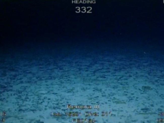
A sea floor sonar survey is called off after several weeks, during which 860 square kilometre of ocean floor is scanned.
June 26, 2014
Authorities prioritise a 60,000 square kilometre search area. An interim report from Australia raises the theory that an unresponsive crew or hypoxia event “best fit the available evidence” for the five-hour period of the flight as it travelled south over the Indian Ocean, likely on autopilot.
October 6, 2014
An underwater search commences, involving four vessels and continues until January 2017.
July 29, 2015
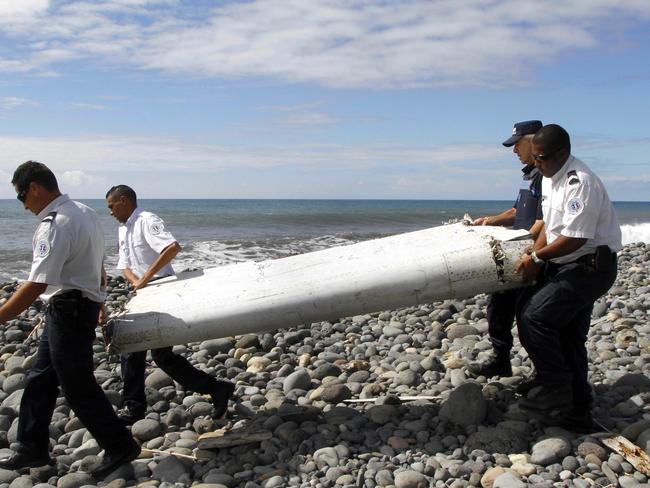
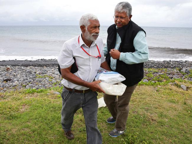
A piece of debris resembling an aircraft flaperon later confirmed to be from MH370 and a suitcase are found washed up on a beach on Reunion Island in the western Indian Ocean. Two days later other items, including a water bottle, are found nearby.
March 2, 2016
A suspected horizontal stabiliser is found on a sandbar in Mozambique and later determined to be from MH370. Later that month, part of an engine cowling is found on the coast of South Africa.
July 27, 2016
Scientists analyse locations where wreckage was found and compare the data to ocean drift patterns. It results in a new predicted area for the crash site, further north than the last agreed search zone.
December 20, 2016
Australian authorities suggest a new, smaller 25,000 square kilometre search area.
January 17, 2017
The underwater search is officially suspended after the examination of 120,000 square kilometres of ocean floor. The total cost of the MH370 search hits $160 million.`
Originally published as Explosive new report virtually pinpoints location of missing flight MH370

Bizarre last moments of missing Aussie mum