
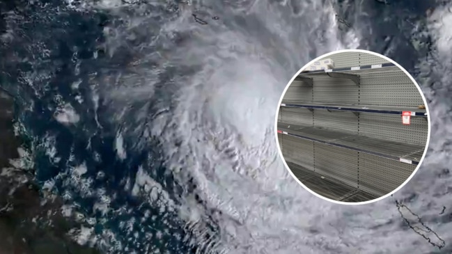
Cyclone Jasper hits: Destructive winds, 500mm deluge, flash flooding expected
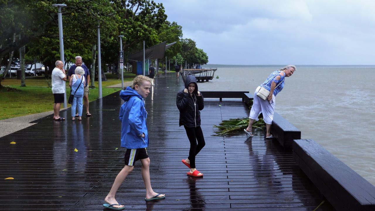
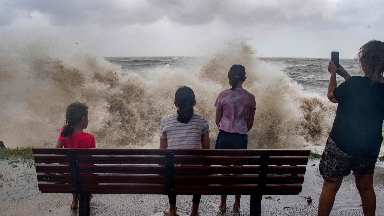
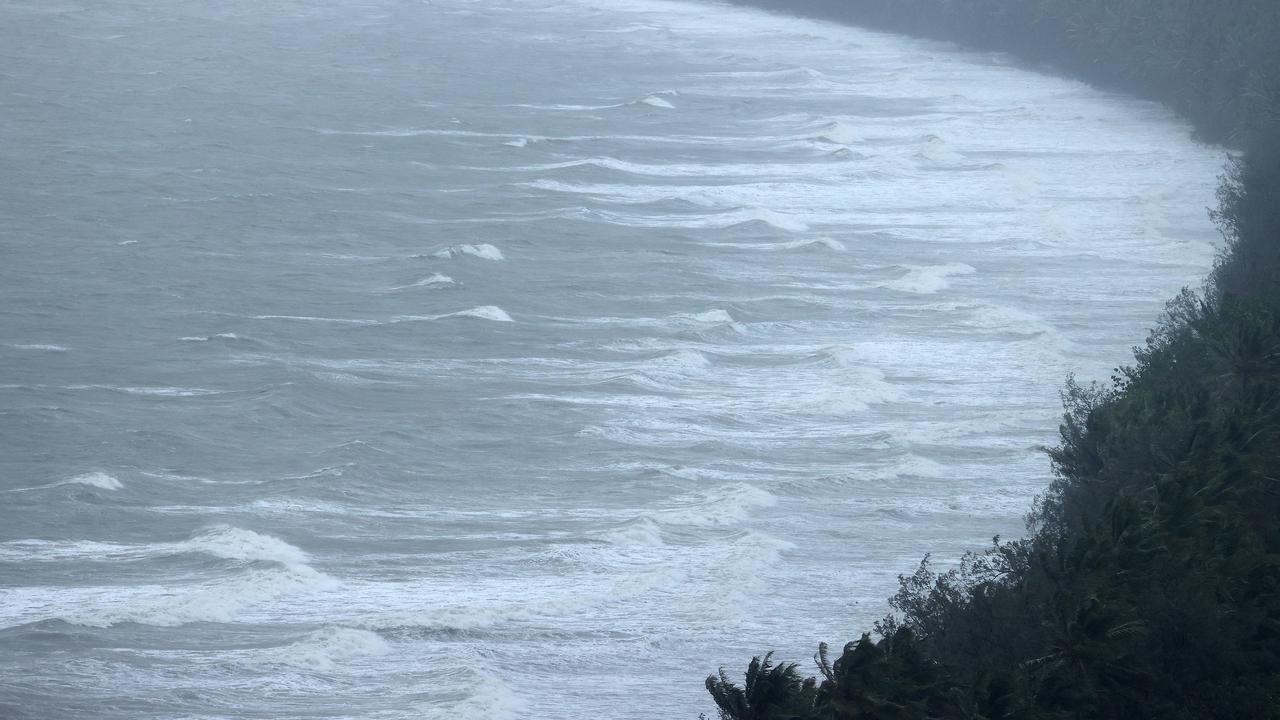
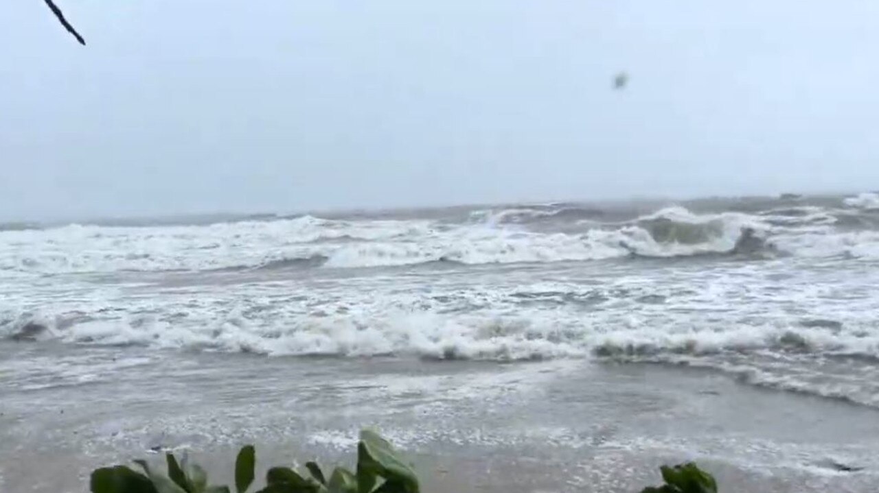
Relentless rain, flash flooding and dangerous wind gusts of up to 140km/h are continuing to batter the Far North as Tropical Cyclone Jasper carves a painfully slow path inland.
Emergency Services
Don't miss out on the headlines from Emergency Services. Followed categories will be added to My News.
Relentless rain and wind are continuing to batter the Far North as Tropical Cyclone Jasper carves a painfully slow path inland.
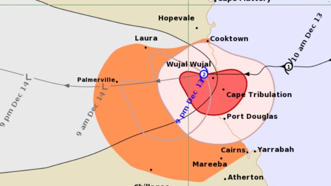
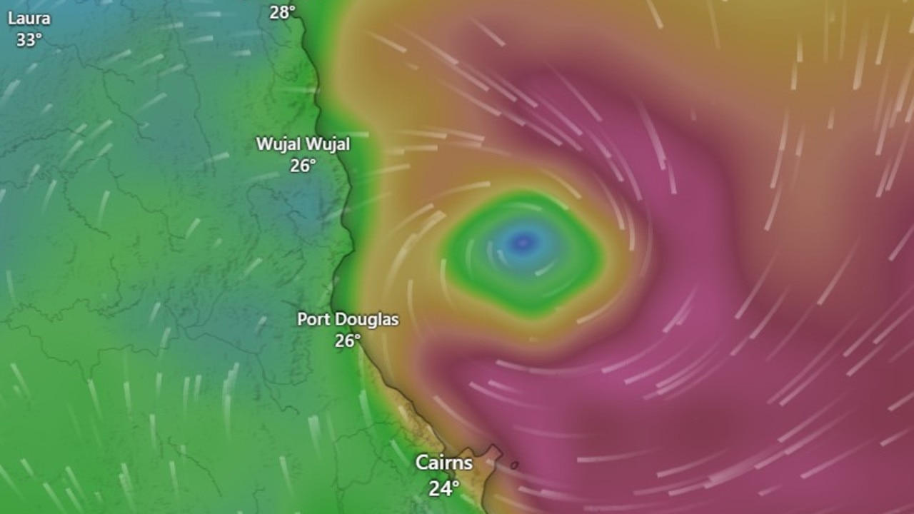
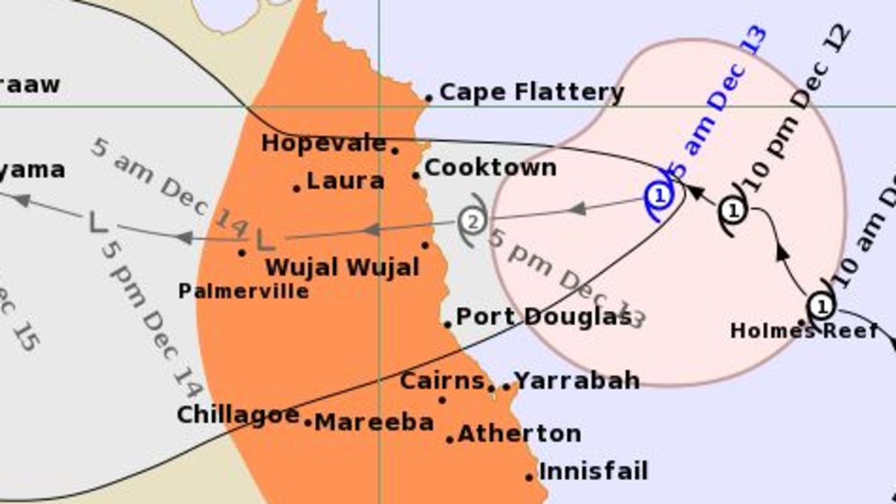
The centre of the cyclone is now over the indigenous community of Wujal Wujal which has a population of about 440 people.
The Bureau of Meteorology said Jasper was still a Category 2 as of 9pm but was expected to be downgraded to Category 1 by 3am.
It will be a long night for those in the storm’s path with non-stop rain and wind causing widespread power outages. The system is moving at just 12km/h.
At Port Douglas, the howling wind is slowly changing direction, bringing with it a new flurry of debris.
The town is pitch black with power to most properties lost before nightfall.
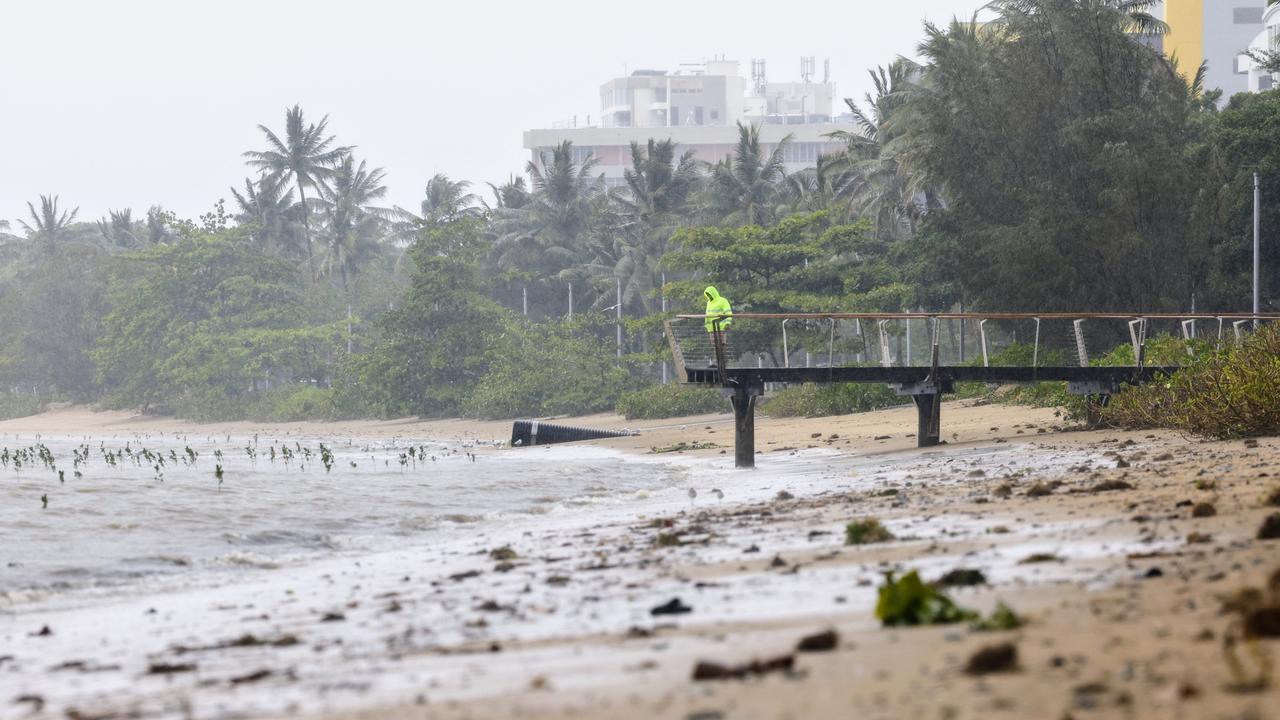
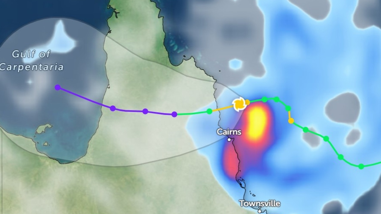
By 9am Thursday, Jasper is expected to have weakened to a tropical low, but forecasters have warned the worst is not over, with flash flooding expected across large parts of the Far North.
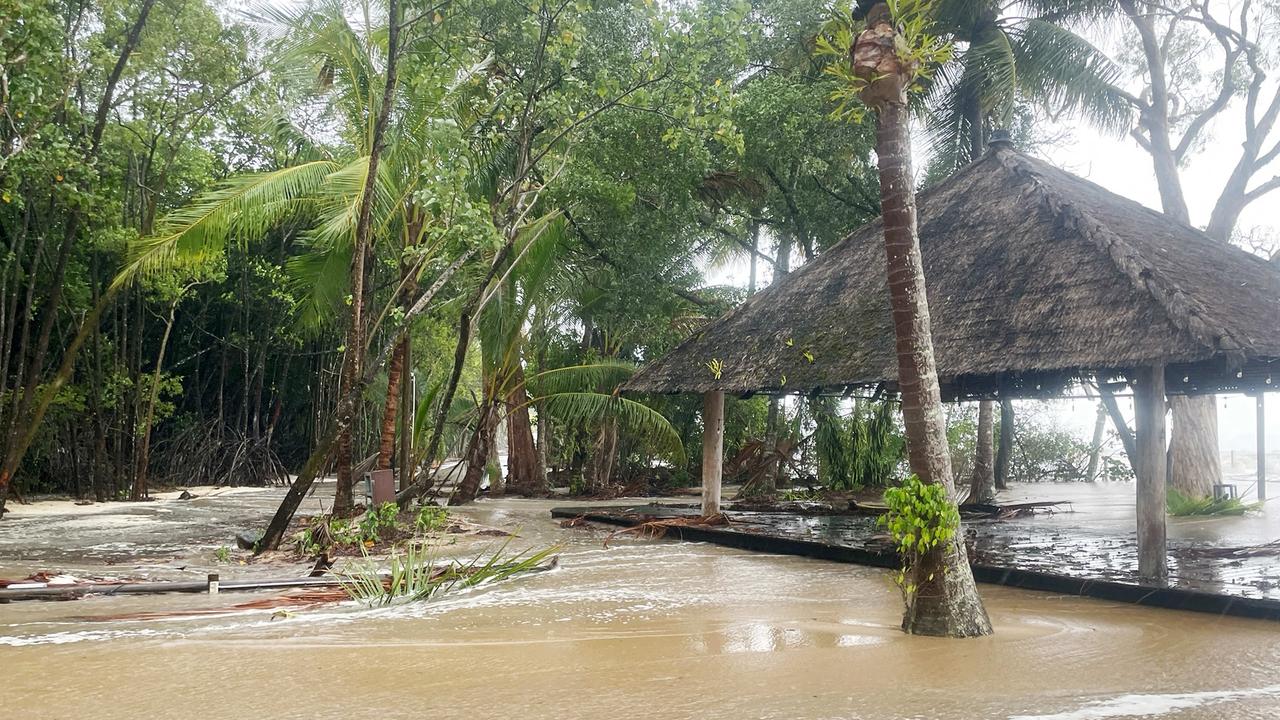
Twenty-four hour rainfall totals of up to 500mm are possible in the deluge.
Tropical Cyclone Jasper will bring destructive winds of 140km/h and “dangerous, life-threatening flooding” as it completely crosses the far north Queensland coast tonight.
The Bureau of Meteorology are forecasting intense rainfall primarily between Cape Tribulation and Cairns that could lead to “dangerous and life-threatening flash flooding”.
As of 7pm they broadened their warning zones to inland areas, including the Atherton Tablelands, Chillagoe and Palmerville.
The Bureau confirmed that TC Jasper is expected to weaken overnight as it moves inland.
The Bureau are also forecasting between 250 to 300mm of rain to fall in the region in the next six hours.
Isolated falls up to 350mm are also expected in the Cape Flattery and Ingham regions with BOM warning residents of heavy rainfall and potential flash flooding.
Destructive wind gusts of up to 140km/h are also expected to lash parts of Port Douglas and Wujal Wujal.
Tropical Cyclone Jasper has gained strength as it crossed the coast with 113km/h wind gusts smashing the Cairns and Port Douglas region, and 17,000-plus homes without power.
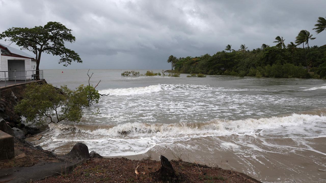
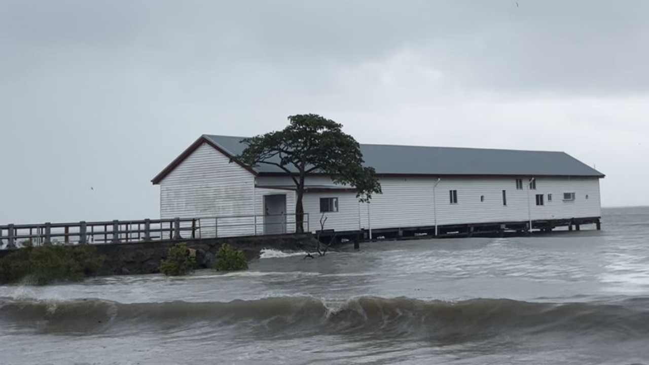
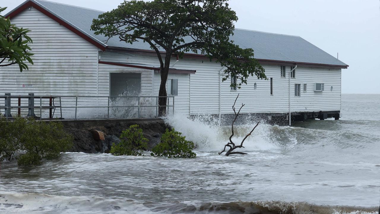
A storm tide is expected along the north Queensland coast on the high tide during Thursday morning with total waters generally expected to approach or marginally exceed the Highest Astronomical Tide level.
Large waves may produce minor flooding along foreshore areas.
Deputy Premier Steven Miles has travelled to Townsville to wait out the cyclone, before heading to Cairns on Friday.
“As we speak right now … the cyclone has begun to cross the coast,” he said.
“It doesn’t officially cross until the eye crosses.”
Cairns residents have been warned of damaging wind gusts reaching up to 70km/h.
Mr Miles said the SES had received more than 120 requests by 3pm Wednesday.
Cape Tribulation, Wujal Wujal and Port Douglas are all currently in the Bureau of Meteorology’s red zone being battered by damaging and destructive winds.
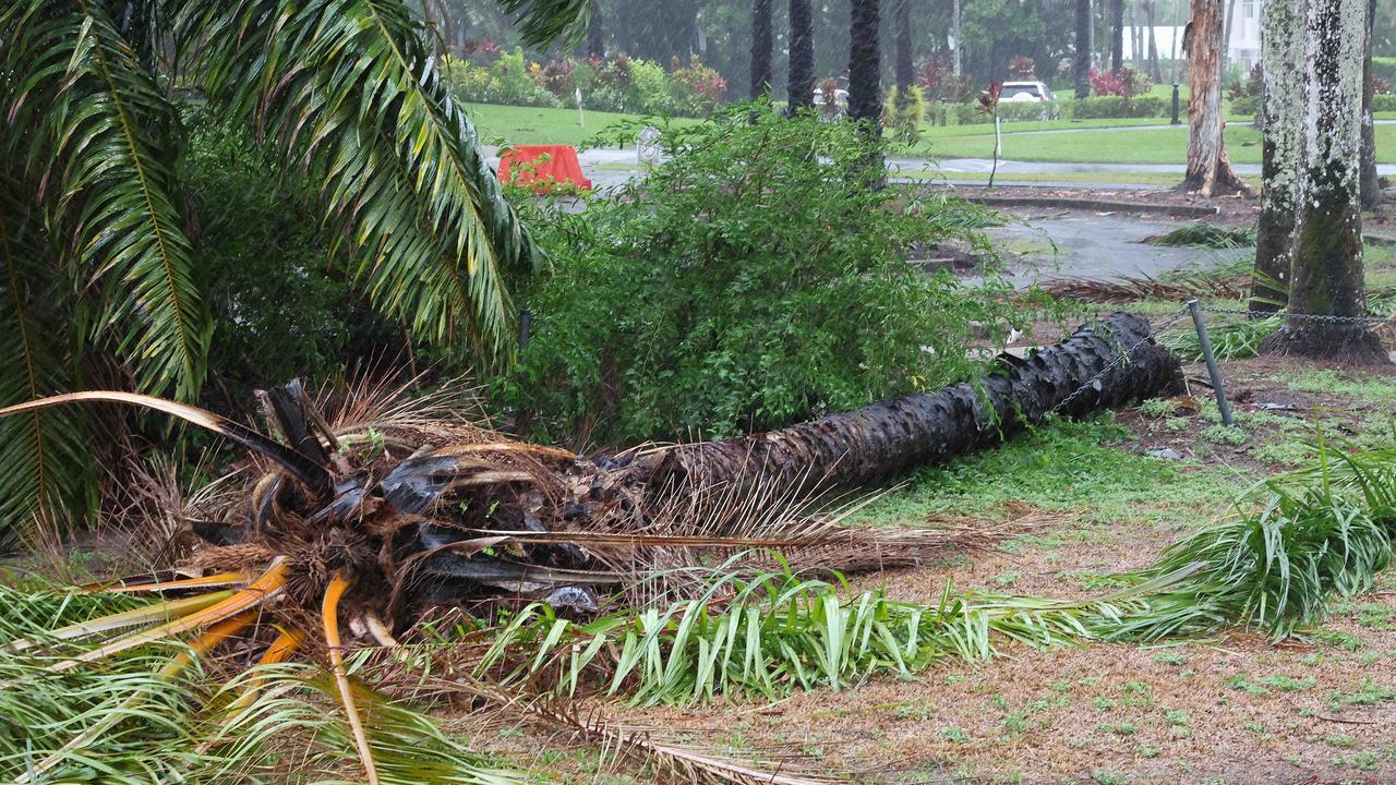
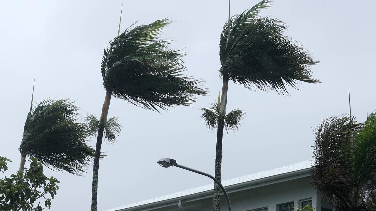
The driving rain has gotten even heavier, being blown almost horizontally by the raging winds that are tearing through the vegetation, bending palm trees and snapping off branches and sending debris flying through the air.
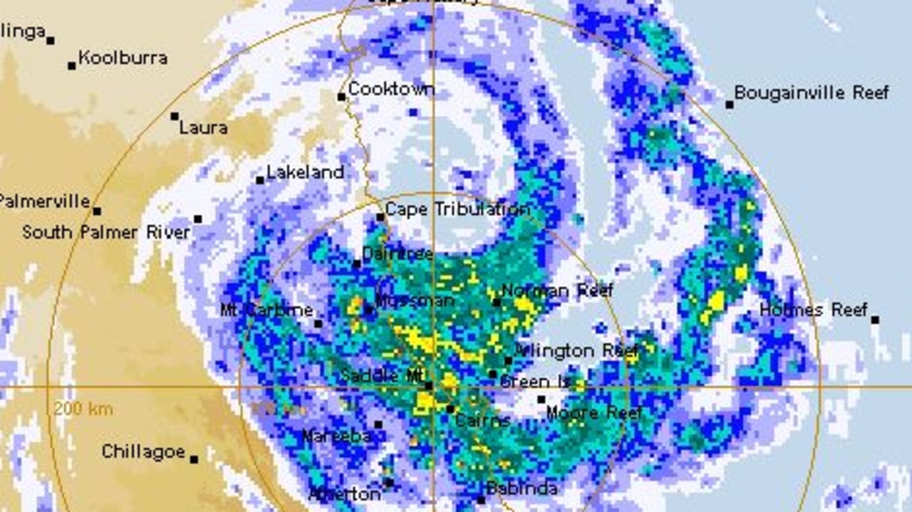
The Bureau’s Patch Clapp has confirmed the cyclone eye is 70km wide, with Jasper expected to slowly make landfall tonight.
“It’s a pretty slow process,” he said.
“When the centre crosses, then it technically made landfall … around that Cape Tribulation is the eye focus but impacts from Cooktown to Cairns.”
Residents have been urged to remain indoors while the eye of the storm passes, and to not be fooled by the temporary lull.
“The eye is really big,” Mr Clapp said.
“There’s a period of calm conditions, a lull, in the eye itself.
“But you can’t pick that time period, so keep sheltering.
“Wait for the whole system to pass.”
Heavy rainfall and life-threatening flash flooding is expected to lash areas between Cooktown and Port Douglas overnight.
“Really heavy totals are coming tonight and tomorrow,” Mr Clapp said.
“It will take quite a while to go out to sea.
“At this stage we’re not expecting it to be out at Gulf waters until Saturday.
“It’s going to be relatively slow moving.”
Mr Clapp warned residents beyond the immediate warning zone that dangerous winds and heavy rainfall would remain for the next two-three days as Jasper crosses the Peninsula.
At 3.30pm the Wujal Wujal Council issued an emergency alert advising residents to take immediate shelter in the strongest part of the building they are in. Destructive winds are expected to intensify from now on as a result of Tropical Cyclone Jasper.
At 2pm, an alert for those in the Douglas Shire was issued warning that destructive winds were likely in the next six to 12 hours.
A text message sent also urged people in the area to immediately take shelter in the “strongest part of the building”.
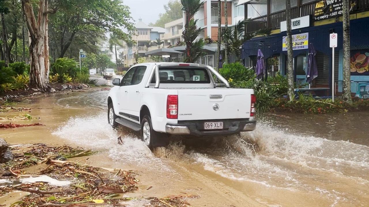
Police in Port Douglas spent the afternoon ordering the few people remaining outside off the streets as damaging winds batter the holiday hotspot.
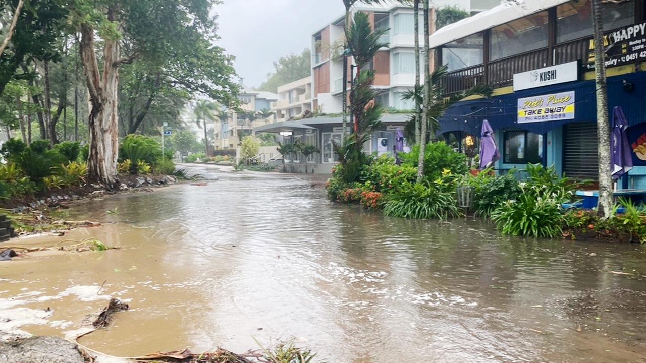
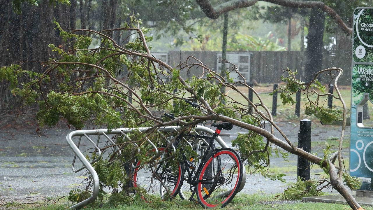
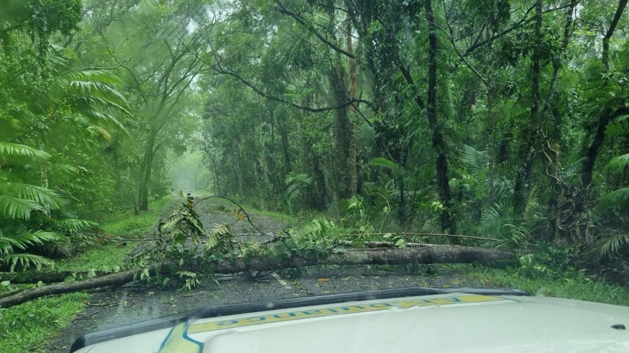
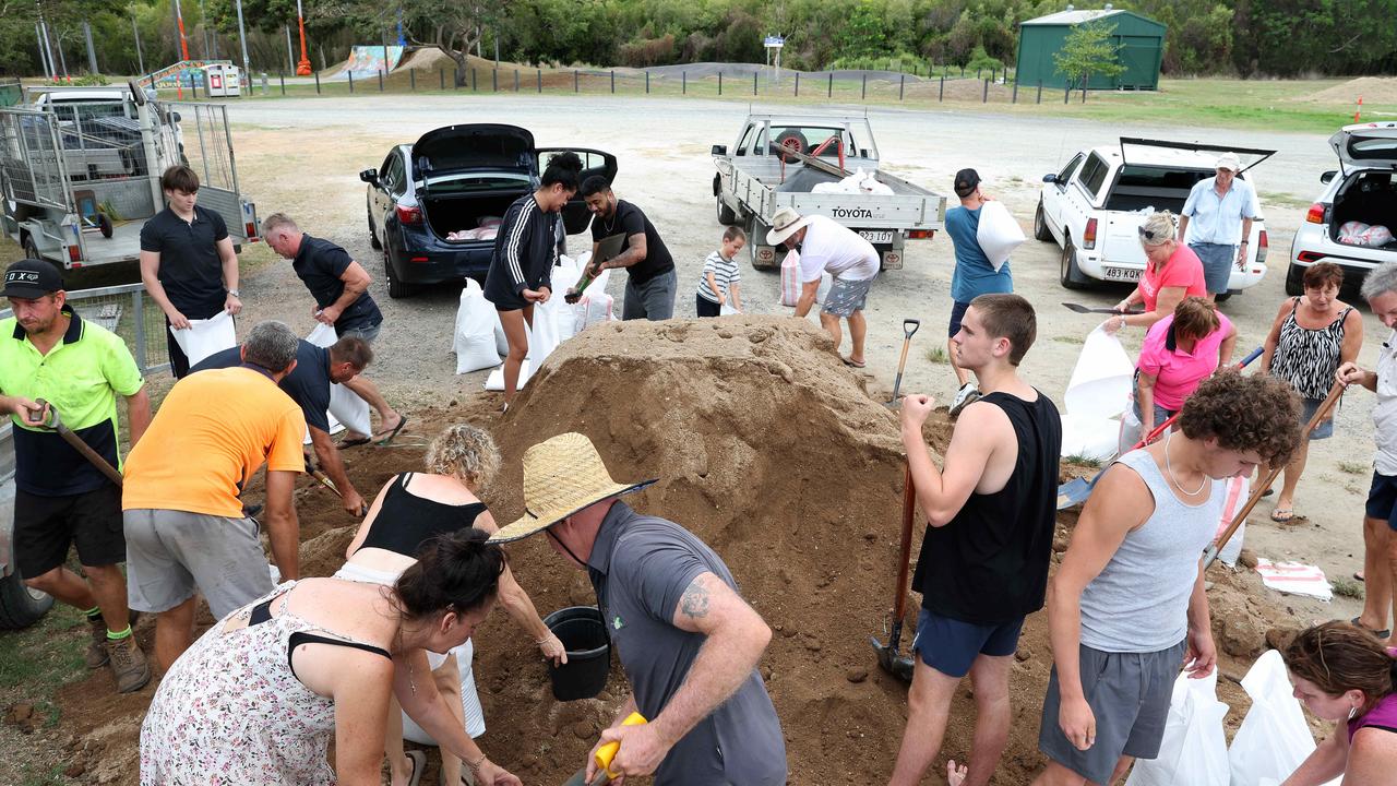
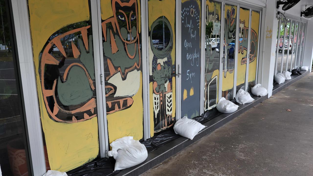
Trees are down across roads, including in the Central Business District where business owners have barricaded their shops with walls of sandbags.
Palm trees have been ripped from their roots and tree branches snapped off in the wind litter the roads.
Winds in excess of 110km/h hammered Port Douglas across the afternoon, along with torrential rain as residents took shelter from the storm.
The main access road leading in and out of town was briefly cut by a falling tree but emergency crews were quick to the scene with chainsaws to remove it.
Around town, the roads are covered with broken branches and other debris.
“Impacts will get worse as we move through the day today,” Laura Boekel from the Bureau of Meteorology said.
“It will cross between Hope Vale and Cairns. At this stage there is no indication that we will see this system (Jasper) intensify to a category 3.
“It’s already very close to the coast … so it doesn’t have a lot of space to intensify.”
She said Jasper would weaken “within hours” of making landfall, with rainfall impacts to linger for “quite a few days”.
Low Isles recorded wind gusts reaching 111km at 2pm.
Rainfall totals between 80-150 mm have been recorded over the Mulgrave and Russell river catchments in the 48 hours to 2pm Wednesday, with isolated falls of 200mm.
The Bureau expects moderate flooding to occur along the Mulgrave River at Peets Bridge on Wednesday afternoon, as well as minor flooding at Gordonvale.
Mulgrave River at Gordonvale is currently at 9.25m and rising.
Another minor flood warning has been issued for the Tully River, which saw isolated falls up to 115mm prior to 9am Wednesday.
The Tully River at Euramo is currently at 2.15m and steady.
There is a moderate chance Jasper will strengthen in The Gulf In of Carpentaria.
Gale force winds are already being recorded in several areas, including the 111km/h near Low Isles, 82km/h in Cairns, 48km/h in Innisfail and 66km/h at Lucinda.
As of about 3pm there were 93 people in evacuation centres, with that figure expected to grow.
Four Bureau of Meteorology employees stationed on Willis Island have escaped Cyclone Jasper by boarding a Royal Australian Navy warship. Guided missile destroyer HMAS Brisbane was returning from a deployment in Northeast Asia on Friday when it was diverted to the small island, located just 450km off the coast of Cairns, to rescue the Bureau staff.
An MH-60R Seahawk helicopter flew to the island to collect the staff one by one.
Overnight rainfall totals recorded at noon revealed several areas between Cairns and Innisfail have already received more than 100mm of rain within a 24-hour period.
Tully was hit with 115mm overnight, Marco St 132mm and Goldsborough Valley 129mm.
On Wednesday morning, Clyde Rd Alert station and The Boulders near Babinda recorded 60mm each in just two hours, while 50mm fell over the Goldsborough Valley before 10am.
Inland from Innisfail, Topaz was lashed with 42mm in less than an hour.
Ms Boekel said the major risk today was “dangerous and life threatening” flash flooding.
Six hour rainfall totals between 250-300mm and 24-hour totals reaching 400-500mm are forecast for areas in the cyclone impact zone.
“There’s also a risk of riverine flooding as well as storm surge as we see the high tide at Cairns at 10am,” she said.
“We still have a (riverine) watch warning current, with some warnings likely to be issued later today as we see more rainfall throughout the day.”

EARLIER:
Police Commissioner Katarina Carroll said there was an online meeting with council mayors this morning who said they were “extraordinarily comfortable” with preparations.
“We have put additional water police assets into the area just in case,” she said.
Deputy Police Commissioner Disaster Coordinator Shane Chelepy asked those feeling unsafe to head to an evacuation centre early to avoid putting first responders at risk.
“The next 24 hours will be critical, so we do want to minimise both the movement on foot and on road,” he said.
Federal Emergency Management Minister Senator Murray Watt said the federal government was “standing shoulder to shoulder with Queenslanders”, with Defence personnel on standby to offer support.
“At this point in time, we haven’t had to contribute a whole lot to the effort in terms of being prepared, aside of course the important work of the Bureau of Meteorology and the Defence Force assisting with the evacuation of BOM personnel from Willis Island a few days ago,” he said.
“There have already been discussions under way at the federal level with the Defence Force to ensure that they are postured and ready to provide assistance.
“We have our payment system ready to go, should the damage involve … financial assistance.”
Those staying in the Douglas Shire on Tuesday night received emergency text messages warning that destructive winds were likely in the coming 12 to 24 hours and to shelter immediately in the strongest part of the building they were in.
Destructive wind gusts of up to 140km/h are forecast to the south of Jasper’s track between Wujal Wujal and Innisfail, including Cairns, from this afternoon.
Mr Miles on Tuesday assured northern residents that all authorities were well prepared for Jasper’s imminent arrival.
“We have been assured by all of them that all of the preparations we can do, all of the people that we can have in place are ready, all of the evacuation centres are ready to go,” he said.
But Emergency Services Minister Mark Ryan warned residents that “it’s going to be rough”.
“Things are going to get a little bit rough over the next 12 to 24 hours,” he said.
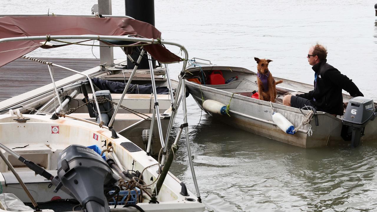
“Don’t be out on the water, it’s going to be rough, watch that storm surge, be prepared for the heavy rain and the flash flooding and also those gale force winds.”

Energy Minister Mick de Brenni on Wednesday said “deenergising” plans were abandoned on Tuesday after a change in weather conditions. He said 8300 homes were without power at 10am.
“We do have crews out on the ground inspecting the distribution network and where it is safe to do so, they will restore that power,” he said.
Commissioner Carroll said one of the reasons that “substantial” police resources were deployed north was to monitor looting post-cyclone.
“If you think you’re going to get away with that, you won’t,” she said.
Areas south of the immediate cyclone zone have already been impacted, with areas near Eungella west of Mackay copping almost 300mm in the past 24 hours.
Rainfall observations show 296mm fell at the Clarke Range alert and 257mm at Mt William.
Ms Boekel said heavy rainfall would linger beyond the cyclone’s passing and areas outside the impact zone would likely face significant deluge over coming days.
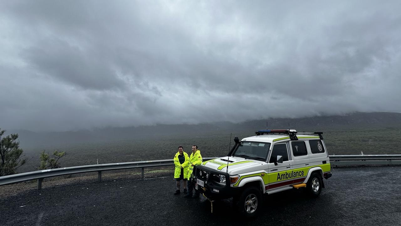
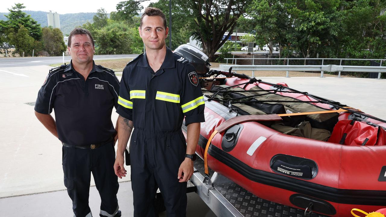
Emergency service back up teams, including 12 swift water rescue technicians, 31 QFES and 70 SES personnel, arrived to Cairns on Tuesday to provide disaster response assistance to vulnerable and flood-affected communities.
All flights have been grounded at Cairns Airport, which was slowly shut down on Tuesday in preparation of dangerous weather conditions.
Chief executive officer Richard Barker urged both domestic and international travellers to stay away from the airport on Wednesday.
“Please do not come to Cairns Airport on Wednesday,” he said.
“Operations will recommence when it is safe to do so.”
Deputy Police Commissioner Shane Chelepy warned those still considering going to an evacuation centre to make a timely decision that did not put them further at risk.
“Our district disaster co-ordinators have already engaged all those remote communities in The Gulf and Cape area just for their preparedness as well,” he said.
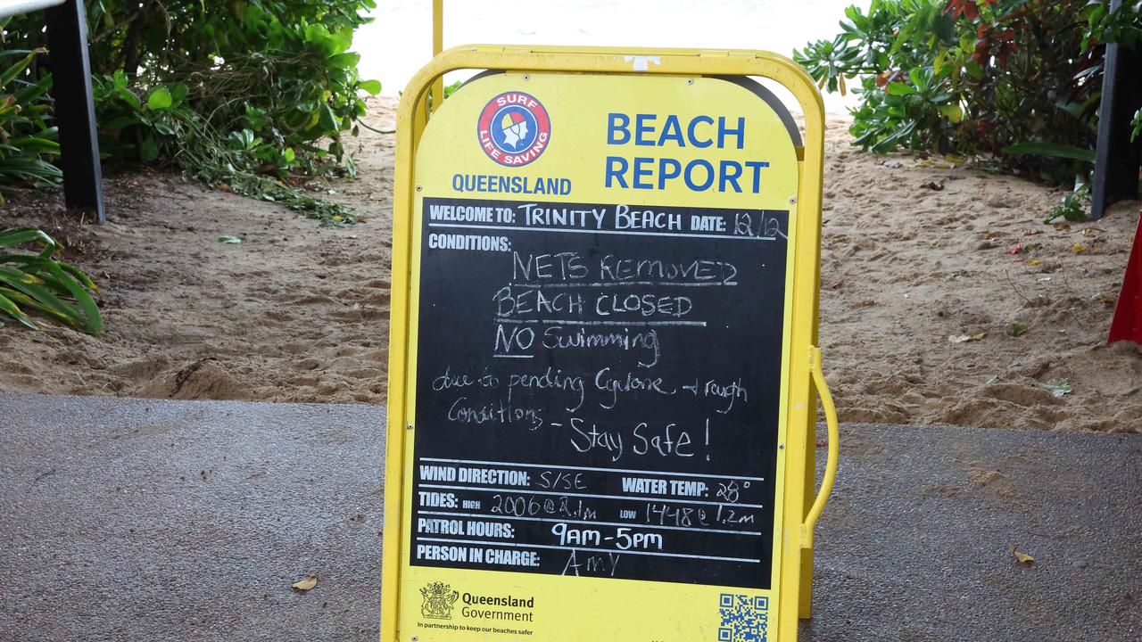
A flood watch is current for the North Tropical Coast, parts of The Cape York Peninsula and Gulf Country.
Shops were shuttered, buildings barricaded with sandbags, windows taped up and essentials stripped from supermarket shelves as the community prepared to wait out the storm.
Among them were sisters Caitlin and Emeir Mernagh who moved from Ireland to Australia just eight weeks ago.
“We’re not really sure how to feel because we’re getting a lot of mixed signals from the locals,” Caitlin said.
“Some are serious and worried about it and others are like ‘oh don’t worry about it, it’s usually nothing’.”
At the Port Douglas Wildlife Habitat, dozens of staff worked tirelessly throughout the day to make sure the hundreds of animals that call the popular tourist attraction would be safe.
General Manager Clare Hunt said the habitat was eerily silent as staff arrived for work on Tuesday, with the animals sensing the coming cyclone.

“There are half a dozen snakes in my office, I’ve got some bettongs about to turn up at reception, and a koala in the shop,” she said.
Ms Hunt said some of the 500 animals were able to stay in their normal shelters with extra food, while others had been moved inside or even sent home with staff.
“There’s some really special animals here that are dear to all of us,” she said.
Port Douglas resident Adam Howard said Cyclone Jasper was forecast to be the most serious cyclone he had experienced in his 13 years living in the coastal community.
“In 2015 we half-missed one but this will be the first proper one for us,” he said.
“I have mixed feelings, it’s exciting but scary. I think people who have been here for a long time are pretty relaxed.
Further south, Paul and Teresa Boswell, who run the NRMA Palm Cove Holiday Park, were busy sandbagging the office and securing any items left outside.
Days ago, the park was bustling with 90 guests but on Tuesday, zero remained.
“We had a few international people who didn’t even know it (the cyclone) was coming,” Ms Boswell said.
Ms Boswell said in addition to the high winds forecast, the park was in the red zone for a tidal surge.
“We know how unpredictable cyclones are so it’s just about being as prepared as possible,” she said.
HIGHEST WIND GUSTS AS OF 5PM WEDNESDAY:
Cairns – 82km/h
Cooktown – 43km/h
Innisfail – 61km/h
Low Isles – 115km/hr
Lucinda – 65km/h
South Johnstone – 52km/h
Townsville – 72km/h
Hamilton Island – 80km/h
RAINFALL TOTALS AS OF 5PM WEDNESDAY:
Cairns – 35mm
Cardwell – 28mm
Cooktown – 18mm
Cowley Beach – 13mm
Innisfail – 26mm
Low Isles – 50mm
Mareeba – 15mm
South Johnstone – 30mm
Join the conversation

‘Every little bit helps’: Loved ones of missing mum make urgent plea
Friends and family of a missing Queensland mum have called for anyone with information “no matter how big or small,” to come forward after she was last seen travelling on a southwest highway.
Read more
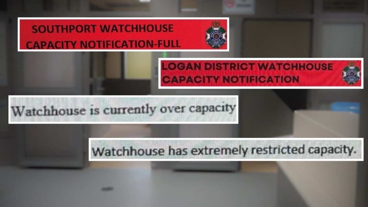
‘It’ll end in a death of a child’: War of words as watchhouses overcrowd
Gold Coast police officers fear there could be a death in custody as a special investigation by the Bulletin reveals just how crammed the lockup have become. Full details
Read more