
UPDATE: New storm warning issued as cell tracks south
Far North areas expected to be impacted by a severe thunderstorm have been revised after 61mm of rain tumbled down in one hour.

Cairns
Don't miss out on the headlines from Cairns. Followed categories will be added to My News.
LATEST: The scope of a thunder storm warning for parts of the Far North has shifted as the storm cell heads south.
In an updated warning at 7:21pm the Bureau of Meteorology said a moist unstable air mass and light winds will lead to scattered slow-moving thunderstorms capable of locally heavy rainfall.
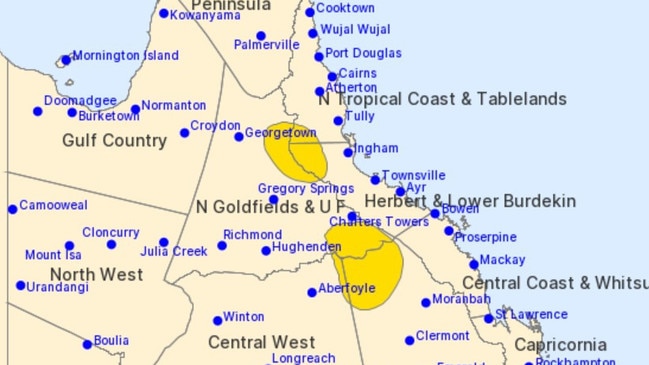
People in parts of North Tropical Coast and Tablelands, Northern Goldfields and Upper Flinders, Herbert and Lower Burdekin and Central Highlands and Coalfields Forecast Districts have been urged to prepare.
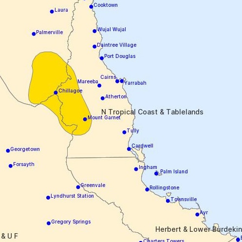
A total of 61mm of rain in 60 minutes has recently been recorded at Upper Poison Creek west of Mount Garnet.
Queensland Fire and Emergency Services advises that people should:
* Never drive, walk or ride through flood waters. If it’s flooded, forget it.
* Seek shelter, preferably indoors and never under trees.
* Avoid using the telephone during a thunderstorm.
* Beware of fallen trees and powerlines.
* For emergency assistance contact the SES on 132 500.
EARLIER: A severe thunderstorm warning has been issued for parts of the Far North after 61mm of rain tumbled down in one hour.
In its warning at 5.55pm, the Bureau of Meteorology said a few slow-moving storms were producing heavy rainfall.
“A moist unstable air mass and light winds will lead to scattered slow-moving thunderstorms capable of locally heavy rainfall,” the BOM said.
“Severe thunderstorms are likely to produce localised heavy rainfall that may lead to flash flooding in the warning area over the next several hours.”
Locations which may be affected include Chillagoe and Mount Garnet.
Upper Poison Creek, west of Mount Garnet, already received 61mm of rain in 60 minutes, the Bureau said.
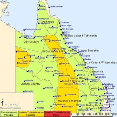
WEDNESDAY MORNING: A big chunk of the Far North is in the firing line for thunderstorms on Wednesday as Far Northerners swelter through some steamy temperatures.
Storms are possible right across the Cassowary Coast, Tablelands, Douglas shire, Western Cape and Gulf country, as well as Cairns itself, the Bureau of Meteorology says.
Severe cells are possible through the interior of the state at locations including Georgetown.
In Cairns, the temperature at 12.20pm was 31.2C, but as always the humidity is making it feel much stickier, with an apparent temperature of 34.9C.
On Cape York, the mercury at Kowanyama hit 36.9C at 11.48am, while Laura was 35.8C at 12.20pm.
The Bureau says a high in the Tasman sea and a trough system over Central Australia will drive a humid tropical air mass over most of Queensland in the next few days.
“The trough will move slowly eastwards across the state, with showers and thunderstorms becoming more widespread to the east and north of this feature.”
The BOM on Tuesday also declared that a La Nina has developed in the Pacific.
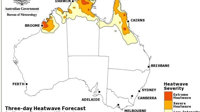
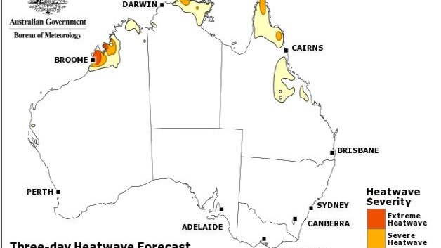
MONDAY: The Far North is bracing for a very hot week with some parts expecting to hit as high as 41 degrees.
Bureau of Meteorology forecaster Kimba Wong said there will be heatwave conditions over the Far North including Cairns.
“Over the Far North we have this heat building over the next few days,” she said.
“There is a stagnant air mass building over the Far North, remaining in place and gradually warming up over the new few days, because of that we will see the maximum during the day increase but also the minimum.”
She said the humidity is also going to be quite high over the next few days.
“The humidity in the air is going to add to that heat stress. The humidity can feel a lot hotter than the thermometer might suggest,” she said.
Cairns is expected to hit a high of 34 degrees over Monday to Wednesday before dropping down to 33 degree for the rest of the week. The minimum temperatures vary between 22 and 25 for the whole week.
Ms Wong said the inland parts of the Far North are expected to hit higher temperatures.
“Over the Cape York peninsula it is going to be quite hot. Some locations there will see over 40 degrees,” she said.
“For example Laura on Monday will hit 41 degrees.”
Ms Wong said in some good news there should be a gradual decline in temperatures.
“Through the second half of the working week we are expecting showers and thunderstorms,” she said.
More Coverage


Originally published as UPDATE: New storm warning issued as cell tracks south

Woman, 26, seriously injured in alleged knife attack
A young woman has been rushed to hospital with a serious stab wound after allegedly being stabbed in the back during an altercation at a property in Far North Queensland.
Read more

Council boss ousted amid inquiry into allegedly false time sheets
The chief executive of a Cape York council who last year won a leadership award will not have her contract renewed while an investigation is held into allegedly inflated overtime claims.
Read more