
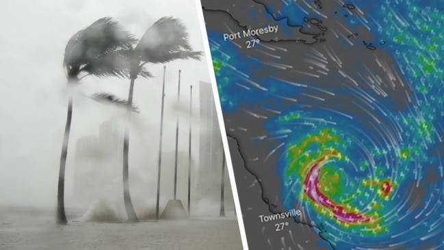
1m of rain, freak 140km/h winds, storm tides: How Tropical Cyclone Kirrily could wreak havoc this Australia Day
Tropical Cyclone Kirrily has been officially declared as a Category One storm, with fears it could dump a metre of rain this Australia Day.

Environment
Don't miss out on the headlines from Environment. Followed categories will be added to My News.
Tropical Cyclone Kirrily is set to wreak havoc this Australia Day, with fears the freak system could dump up to 1m of rain on Queensland’s storm-ravaged regions.
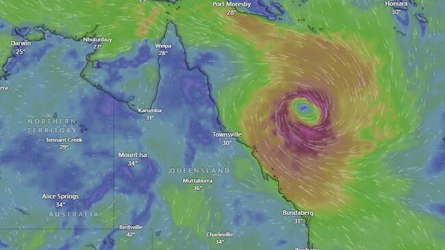
Kirrily was officially confirmed as a category 1 cyclone on Wednesday afternoon.
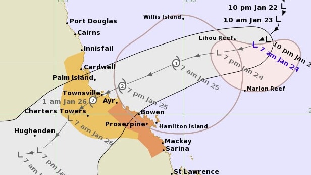
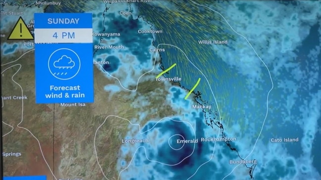
It was moving slowly over the Coral Sea and expected to cross the coast between Cardwell and Bowen, in central Queensland, on Thursday night
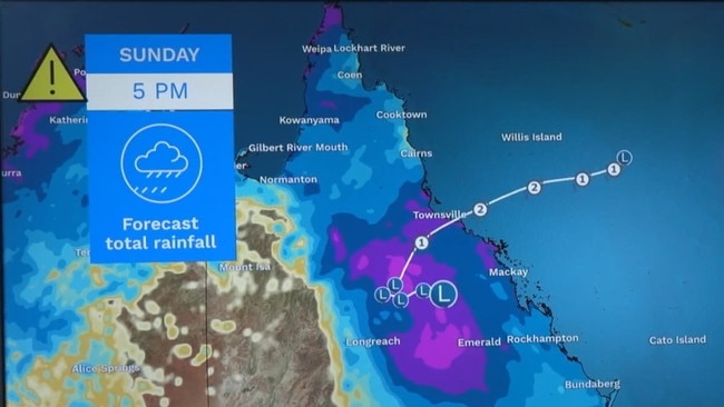
The Bureau of Meteorology has forecast the system will likely track further inland as a tropical low over the following days, bringing heavy to intense rain to central and western parts of the state.
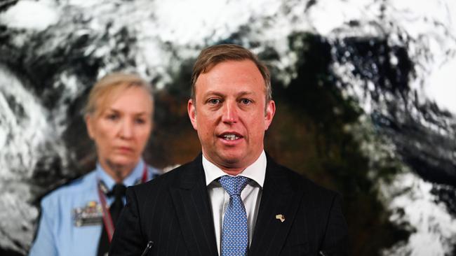
Authorities are already on high alert for the event, with Queensland Premier Steven Miles on Tuesday urging people in areas between Cardwell and Airlie Beach to monitor warnings from the bureau and their local government.
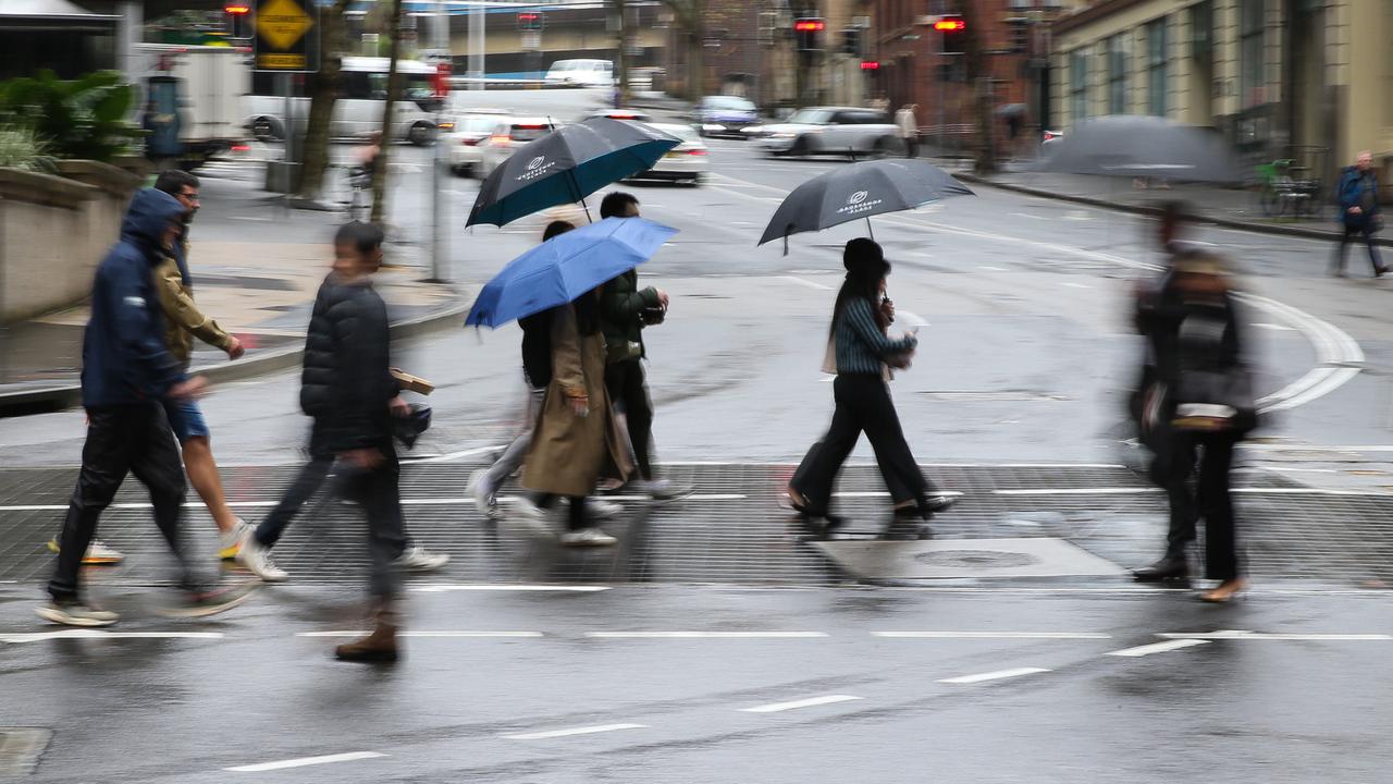
Some areas can expect up to 1m of rain from the resulting storms once the cyclone subsides.
Gold Coast Mayor Tom Tate said the resulting storms would be a disaster for areas in the southeast already ravaged by storms over January.
“We’re going to have to have a look at our dam levels, we’re up 100 per cent,” he told 9 News on Wednesday.
Areas of the Gold Coast had already endured fierce storms and devastating flooding when a series of storms tore through the region earlier in the month.
The bureau states “destructive” wind gusts may develop about coastal and island communities between Cardwell and Proserpine, including Townsville and the Whitsunday Islands, later on Thursday.
Flash flooding from heavy rainfall has also been forecast for coastal areas between Innisfail and Sarina from early Thursday.
“People between Innisfail to Ayr, including Townsville and inland to Charters Towers, should consider what action they will need to take if the cyclone threat increases,” the bureau’s latest hazard update states.
On Wednesday, Mr Miles said Townsville airport would be closed from noon on Thursday as the brunt of conditions hit the region.
He was due to travel to Townsville for an Australia Day event but said the plans had changed due to the airport being closed and the event itself being cancelled.
Asked whether people should cancel their public holiday plans, Mr Miles said: “I encourage people to look at the forecasts and make sensible decisions.
“Certainly you wouldn’t want to be travelling great distances in these conditions,” he continued.
“They’re the kinds of things we’re asking people to take into account.”
Mr Miles warned there would still be very high levels of rainfall despite the system now only forecast to strengthen to a category 2 system instead of a category 3.
One hundred additional Queensland Fire and Emergency Services (QFES) personnel have been deployed to Townsville, including swiftwater rescue crews.
Mr Miles said Queenslanders needed to consider what travel was necessary due to the heavy rain forecasts.
“Look out for those warnings from the bureau and from (your) local government,” he said.
Dams in affected regions are being monitored for potential water releases, but Mr Miles said Townsville would not be taking active steps to release their dams.
Wivenhoe Dam was standing at 66 per cent, he explained.
Senior meteorologist Dean Narramore said there was a slight delay to the system making landfall due to dry air wrapping into the low in the Coral Sea.
“Combined with stronger mid-level winds … (it has) disrupted the development of the cyclone,” he said.
Mr Narramore said widespread heavy rainfall was expected for swathes of Queensland as the cyclone weakened into a tropical depression.
This could set the stage for a large flood event heading into the weekend, he explained.
“Widespread heavy rainfall is likely to lead to flash and riverine flooding for our inland communities across the weekend and even into early next week,” Mr Narramore said.
State disaster co-ordinator Deputy Commissioner Shane Chelepy said the next 24 hours would be critical for Queensland’s coastal communities in the cyclone’s firing line.
“We will start to see strong winds and rain this evening,” he said.
He said people in the affected communities needed to make sure their emergency plans were in place, including making sure they checked in on their neighbours and family.
“As of this evening, we will ask the community to start limiting their travel due to strong wind and rain,” Mr Chelepy said.
“The police and emergency services staff have predeployed into the areas … our energy crews are already staged in Rockhampton so we can respond to our communities as quickly as possible.”

Originally published as 1m of rain, freak 140km/h winds, storm tides: How Tropical Cyclone Kirrily could wreak havoc this Australia Day
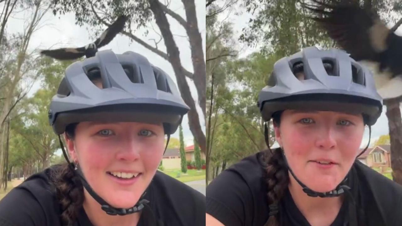
Horror moment as magpie season kicks off
A chilling video has revealed that the season Aussies dread most has arrived earlier than expected.
Months of ‘destructive’ weather to hit Aussies
One state has been warned to anticipate destructive storms and high temperatures over the coming months, with experts urging people to prepare their homes.