
Freak 150km/h wind gusts, ‘life-threatening’ flooding forecast as Cyclone Kirrily bears down on Qld coast
A dire warning has been issued as a freak weather system prepares to hit land and bring “destructive” wind and “intense” rainfall.

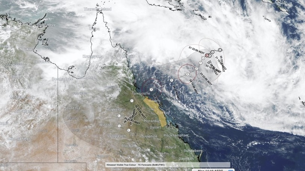
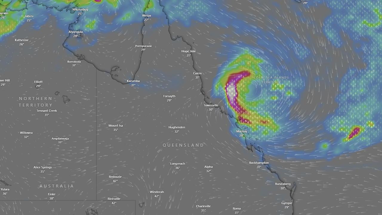
Thousands of people in Queensland’s central and northern regions have been urged to prepare for a tropical low, now inevitable to intensify into Tropical Cyclone Kirrily, to cross the coast overnight.
The dire warning comes as the Bureau of Meteorology forecasts gale-force wind gusts of up to 150km/h, storm tides and heavy rainfall – some of which could lead to “life-threatening flash flooding” – to wreak havoc on coastal and island communities.
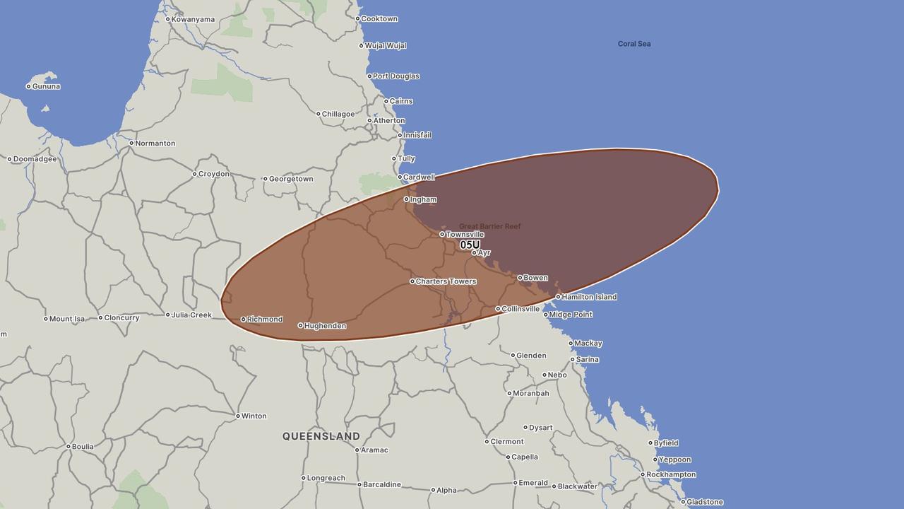
The weather system is 840km east-northeast of Townsville and tracking slowly to the coast.
On Tuesday, bureau senior meteorologist Laura Boekel said the low was now expected to develop into a tropical cyclone overnight or later on Wednesday.
A coastal crossing was likely to occur near Cardwell or Airlie Beach overnight on Thursday, Ms Boekel said.
However, she revealed the chance of it intensifying into a “severe” category 3 system had decreased.
“Our most likely scenario is still in that track map, which has a category 3 crossing,” Ms Boekel said.
Queensland Premier Steven Miles said it was “critical” for people in the area between Cardwell and Airlie Beach to be prepared by “monitoring the bureau’s warnings and the warnings from their local government area”.
“Widespread flooding is likely to follow the cyclone crossing the coast,” he said.
Mr Miles said additional Energex and Ergon crews were being deployed into Rockhampton to be ready to move into areas impacted by the system.
Much of the region was battered just before Christmas by the aftermath of Tropical Cyclone Jasper, which caused widespread flooding further north around the Cairns and other Far North Queensland centres.
On Monday, Mr Miles said one of the government’s biggest concerns was the “fatigue” of volunteers and emergency services after the hellish summer of storms.

“We’ll be carefully making sure they have all the support and services they need,” he said.
Dams across the affected regions are also being reviewed for possible water releases should they reach capacity from the heavy rainfall.
State disaster co-ordinator Shane Chelepy said additional resources had been deployed in preparation for Tropical Cyclone Kirrily.
Mr Chelepy revealed it was a crucial 48-72 hours for people and emergency services to “get prepared”.
He urged anyone on a riverine system subject to flooding to get ready by having plenty of bottled water, canned food, medications, batteries, torches and essential items stocked up.
“Engage with your local disaster management website, or Get Ready Queensland website, and take preparation activities,” Mr Chelepy said.
“It is at times up to 72 hours before emergency services can respond and provide assistance to you after these major events when it is safe for us to come out and support you.”
Major regional cities like Townsville, Mackay and Rockhampton are all in the firing line alongside coastal and island communities.
From Friday, the system is forecast to move further south over inland parts as a tropical low, the bureau’s latest warning states.
Gales with damaging wind gusts of up to 120km/h may develop around the Whitsunday Islands from Wednesday evening and extend to mainland communities between Townsville and St Lawrence overnight or into Thursday morning.
“Destructive” gusts of 150km/h may develop about coastal and island communities between Cardwell and Bowen, including Townsville, during Thursday.
This is in addition to heavy rainfall that could lead to flash flooding in the same area from late Wednesday.
The BOM’s latest warning states this rain will likely spread to adjacent inland areas and north to Cairns during Thursday and into Friday.
“During Friday, the system is expected to become an inland rain depression,” the warning states.
“Heavy rainfall may develop across central and southern inland areas, as well as southeast Queensland over the weekend as the system tracks south.”
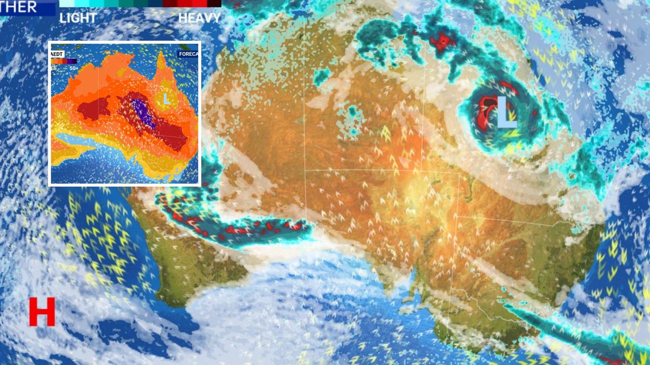
The renewed cyclone warning follows heavy rainfall continuing across the northern tropics over the past week.
An active monsoon trough and tropical low hanging around the Top End in the Northern Territory has led to “extensive” thunderstorms.
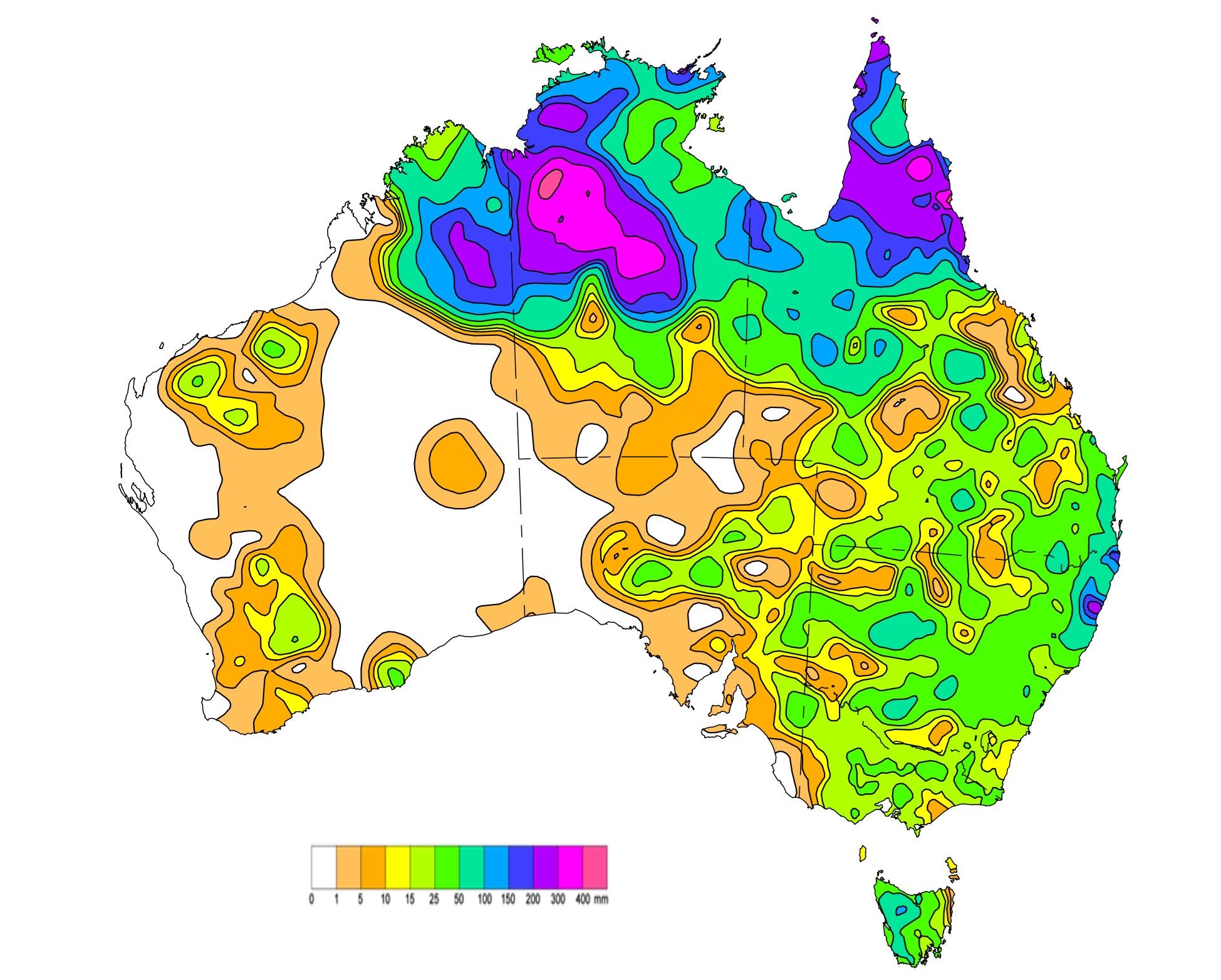
“These systems brought widespread heavy rainfall, thunderstorms with areas of heavy to locally intense rainfall and flooding to large parts of the Northern Territory and northern Queensland,” the bureau’s weekly rainfall update states.
Some areas of central and western Northern Territory and northern Queensland received more than 300mm of rainfall.
Other totals exceeded 100mm across large parts of northern Australia, along with isolated areas of northeast NSW and southeast Queensland.
The highest weekly rainfall total was 429.4mm at Montejinni in the NT.
Lowanna in NSW received the highest daily rainfall total during the week, with 373mm falling in the 24 hours to 9am on January 16.


Originally published as Freak 150km/h wind gusts, ‘life-threatening’ flooding forecast as Cyclone Kirrily bears down on Qld coast

