
0.4mm vs. 19.3mm: Patchy rain could turn into inland storms
A light patter of rain graced rooftops overnight, but Townsville missed out on a significant downpour, with neighboring towns like Ayr and Ingham seeing more substantial rainfall totals.


Townsville
Don't miss out on the headlines from Townsville. Followed categories will be added to My News.
A patter of rain was heard across our rooftops last night, but Townsville largely missed out on a decent drop, overshadowed by totals recorded in Ayr, Ingham and more.
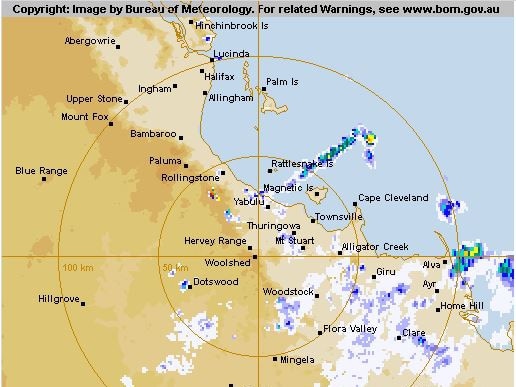
The rain event was first captured on Bureau of Meterology observations at 9pm in Bowen.
The fishing town continued to get a steady drizzle until 5.30am in the morning - a total of 13.2mm all up.
The rain band travelled northwest through the night.
It reached Ayr and Townsville around 2am and Ingham at 5am.
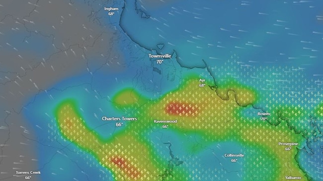
- Bowen, 13.2mm
- Ayr, 14.6mm
- Alva Beach 19.3mm
- Ingham 11.6mm
- Townsville 0.4mm
- Mount Stuart 1.8mm
- Charters Towers 0mm
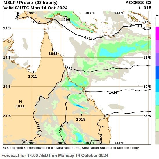
Forecasts for the rest of Monday, October 14 include a possible storm for Charters Towers and Ingham.
BOM forecasts is for the rest of the week to be dry, but shaded by lingering cloud cover.
Cardwell, Innisfail and Cairns are expected to receive the largest amount of rain from this weather pattern.
This rain comes as North Queensland residents hang out for the start of the wet season, which typically strikes in November.
The BOM has predicted an average-rainfall wet season for the Townsville region, with above-average temperatures and an normal risk of cyclones (four are predicted to cross the Qld coast).
You can keep an eye on the wet season start with this BOM northern rainfall map.
More Coverage

Originally published as 0.4mm vs. 19.3mm: Patchy rain could turn into inland storms

Nurse shares what fuels her passion after 40 years on the job
A woman with an impressive four decades of service at Townsville University Hospital is among 600 dedicated health staff members whose combined healthcare experience amounts to nearly 10,000 years.

Man allegedly attacked by dirt bike riders on rural property
A 54-year-old man has been taken to hospital after two men on dirt bikes allegedly trespassed on his property and assaulted him in a disturbing incident in Townsville’s rural area.