
Wild winds, huge swell and thunderstorms: SA warned to brace for extreme weather chaos
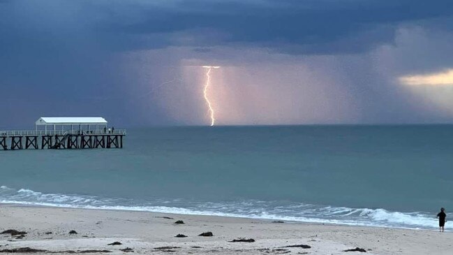
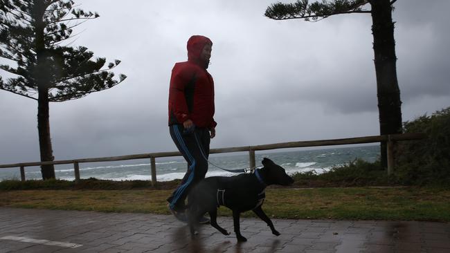
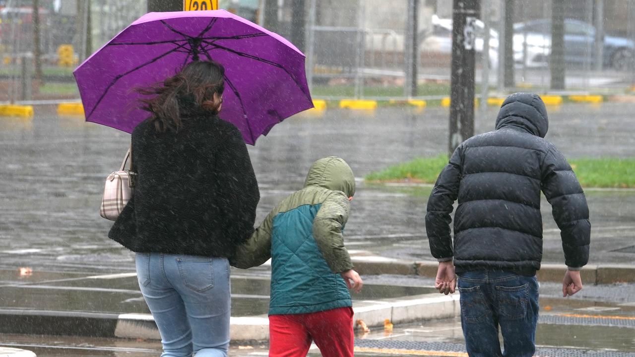
Weather forecasters are warning South Aussies to brace for chaos this weekend, with wild winds, monster swells and thunderstorms expected to lash the state.
Weather
Don't miss out on the headlines from Weather. Followed categories will be added to My News.
Extreme wind gusts of more than 100km/h are expected to sweep across South Australia this weekend, paired with intense thunderstorms and showers coming on Monday.
Additionally, the strong winds are expected to raise ocean swells by several meters.
Senior metrologist from the Bureau of Meteorology Hannah Marsh said South Aussies should prepare for the wild conditions.
“We’ve got an extreme weather event including damaging winds, squally showers, thunderstorms, and the potential for record waves, which is forecast across southern South Australia over the weekend,” Ms Marsh said.
“With these severe winds – which we’re expecting to be between 90 to 120km/h – we’re also seeing large waves of around 6m to 9m developing about the coasts on Monday.
“We’re also seeing elevated sea levels well above the astronomical high tide, with possible impacts to the foreshore, including across the metropolitan beaches.”

Ms Marsh warned the wild weather was developing on the back of one of SA’s direst starts to a year.
“In the last 15 months we’ve seen severe rainfall deficiencies across South Australia’s agricultural area … in Adelaide we’ve seen the driest start to the year since records began in 1939 and we’ve only seen 30.8mm recorded so far this year.”
She warned dry conditions mean trees may be suffering from a lack of moisture – which made them much more susceptible of being uprooted or dropping branches in the face of strong winds.
Ms Marsh added there are three “intense, low pressure systems” developing.
“We’ve got the three systems, the first one being on Saturday afternoon,” she said.
“Then, that more intense one being Sunday evening into Monday and then we have the third one on Monday afternoon.
“This will be the strongest cold front that we’ve seen since last winter.
“Rainfall totals over the two days, we’re looking at less than five millimetres about the northern agricultural area, then 5mm to 20mm about the southern agricultural area, with isolated falls of 20mm to 40mm about southern coasts and the Mount Lofty Ranges.”
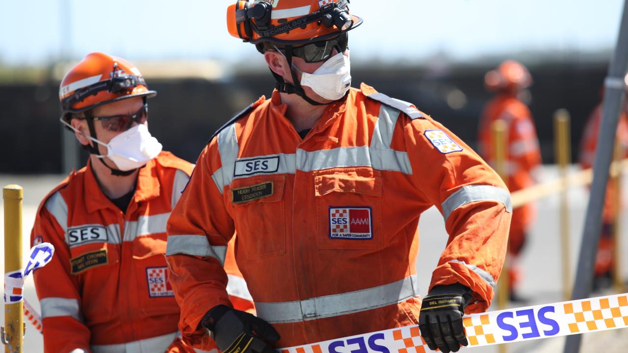
Meanwhile, the State Emergency Service has also issued a recommendation for people to prepare their properties by clearing their gutters, moving their cars into garages, and ensuring there are no items in their yards that could go flying.
The State Duty Officer Craig Brassington said he encourages people to “undertake some simple, proactive steps” as they might “contribute to minimising potential storm damage to homes and properties”
Weather forecast across South Australia:
ADELAIDE
Saturday: 21C, shower or two
Sunday: 21C, shower or two developing, windy
Monday: 17C, showers, windy
NURIOOTPA
Saturday: 20C, windy, mostly sunny
Sunday: 21C, becoming windy, sunny
Monday: 15C, showers, windy
MAITLAND
Saturday: 20C, partly cloudy
Sunday: 21C, shower or two, windy
Monday: 21C, shower or two, windy
MOUNT GAMBIER
Saturday: 18C, shower or two
Sunday: 19C, shower or two
Monday: 15C, showers
MURRAY BRIDGE
Saturday: 23C, partly cloudy
Sunday: 23C, possible shower
Monday: 18C, showers, windy
PORT PIRIE
Saturday: 23C, mostly sunny
Sunday: 23C, becoming windy, sunny
Monday: 19C, showers, windy


Feeling chilly? SA shivers through coldest morning of the year
Adelaide has recorded its coldest morning of the year with the teeth-chattering weather expected to hang around this week and bring some showers with it.
Wet weather on the way – but will it break Adelaide’s record dry spell?
After one of our driest starts to a year on record, rain is forecast to fall again over SA. But how much will we get – and will it be enough to break our dry spell?