
Make the most of the warm weather – a rain bomb is coming
Rain and possible thunderstorms are on the way in a big change from the past few days of warm, springlike weather.
Weather
Don't miss out on the headlines from Weather. Followed categories will be added to My News.
South Australia is set to receive a soaking this evening as heavy rains – with possible thunderstorms – move in.
Following the past few days of warm, springlike weather – when temperatures reached as high as 8C above the average winter maximum – conditions will begin to cool as a front rolls in on Thursday.
If the forecast holds, temperatures will plummet from today’s expected top of 24C and as much as 15mm of rain could fall.
It would follow falls of 6mm in the city overnight.
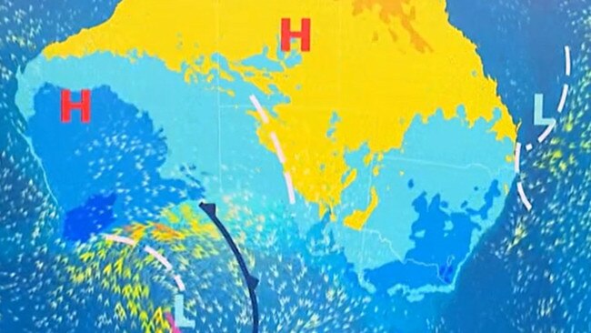
Bureau of Meteorology community information officer Morgan Pumpa said the “unusually” warm temperatures recorded this week were due to a high pressure system quite low in the Tasman Sea.
“It’s been quite large,” she said.
“But now we have a cold front coming through, we will start seeing a change in the weather.”
Ms Pumpa said temperatures would remain warm in the city before the change was expected to hit in the early evening.
The rain is expected to ease just before sunrise on Friday, before redeveloping in the late morning and into the afternoon.
“There’s a chance of heavy falls with some concern about the Hills” Ms Pumpa said.
“So take care on the roads because we could see some flash flooding from this frontal system.”
That front is forecast to deliver falls ranging from 2-15mm across the state’s regions, with possible thunderstorms in the Hills and southern suburbs, as temperatures drop back to the winter average of 16C.
Adelaide details for the next six days:
Friday, August 16: Cloudy. Very high chance of rain. N/NW winds Min – 11. Max – 16.
Saturday, August 17: Partly cloudy. Showers easing. W/SW winds Min – 11. Max – 17.
Sunday, August 18: Partly cloudy. E/NE’ly winds Min – 7. Max – 19.
Monday, August 19: Partly cloudy. Chance of showers. NE’ly winds tending NW Min – 10. Max – 19.
Tuesday, August 20: Partly cloudy. High chance of showers. N/NW winds Min – 10. Max – 18.
Wednesday, August 21: Partly cloudy. Medium chance of showers. NW’ly winds Min – 11. Max – 18.


Extreme chill sets in after wild winds and heavy rain
The worst of the wind and the rain may have moved on after wreaking havoc, but SA is now in the grips of an extreme chill bringing the coldest temperatures of the year by far.

Dust and desperation: Inside the fight to save SA’s farming future
The driest year on the books has pushed SA farmers to the brink. And on Friday, there were emotional scenes in the state’s Mid North. Find out why.