
Golf ball-sized hail and massive lightning bolts hammer down as intense thunderstorms sweep across Adelaide
Massive hailstones and drenching rain has pummelled SA as widespread storms smashed the state. Meanwhile, nine schools have been closed – see which ones.
SA News
Don't miss out on the headlines from SA News. Followed categories will be added to My News.
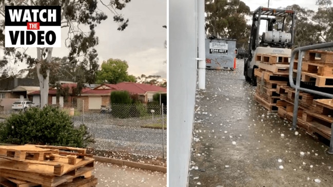
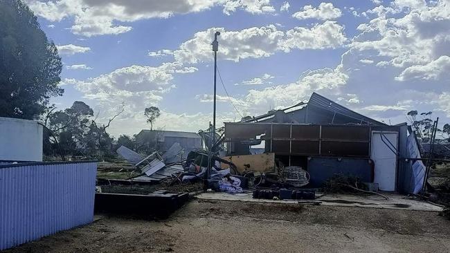
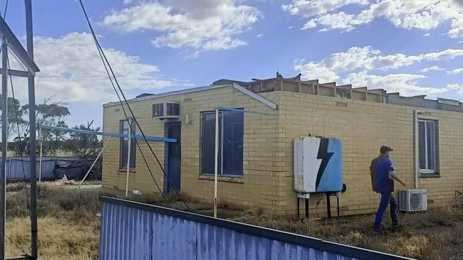
An intense storm sweeping across the state has left a swathe of damage across Adelaide’s northern suburbs, Adelaide Hills and the Barossa Valley.
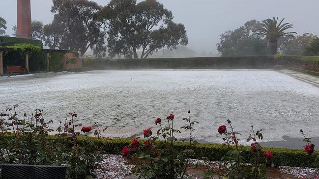
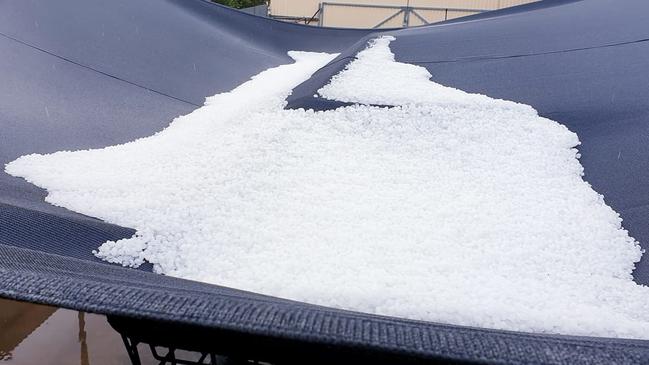
Large hailstones have dented vehicles in Elizabeth and Craigmore while numerous vineyards have been stripped.
A severe weather warning for damaging winds is current for large sections of SA.
SES spokesman Jon Carr said emergency crews had responded to 550 call-outs since late Thursday morning.
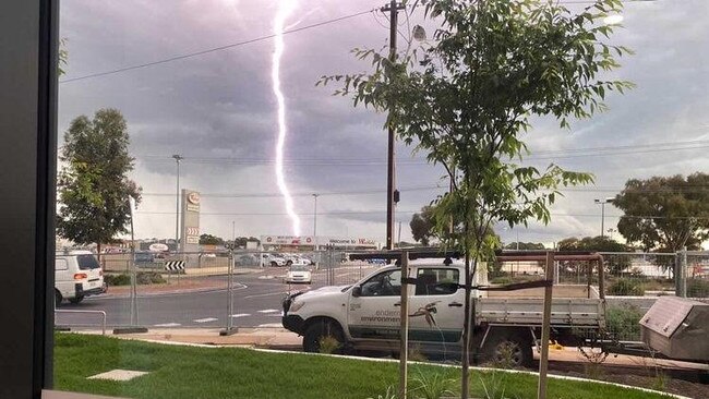
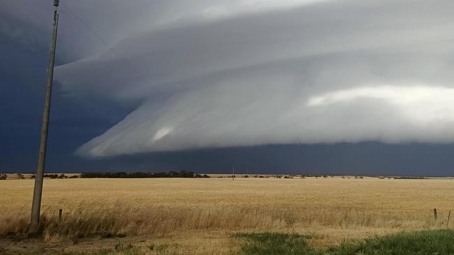
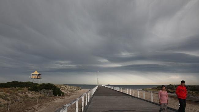
Adelaide and surrounding areas was pummelled in waves by large hailstones, intense lightning and drenching rain from early Thursday morning.
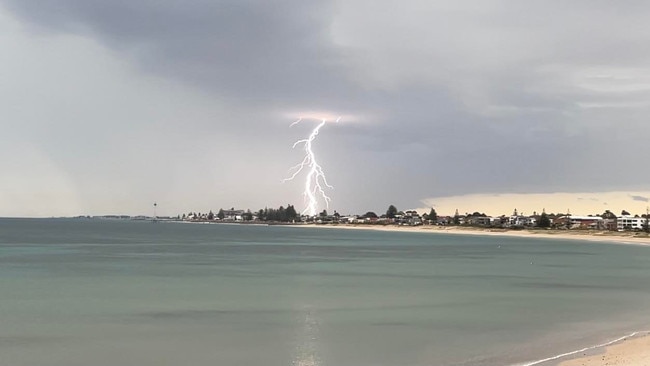
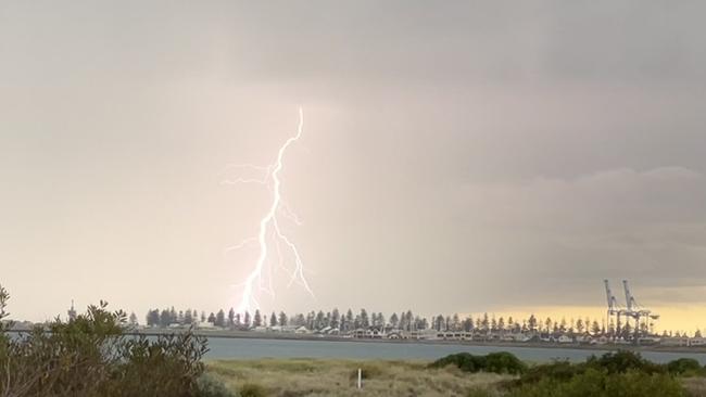
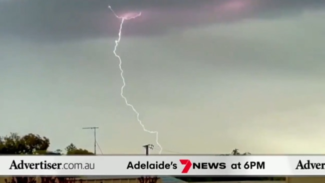
More than 72,000 lightning strikes were recorded across SA over the past 24 hours.
Nine schools have been closed after flooding or power blackouts.
BOM duty forecaster Jenny Horvat said there was more storm activity to come this afternoon, with the storm moving southeast through the Murray Mallee.
“We are not out of the woods yet,” she said.
“There was some flooding, including from hail which melted as it was falling,” she said.
.@BOM_SA has issued a Severe Weather Warning for DAMAGING WINDS 💨 For people in Adelaide, Port Lincoln, Whyalla, Renmark, Mount Gambier, Kingscote, Naracoorte, Roxby Downs and Leigh Creek. https://t.co/BuU3rJXFbkpic.twitter.com/MiCTdKJ1vO
— SASES (@SA_SES) October 28, 2021
In the past 24 hours to 2pm Thursday over 70000 lightning strikes have been recorded. More thunderstorms are expected this afternoon and evening, keep up to date with current warnings: https://t.co/q64TOIpKnbpic.twitter.com/VvMOeKnZbE
— Bureau of Meteorology, South Australia (@BOM_SA) October 28, 2021
A severe thunderstorm warning was issued for Adelaide and a swath of other SA areas, but cancelled around noon – although forecasters say there could be more storms coming.
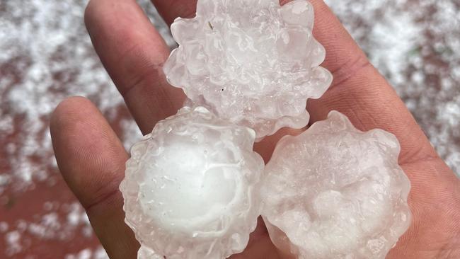
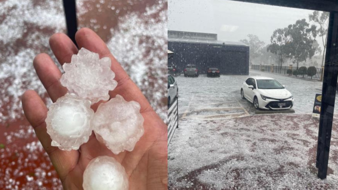
The city woke up to spectacular cloud formations and intermittent rain and lightning, with hailstones the size of golf balls pelting down on the northern suburbs.
The thunderstorms also blacked out thousands of homes across the state, especially in the Adelaide Hills.
SES Volunteer Paul Pearce said he had “never seen anything like it before”.
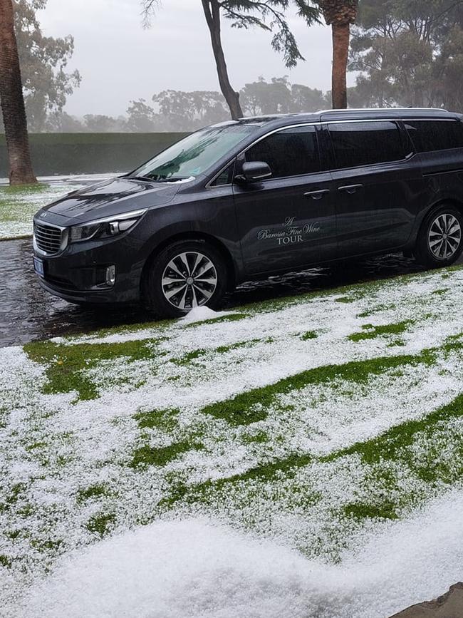
Iconic Barossa winery Seppeltsfield reported flooded offices and Faith Lutheran School also reported flooding through the roof.
A severe weather warning remains in place for much of South Australia, including Adelaide, Port Lincoln, Whyalla, Renmark, Mount Gambier, Kingscote, Naracoorte, Roxby Downs and Leigh Creek.
The clean-up and now begins, especially in north of the city and in the Barossa area, where many homes and businesses have been flooded by muddy water after the heavy rain.
The gruelling clean up task now begins in the Barossa. Plenty of mud and water around and it’s not just businesses who’ve been hit, people’s homes have been flooded too. This local was taking no chances with more rain on the way, clearing the hail from the gutters. @9NewsAdelpic.twitter.com/HvADcvo1ae
— Keziah Sullivan (@9keziahsullivan) October 28, 2021
THE HAIL

THE LIGHTNING
THE STORMFRONT
THE FORECAST
On Thursday, Bureau spokeswoman Jenny Horvat said a series of storms would create breaks in wet weather.
“It'll be a bit hit and miss as we head through the morning, there’s certainly quite a lot going on around the state today,” she said.
On Wednesday night a wind gust of 98km/h associated with a thunderstorm was reported at Leigh Creek.
The temperature in Adelaide for Thursday is expected to hit 29C but drop to 18C by Friday.
Thunderstorms are moving over SA this morning. This radar image shows thunderstorms over the Gulfs, Eyre and Yorke Peninsulas and the Adelaide area. Thunderstorms could be severe today so keep up to date with warnings at https://t.co/NXxgiBlvAlpic.twitter.com/bwVCHNSlxs
— Bureau of Meteorology, South Australia (@BOM_SA) October 27, 2021
“By Friday we would’ve settled into a more cooler, south to south-westerly air stream, so for Adelaide we’ll be back down to around 17 or 18C by Friday,” Ms Horvat said.
Ms Horvat said despite a forecast 14 degree drop in temperature by Friday, this weather was not unusual for spring.
“This is to be expected with the dynamic nature of the systems, it’s quite changeable weather at this time of the year.”
Despite the wet weather in many parts of SA, a fire weather warning is current for the North West Pastoral, Eastern Eyre Peninsula and Flinders districts as hot, dry windy and gusty northerly winds ahead of a change are forecast.
Temperatures will hit nearly 40C in many parts, adding to the fire danger.
Ms Horvat said Adelaide saw its warmest minimum temperature in eight months on Wednesday morning, with an overnight low of 21.8C at 5.50am Wednesday.
“Back in February we saw a minimum of 26.6C and that was on the 19th of February, so it’s our warmest night since then,” she said.
The official bushfire season will begin for some parts as early as November 1.


Join the conversation

Press Council Adjudication
The Press Council has decided that a series of front page articles concerning the gas industry did not breach its Standards of Practice.
Read more

‘This is historic’: 1000 flock to The Advertiser’s Peter Party
Peterborough has been ravaged by drought, but on Monday there was a flood of joy as The Advertiser’s Peter Party came to town.
Read more