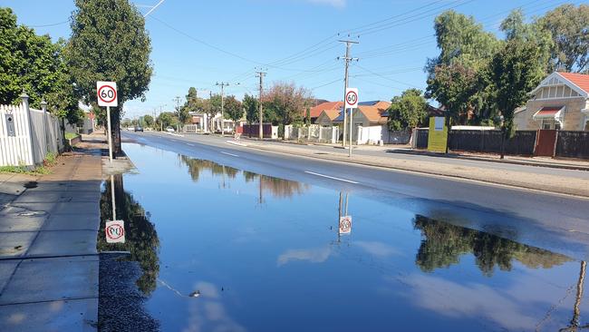
Flooding up to the footpath on Marion Rd, while farmers rejoice the end of the dry season
Marion Rd is flooded up to the footpath in the left lane between Elizabeth St and Henley Beach Rd. Meanwhile, drought stricken farmers are welcoming the heavy rain.
SA News
Don't miss out on the headlines from SA News. Followed categories will be added to My News.
Following the state’s highest recorded rainfall totals since June over the weekend, a major thoroughfare, Marion Rd, is flooded between Elizabeth St and Henley Beach Rd in Brooklyn Park.
A caller reported the water to have reached the footpath across the entire left lane, affecting motorists.
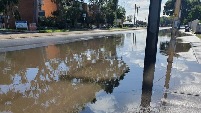
SA Water attended the scene to determine the cause of flooding, but put it to heavy rainfall.
Meanwhile, drought stricken farmers across South Australia are rejoicing over the heavy rainfall.
Lobethal and Ashton in the Adelaide Hills saw 44mm over 24 hours from Saturday, the highest rainfall totals since June 12 2019, where 39.8mm was recorded at West Tce, in Adelaide.
Bureau of Meteorology Duty Forecaster Bonnie Haselgrove said the rain was wide spread across SA, with particularly wet areas recorded through the Yorke Peninsula, Mount Lofty Ranges and the Murraylands.
“In terms of comparing it to other rainfall days we’ve had through the rest of Autumn and Spring last year, we have to go all the way back to June until we get a day that's as wet,” Ms Haselgrove said.
Lenswood apple, pear and cherry grower, and chairman for the Apples and Pears Association, Ashley Green said he was pleased with the rain.
“We welcome the rain nonetheless, because it gives us the chance to not have to irrigate.” Mr Green’s properties in Lenswood and Birdwood were lucky to escape damage from the December fires, but was heavily affected by the previous hot and dry season.
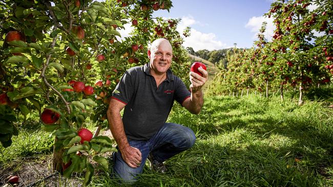
“Regular rainfall events throughout Spring and Autumn and Summer rainfall … is always welcome, and in winter time we love to have regular rains and big rainfall events.”
Wade Dabinett, Chairman, for Grain Producers SA said the weekend’s rain gives farmers in the agricultural area a chance for a good season.
“Its probably the best start we’ve had in a long while, and after the last couple of seasons it certainly signals hopefully a turn around in seasonal conditions, after some pretty terrible dry tough times,” Mr Dabinett said
“It looks like we’ve had widespread opening rains right across our agricultural zone in SA which gives nearly every farmer growing grain in the state an opportunity to start their sewing program.”
Ms Haselgrove said we can expect more wet weather from Tuesday, and a cold front moving through on Wednesday morning and possible hail across the agricultural districts.
“When this cold front comes on Wednesday it will be noticeably cold and windy and wet.” She said the days going forward will be start of the cold winter season.
“We’re looking at cold days that we haven’t seen since September last year – to have so many days in a row that cool.
“This will probably looking like it will be sort of the shift into the wintry season.”
THIS WEEK’S FORECAST:
Monday: 20C
Tuesday: 23C
Wednesday: 16C
Thursday: 15C
Friday: 16C
Saturday: 18C
Sunday: 18C