
Cold front to bring widespread rain across South Australia after unseasonably warm start to winter
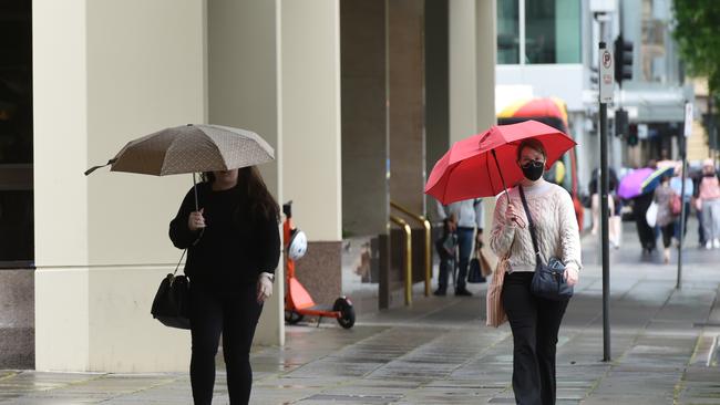
A wild cold front that dumped more than 60mm of rain on Perth in three hours is heading to SA to put a dampener on our glorious start to winter.

SA News
Don't miss out on the headlines from SA News. Followed categories will be added to My News.
A cold front that dumped 60mm of rain in Perth in the space of three hours on Sunday night is on its way to South Australia to crash our unseasonably warm start to winter.
Much of South Australia saw temperatures north of 20C over the weekend, with Adelaide recording a high of 25.3C on Saturday – the fourth warmest June day on record.
It was just shy of the 25.6C on June 4 in 1957 as the highest temperature recorded for the month.
But Bureau of Meteorology duty forecaster Hannah Marsh said there will be “a front coming through” during the week in Adelaide.
“We’ll see a rain band developing on Tuesday and there’s a chance of thunderstorms in this rain band,” Ms Marsh said.
“More generally for the state we’re looking at 10-30mm of rain.”
The same weather system dumped 66mm of rain on Perth on Sunday evening, the majority of which fell in a three-hour period.
The unseasonably warm start to winter will continue until the front arrives, with tops of 21C and 23C forecast for Adelaide on Monday and Tuesday.
There will be medium chances of showers to start the week but Wednesday will see temperatures drop to 20C with showers, a chance of a thunderstorm and heavy rainfall possible.
Between 8mm and 25mm rainfall is expected on Wednesday in Adelaide, with another 2-7mm on Thursday and 0-4mm on Friday.
Winds during the rainfall peak on Wednesday morning will be 25-35km/h north-westerlies.
More extreme weather with “25 to 50mm of rain with thunderstorms east of the Flinders Ranges” is expected on Wednesday, Ms Marsh said.
By Friday in Adelaide the mercury will drop to 16C with a high chance of showers.
North of the city in Elizabeth, 23C on Tuesday will be the top of the week and Wednesday will see 10-25mm of rain and by Friday, temperatures will be as low as 15C with a high chance of showers.
HIT PLAY TO SEE FORECAST RAIN PATTERNS
In the Adelaide Hills, Mount Barker will see a top temperature of 21C on Tuesday, dropping down to 14C by Friday.
In Stirling, Tuesday will see the top temperature for the week at 19C before a low of 12C with showers on Thursday and Friday.
Elsewhere in the state, the mercury in Port Augusta will reach as high as 26C on Tuesday but by Friday, after midweek showers, it will be as low as 18C.
Port Pirie will have a similarly warm start to the week with 22C and 26C across Monday and Tuesday before a low for the week of 17C with a shower or two on Friday.
India Ward said she enjoys winter and the chance to get cozy.
“I might be in the minority but I think the older I get the more I realise I prefer and embrace winter,” she said.
“Maybe it’s because my birthday is in June and I love being cozy.
“It’s always easier to warm up than to cool down.”


Man in his 70s brutally assaulted in broad daylight backyard attack
An elderly man's afternoon took a violent turn when an intruder allegedly stormed his backyard and punched him in the face, in an unprovoked attack in a quiet SA town.

Getting on with business
Supercharging from start-ups to stars – Small Business Week helps build successful South Australian enterprises