
Cyclone danger for Queensland as La Nina comes to an end
Queenslanders have been warned of fresh tropical cyclone danger as forecasts show La Nina finally coming to an end.
QLD weather news
Don't miss out on the headlines from QLD weather news. Followed categories will be added to My News.
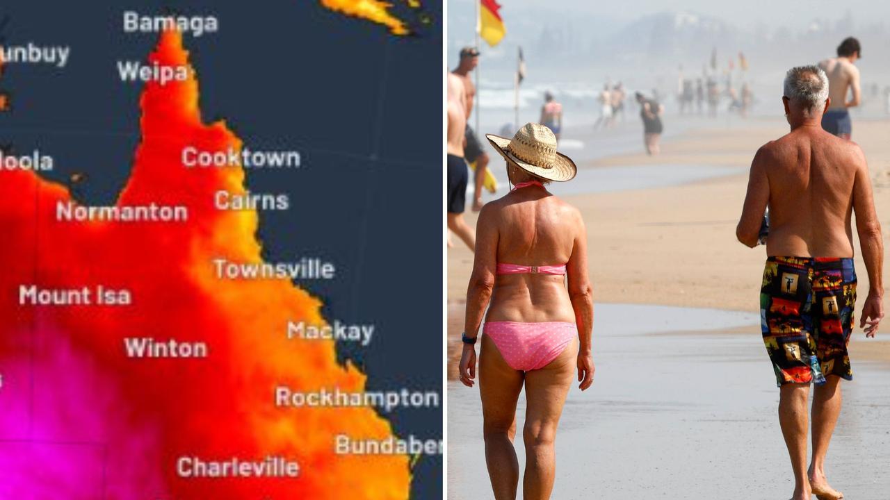
After a relatively dry Queensland summer the Bureau of Meteorology has confirmed La Niña will soon come to an end but the state has been warned of fresh tropical cyclone danger due to warming sea temperatures.
Initial predictions indicated Queensland would experience higher than average rainfall and possible flooding during December however, most areas received less than average monthly totals with the exception of western parts of the state.
The Bureau’s latest climate outlook now shows La Niña conditions have significantly weakened with the ENSO cycle predicted to return to neutral in January.
But Senior Meteorologist Jonathan How said Queenslanders would have to keep a keen eye out for cyclone’s, with further heavy falls also not yet ruled out as part of the states traditional summer weather.
“The important thing is that the rainfall won’t switch off automatically just because La Niña is switched off, it will simply return to its old pattern, and the ground is still fairly wet so any heavy rainfall can still provide flooding,” he said.
“Sea surface Coral Sea temperatures are incredibly high, which means there’s a lot more moisture and vapour in the air.
“When there’s any tropical storm or cyclone there’s a lot more fuel for that, so regardless of whether La Niña weakens off were still expecting above average cyclone season.”
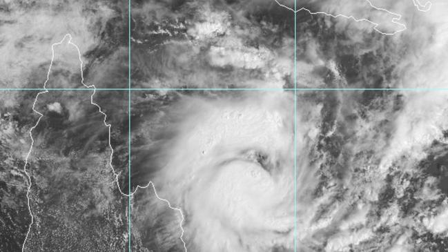
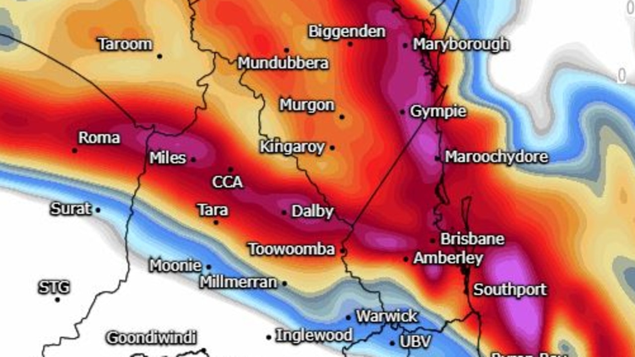
Queensland has already recorded two tropical cyclones over the past two weeks, Darren and Airlie, with warm sea temperatures currently migrating south.

Although cyclones are notoriously erratic and difficult to track, Mr How said further ocean warming would pump more moisture into the air and give any potential cyclone extra “fuel” to travel further south.
“The main risk area is anyway north of Bowen, Mackay up to the tropics,” Mr How said.
“It’s difficult to say which southern areas will get them as well.
“With warmer temperatures moving further south there’s always the chance the system can maintain their strength for a longer period … Oswald went down to Brisbane and into the Lockyer Valley as well.
“This is a timely reminder to people that this is the wet period, don’t drive in flood waters and keep your cyclone plan ready to go.”
But Bureau of Meteorology forecaster Danny Johnson said there is still expected to be some sunny days in January.
“For the next few days, we are going to have a bit of a partly cloudy with a possible shower or two,” Mr Johnson said.
“We’ve got some pesky little systems until Monday then we should see a return to normal conditions.
“We are going to have some pretty sunny days, then we will have some rolling afternoon thunderstorms.

Shelby Ackerman, of Albion, said she was hopeful there would be plenty of sunshine in the New Year because she loves to visit Scenic Rim and hike.
“There’s a lot of sightseeing, the wineries have outdoor venue. It’s definitely a get outside kind of area,” she said.
“The best of it is nature.”
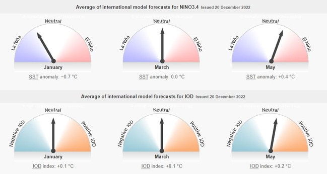
Meanwhile the Indian Ocean Dipole (IOD) has already returned to neutral and is not affecting Australia’s weather, while The Southern Annular Mode (SAM) is expected to switch from positive to neutral phase during January and February.
The Bureau’s long term climate outlook predicts Australia will move into an El Nino phase during May however, Mr How says it’s still too early to confirm.
El Nino weather patterns usually indicate dry, drought-like conditions, particularly in eastern Australia with nine of the ten driest winter – spring periods on record occurring during El Nino years.
“Australia is more rigorous compared to other agencies. We look at pressure, winds, sea temps, cloud cover before we declare La Niña being over or not,” Mr How said.
“The recent observation is the Pacific Ocean is starting to warm up which indicates a warming of La Niña and is one of the first signs of weakening.
“All the models are pointing toward that warming and that’s basically over the Pacific Ocean which means a move towards El Nino
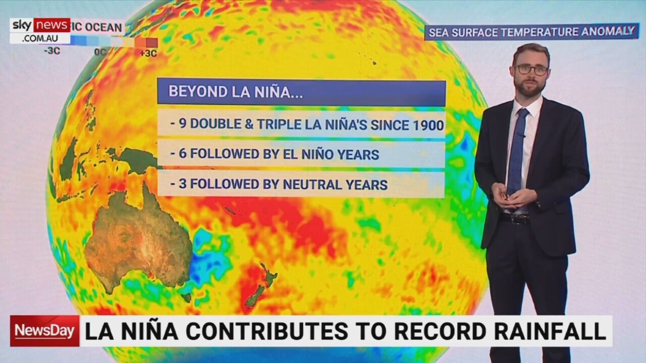
“It’s probably too early to say … but 40 per cent of La Niña’s are followed by El Nino so it does happen.”
The Bureau will release its next climate outlook on January 4.
More Coverage

Originally published as Cyclone danger for Queensland as La Nina comes to an end
Storm chasers warn of destructive winds, giant hail; BOM says ‘outside chance’
Amateur storm chasers are warning destructive storms are possible for large parts of southern Queensland this afternoon. It comes as temperatures soar over 36C in parts.
Supercell, large hail threat for Qld amid 40C temp spike
Temperatures of nearly 10C above the October average are set for parts of Queensland today and into the weekend with conditions prime for thunderstorms.