’Early summer’: Australia to be hit by double whammy heat
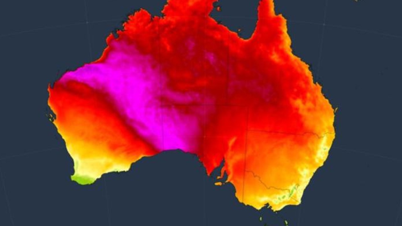
Unseasonably warm heat is building in Australia’s interior getting set to shoot across the country to our major cities over the coming days.
Weather
Don't miss out on the headlines from Weather. Followed categories will be added to My News.
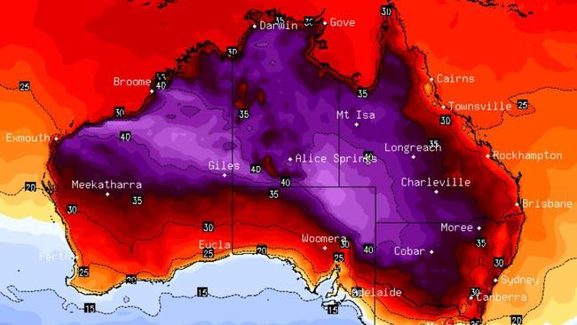
A double whammy of heat is set to creep across central Australia towards eastern and southern cities bringing above average temperatures and an “early taste of summer” for the first days of November.
Parts of Sydney and Adelaide could reach the mid-thirties on the weekend while Perth is looking at 33C on Thursday. Parts of the interior could streak far beyond 40C highs.
It comes as forecasters say a re-emergence of the La Nina climate driver is becoming more likely, which could lead to a wetter summer.
A large area of high pressure is parked off the south coast of Australia allowing heat to build up in the country’s north west.
A cold front crossing southern Australia will then funnel that heat toward the south.
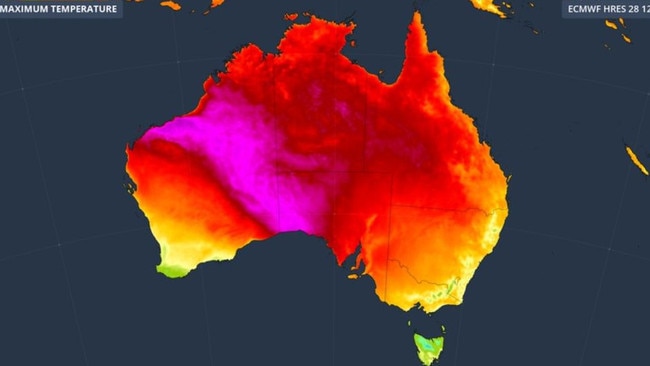
“A large pool of hot air will spread across Australia in the opening week of November, giving many parts of the country an early taste of summer.,” meteorology website Weatherzone stated.
“A tongue of heat will spread over South Australia on Saturday and into eastern Australia from Sunday.
“A second wave of heat is then expected to drift across central and southern Australia next week.”
At this point, temperatures for next week could fluctuate as we’re still several days out. But 40C highs particularly for parts of the nation’s interior look likely.
Capital cities getting warmer
It’s already heating up in Perth with a 31C maximum for Wednesday followed by 33C on Thursday.
But because the WA capital is nowhere near the cold front, temperatures will actually drop as we head towards the weekend with a highs of around 22C and a Sunday morning low of just 11C.
Yet up in the state’s north it will be scorching. Broome will settle around 35C, Port Hedland will bounce around 39-42C for the next seven days and always boiling Marble Bar can expect 44C on Friday.
Mid-twenties highs for the rest of the week in Adelaide will shoot up to 33C on Saturday before a dip back into the twenties.
Melbourne will see a mild maximum of 17C on Friday with a chilly Saturday low of 8C. But during the day on Saturday it will creep up to 26C and then 29C on Sunday.
Hobart on Wednesday will peak at 18C and then a mere 15C for a showery Thursday and Friday. Saturday will see temperatures rising initially to 22C and then 26C on Sunday when some showers are due.
Pleasant in Canberra with a high of 27C on Wednesday and 23C on Friday. The weekend will start at 25C on Saturday and then top out at 31C on a mostly sunny Sunday.
Sydney’s CBD will see some rain on Thursday, Friday and Saturday. Heading towards the weekend, temperatures will peak around the mid twenties. But Saturday could see 31C and 28C on Sunday, which should both be dry.
The usual maximum for Sydney’s CBD in November is below 25C.
The city’s west will be even warmer with a high of 36C on Sunday in Penrith
Brisbane will get to 31C on Thursday and Friday with some storms. Saturday and Sunday will edge towards 30C highs with mostly clear days.
Tuesday of next week could see 31C again in the CBD with 34C in Ipswich, in the city’s west.
Darwin will bob around 34C for the rest of the week and into the weekend. Alice Springs will be hotter, right under that funnel of heat from the north west to east. It could reach 40C on Sunday and not far off that on Saturday.
La Nina bubbling up
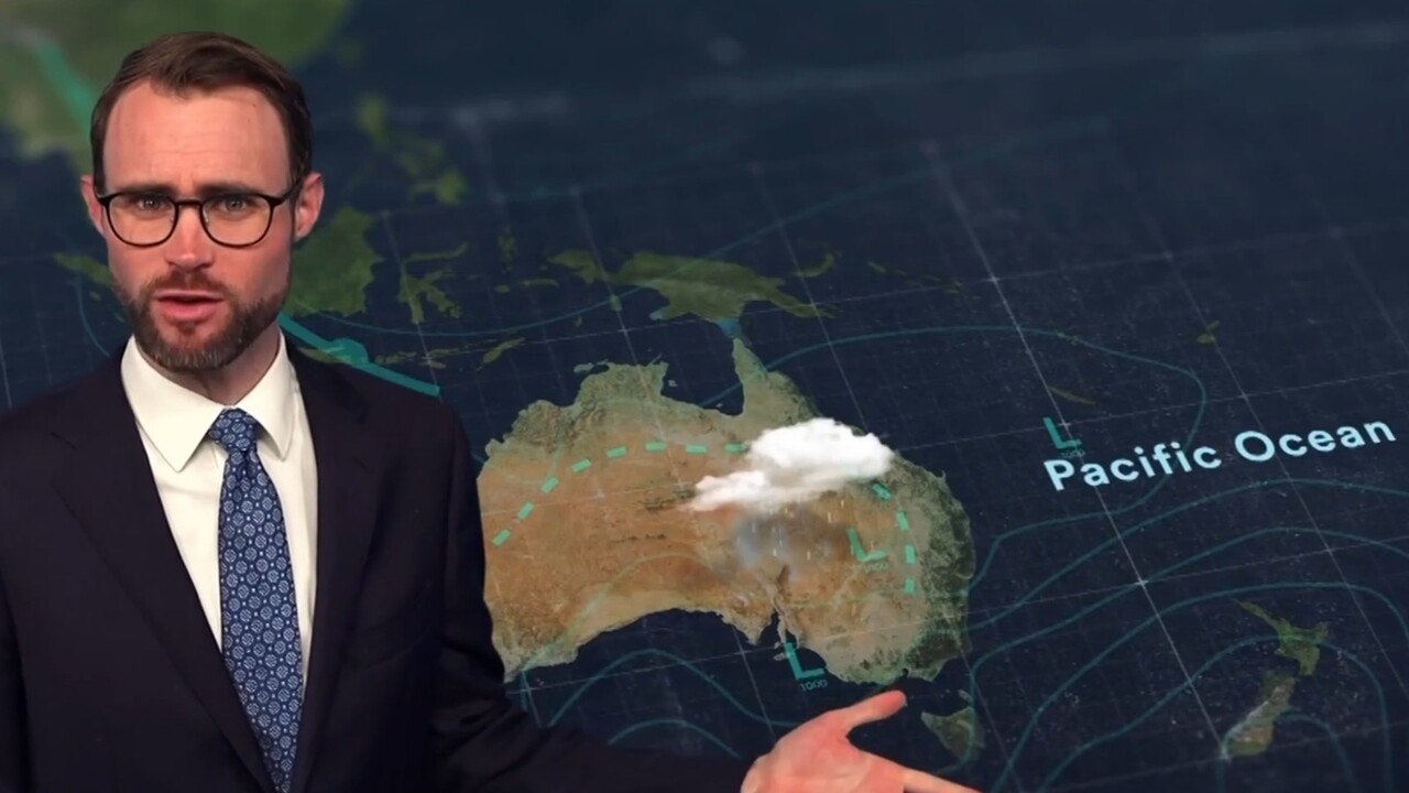
Winds are building and waters are cooling in the Pacific Ocean, heading towards La Nina levels.
The Bureau of Meteorology has said there is a 50 per chance that the climate driver could come back.
“The atmosphere is starting to kick in because the ocean is already in La Nina territory,” said Sky News meteorologist Rob Sharpe.
“Winds have been stronger than usual in the past couple of months, reaching the (La Nina) threshold”.
A La Nina tends to lead to warmer waters around Australia – even if they’re cooler in the heart of the ocean. These warmer seas can produce more clouds over Australia’s east coast increasing chances of rainfall. Temperatures can also be below average.
“If La Nina does come into effect, Australia can expect to see an increase in wet weather from the middle of November and beyond to early December,” stated Sky News.
Originally published as ’Early summer’: Australia to be hit by double whammy heat


