
‘Unusually’ warm and wet: Weather outlook for next three months
Forecasters have looked into their crystal balls and, well, for some it’s not great news for spring and early summer weather.

Environment
Don't miss out on the headlines from Environment. Followed categories will be added to My News.
Forecasters have warned the weather during the remainder of spring and into early summer could be unpleasant for some.
Get ready for more and heavier rain across much of the country as well as “unusually” warm days and nights, particularly in the north of the country.
With all that moisture and warmth, humidity could be a factor too.
The Bureau of Meteorology (BOM) has released its longer range weather outlook for the next three months into the New Year.
It comes as the expected La Nina climate driver, which increases the chance of wetter than average conditions for the east due to warmer waters off the coast, is still yet to materialise.
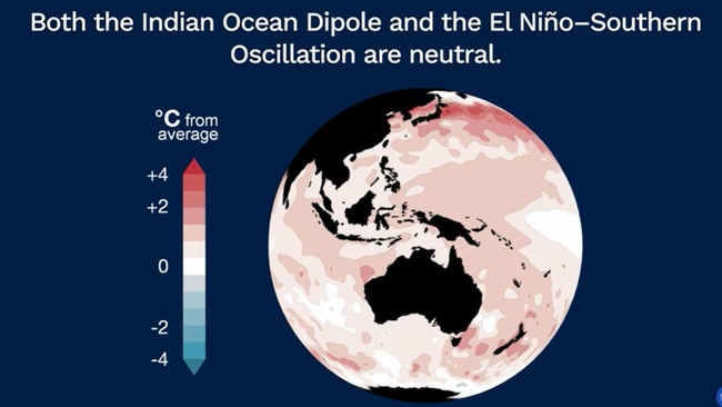
The El Nino-Southern Oscillation (ENSO), which fluctuates between La Nina and the drier El Nino, remains in neutral mode, the BOM has said.
Most climate models have suggested it will remain this way until at least the New Year. But the BOM has stated that a La Nina emerging is still a greater than 50 per cent possibility going forward.
While US meteorologists – which have a slightly different definition of La Nina – have said the climate driver is “slowly developing”.
Indeed, ocean temperatures are warmer than average around Australia – just not quite to La Nina definitions.
This means even with ENSO in neutral mode, Australia’s weather may still have some wetter La Nina characteristics for months.
Off Australia’s west coast, the Indian Ocean Dipole – the equivalent to ENSO – is also parked in neutral gear.
It could slip into a weakly negative mode at some point which would mean sea temperatures have risen aiding in some increased rainfall.
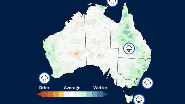
During September, rainfall was lower than average for a parts of south eastern Australia, including Victoria and South Australia, south west Western Australia and large chunks of Queensland and New South Wales.
Going forward, while a wet morning commute may not be welcome for many, the moisture should top up drier soils in many areas.
“For November to January, rainfall is likely to be above average for most of Queensland, and extending along the New South Wales and Victorian east coast and into north eastern Tasmania, the southwest of Western Australia and far north of the Northern Territory,” said BOM meteorologist Miriam Bradbury.
Elsewhere, rain is likely to be around average.
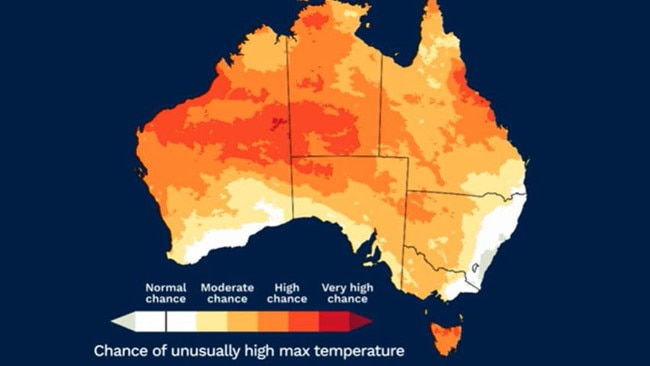
Last month, temperatures were above the norm and the long range forecast shows no signs of that relenting.
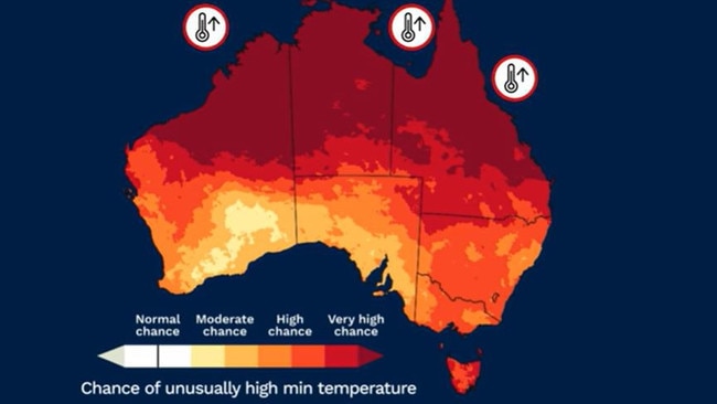
“To January, there is an increased chance of unusually high maximum temperatures across most of Australia,” said Ms Bradbury.
Tasmania could be particularly warm, the BOM has warned.
“There is also an increased chance of unusually high overnight temperatures, especially across the north where the likelihood exceeds 80 per cent around Australia.”
Originally published as ‘Unusually’ warm and wet: Weather outlook for next three months
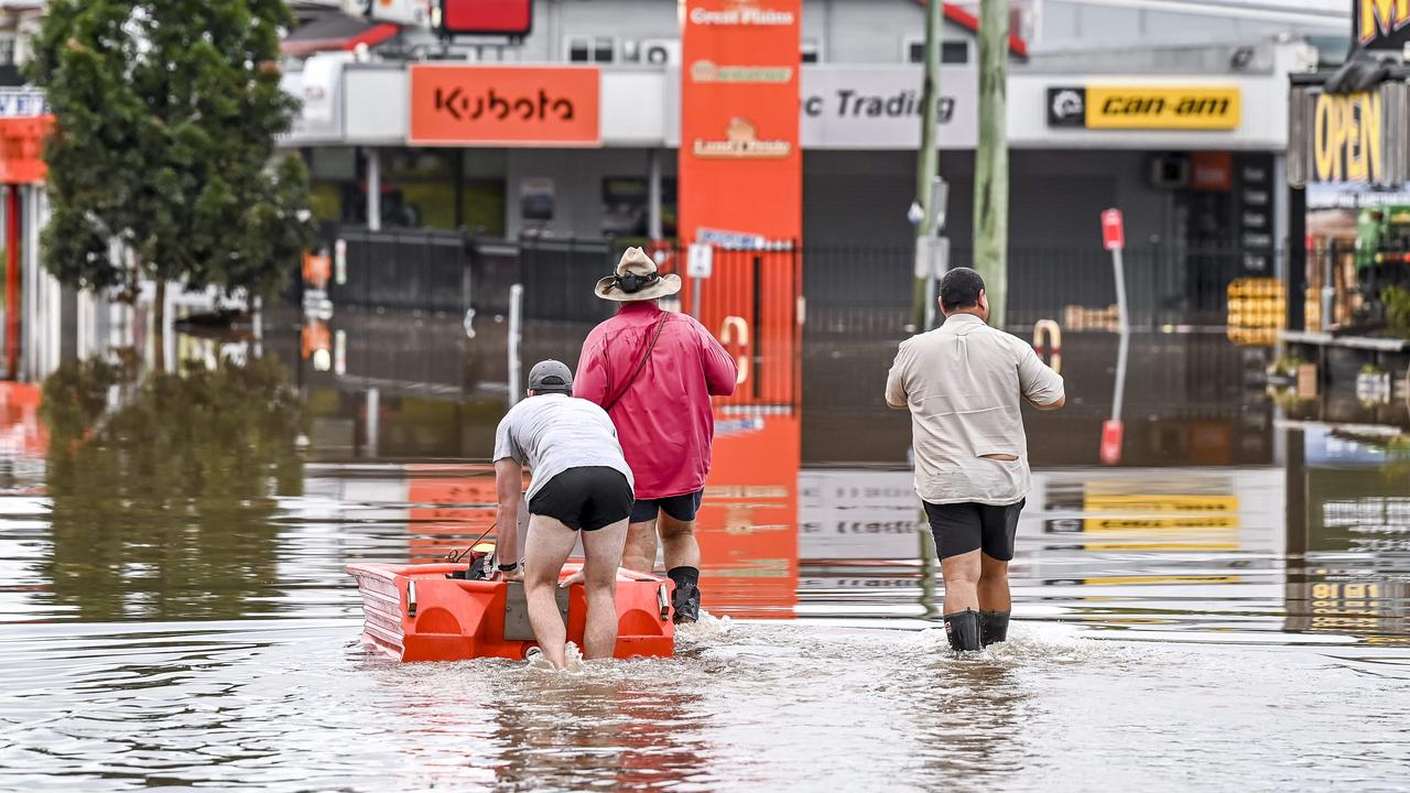
‘Failed too many’: Insurers lashed on floods
A parliamentary inquiry into the response of insurers to severe floods in several states in 2022 had let down many victims by failing to meet their obligations.
Damaging winds, hail warning for weekend
Parts of the east coast of Australia are likely to be impacted by severe thunderstorms, hail and damaging winds across the weekend.