
Bureau of Meteorology says tropical low poses moderate cyclone risk as monsoon arrives in the Top End
Weather watchers have warned that there is a moderate chance of a tropical low developing into a cyclone near the Top End, as another tropical low also looms. Read the forecast.

News
Don't miss out on the headlines from News. Followed categories will be added to My News.
Weather watchers have ruled out the possibility of the Territory being smashed with two cyclones at once as the monsoon arrives in full force.
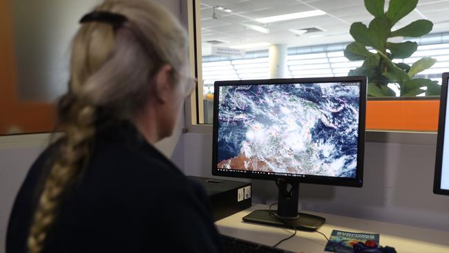
The Bureau of Meteorology confirmed the Top End was predicted to be sandwiched between two tropical lows in the coming days, with systems developing over waters to the east and west.
On Wednesday, senior metrologist Sally Cutter said there were systems forming in the Joseph Bonaparte Gulf — near the Victoria and West Daly region — and the Gulf of Carpentaria.

“At this stage there’s moderate chance of the low in the Joseph Bonaparte Gulf to develop into a cyclone but and only low chance for the one in the Gulf of Carpentaria,” Ms Cutter said.
She said it was unlikely that both lows would develop into cyclones, as they would “probably need to be a little bit further away”.
“Two lows close together don’t really help the evolution of either them,” Ms Cutter said.
Wet weather increasing for the #TopEnd this week, with #monsoon conditions developing across the northern Top End from Friday https://t.co/DRE9v9sgcV
— Bureau of Meteorology, Northern Territory (@BOM_NT) January 9, 2024
There is an increasing risk of a #tropicalcyclone in the Timor Sea from Friday https://t.co/xVWNgbEm7fpic.twitter.com/cjlq1eMubi
The monsoonal conditions are expected to dump between 50-100mm of rain in isolated areas, as “squally showers and storms” moved quickly over the region.
“They will get more frequent as we go into the weekend and that monsoonal surge that’s coming down the Banda and Arafura seas moves into the Top End,” Ms Cutter said.
The #MonsoonTrough will move over northern Australia this week, with extensive rainfall likely across the Top End. An area of low pressure is forecast to form in the Timor Sea, with a 25% chance it will develop into a tropical cyclone over the weekend.https://t.co/HAu9HKDVV0pic.twitter.com/bEBowMex64
— Bureau of Meteorology, Northern Territory (@BOM_NT) January 9, 2024
She said it was expected that the rivers would start to come up particularly in the Victoria River catchment, and like most wet seasons some remote communities would be cut off by the rainfall.
“If you are heading out bush just keep an eye on what the weather’s doing,” Ms Cutter said.
The next cyclone system is expected to be called Kirrily, however the senior metrologist said there was no guarantee these tropical lows would intensify to cyclonic conditions.
“We may just see the lows sit off the coast and it will ease just spin around a little bit and then move southward,” she said.
Ms Cutter said the current monsoon was a bit behind schedule, which was expected given arrival of the El Nino and the positive Indian Ocean Dipole.
“Each wet season we have these monsoon bursts that generally last a week or so, and then there’ll be a three to four week break until the next burst,” she said.
Ms Cutter said so far the Wet had been “fairly patchy … but it only takes one load to move over the top and drops to 100 or 200 millimetres and we’ll get back to that average”.
She advised everyone to keep across any weather warnings or alerts over the coming days.
More Coverage


Originally published as Bureau of Meteorology says tropical low poses moderate cyclone risk as monsoon arrives in the Top End

Darwin mayoral candidate’s stylish vision for Top End capital
Former Deputy Chief Minister Peter Styles has thrown his hat into the ring to become the next Lord Mayor of Darwin. Find out what he is campaigning on.

Costs claim against ‘racist’ former cop declined by NT Appeals Court
A cost order against a former NT cop’s unsuccessful appeal in the Kumanjayi Walker inquest – in which the findings labelled him a ‘racist’ – has been declined. Find out why.