
Murray Bridge told ‘act now’ to defend against rising flood risk
The really high levels of flood water may still have a way to travel downstream – but these riverside locals have been told waiting time is over.
Local
Don't miss out on the headlines from Local. Followed categories will be added to My News.
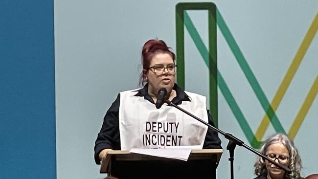
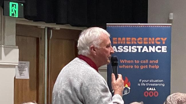
River dwellers, farmers, and tourism operators have packed out the Murray Bridge Town Hall as the community braces for rising River Murray waters.
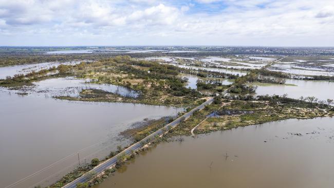
Flood modelling predicts water to inundate low-lying areas of Lower Murray townships, river shacks and farming land by mid-December and about 300 people turned out on Monday to hear from emergency services and state agencies before peak flows hit.
The message for those in the flood’s path was clear – act now.
Representatives from the SES, SA Water, SA Power Networks, Murray Bridge Council and state government departments briefed the community on Monday on a wide range of potential impacts.
Residents were warned of potential power supply disruptions to low-lying homes and shacks, impacts to sewage services, road closures, and even the impact to tap water quality.
It is predicted Murraylands ferries will close, forcing motorists to rely on bridges more than 100km apart at Murray Bridge and Blanchetown.
Environment Department water delivery manager Chrissie Bloss said the flow levels in the Riverland – where floods have been described as a crisis – took about two-and-a-half weeks to arrive at Murray Bridge and while flood mapping was essential, it was sometimes unpredictable.
However, she said the department expected the water levels to remain high after the peaks arrived.
“We’ve recently upped the forecast again to 165GL a day, possibly up to 200, 220,” she said.
“This flood is going to last for a long time … it’s going to stay high for probably months.
“It‘s going to be an inconvenience and disruption with a lot of water sitting around in the flood plain.”
And while the message was clear to residents and recreational water users to get out of harm’s way, farming operations on the Lower Murray swaps are relying heavily on the river’s levee banks to protect their livelihoods.
Murraylands dairy and cropping farmer Clem Mason – who farms at the bottom of the river near Jervois, and at Lake Alexandrina and Lake Albert – attended the meeting and said he was optimistic the levee banks would withstand the high flows, but reminded farmers to be vigilant.
“We’ll save the levee banks; at 220 (GL) most of the levee banks are going to handle,” he said.
“Let’s go back to 1956, that’s when they didn’t – that was 350GL a day and there are a few people here today that can remember ‘56, I can.”
Mr Mason organised a meeting of farmer at Jervois on Tuesday and told The Messenger levee breaches would spell trouble for farmers.
“There will be events but we’ll fight them and identify breaches and fix them … we are going to patrol this levee every two days with two people, record what we see and any weaknesses that occur,” he said.
Mr Mason said farmers had relied upon the integrity of the levee banks since 1927 when they were first built.
“These levee banks; built by government, set up by government, maintained by government, are the responsibility of government,” he said.
“(But) the responsibility of everyone on the swaps; be vigilant, drive along your banks, watch out for breaches, report them, get onto it and let’s fix them as they start cracking.”
He said major levee failures would have dramatic event and could damage operations for years to come.
“We would have to repasture, re-fence, irrigation channels would cave in, re-level … we don’t want to have to get to that,” he said.
“We want to work together with the government to save the levee bank, saving our land and saving farmers livelihoods.”
More Coverage


Fast food and ‘deradicalisation’: Glenunga school bomb plot twist
A young Adelaide man who allegedly threatened to attack a high school and contaminate food wants to return to his job in the fast food industry on bail, a court heard.

Neo-Nazi demands SA taxpayers cough up for his legal bills
The Victorian leader of the National Socialist Network is no longer charged over a Survival Day protest in Adelaide – and now wants his legal fees paid for.