
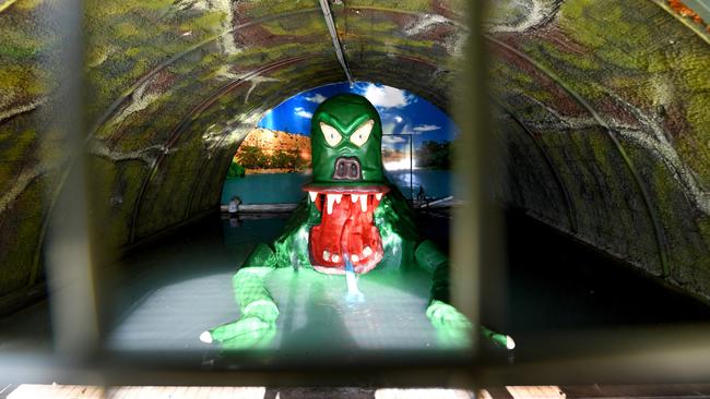
Murray Bridge’s Sturt Reserve - home of the iconic tourist attraction the Bunyip - could be in River Murray flood path
Flood modelling show the home of Murray Bridge’s iconic Bertha the Bunyip could be in the flood’s path when peak flows hit.
Adelaide Hills & Murraylands
Don't miss out on the headlines from Adelaide Hills & Murraylands. Followed categories will be added to My News.
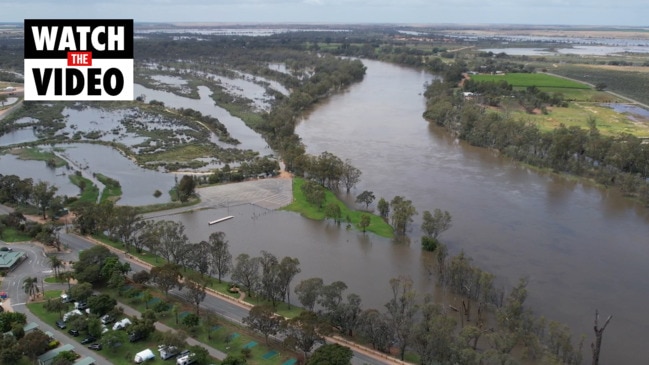
The Murray Bridge community is bracing for impact with the fast flowing waters of the River Murray expected to inundate Lower Murray towns in the coming weeks.
The Department for Environment and Water’s latest inundation mapping shows Murray Bridge’s Sturt Reserve - home of the iconic tourist attraction Bertha the Bunyip - could be in the flood’s path.
The Murray Bridge council has already closed some riverfront reserves, jetties and boat ramps in an effort to protect residents and infrastructure as River Murray peak flow predictions continue to rise.
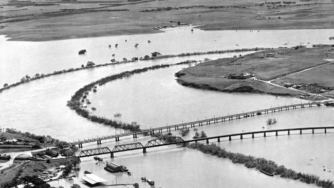
The state government announced flows were expected to increase to 165GL a day from early December with a chance of even higher flows and the inundation map shows at flows of 160GL, water could flow over Murray Cod Drive at Sturt Reserve.
Nearby shacks at Riverfront Drive and Wildens Way could be in the rising water’s path.
In response, a public meeting has been called for Monday, November 14, at 6.30pm at the Murray Bridge Town Hall for residents regarding the impact of the high flows and to discuss ways to be best prepared.
Rural City of Murray Bridge chief executive officer Michael Sedgman said the council had been updating its flooding map predictions based on the revised flow forecasts and was ready to act accordingly.
“It‘s pretty clear that we’re going to see some impact in the next 10 to 14 days,” he said.
“(The council) is gaining an understanding of the shack area and the impact on them, and also, those more rural communities that are in the lower lying areas - that will be a key focus over the next five days,” he said.
“Based on a worst case scenario we’ll need to close Sturt Reserve but we are progressing the detailed work around those predictions,” he said.
Mr Sedgman said he strongly encouraged residents to attend the meeting and raise their concerns.
Despite the projections, 1924 River Tavern manager Damien O’Riley - who runs a riverfront restaurant in the wharf precinct of Sturt Reserve - said he was optimistic the rising water would not impact business
He said he had been monitoring water levels and had five visual indicators to gauge when action would be required and when water reached indicator four, it would be time for action.
“The SES came down and gave us an indication of what might happen and what times we should be sandbagging and things like that,” he said.
“About nine days ago, the wind came up from the lakes and (the water) got to indicator four and we went, okay this is serious … but every day since then it’s been floating down at a lower level so we are confident we will be fine.
“I’ll be keeping an eye on the five indicators and when it gets to four I’ll start panicking.”
Mr O’Riley said he was “cautious but not worried” and expected water would not reach the restaurant.
“We are letting customers know that around December 15 there might be an issue but they are booking anyway so fingers crossed it all goes well,” he said.
“Is there going to be a rise? Yes. Do we have a lot of leeway? Yes we do,” he said.


Aged care Contiki: Inside hot new Aussie travel trend
The Williams have mastered the jesetting life of leisure in retirement but their secret might not be quite what you expect.

Surprising suburbs where homes are most at risk
Cost of living and high interest rates are pushing SA households to the brink, the latest mortgage stress data shows. Search the suburbs most at risk.