
25 of the most unusual places in South Australia
Lakes of two colours. Hills where your car rolls upward. Rocks eroded by millions of years of sea-spray. Deep, unexplored caves. SA has some remarkable places.

Lifestyle
Don't miss out on the headlines from Lifestyle. Followed categories will be added to My News.
If you live here, you already know South Australia has remarkable places, rich in natural and cultural history.
From unexplored caves – some filled with water – to rocks that have existed for 1500 million years, we take a look at some of the most unusual places and experiences in SA.
And if we missed one, let us know in the comments.
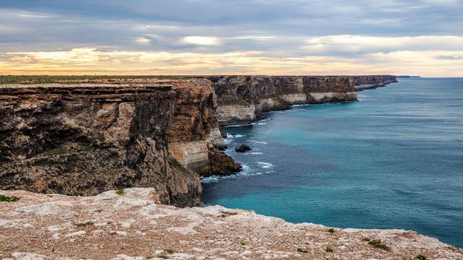
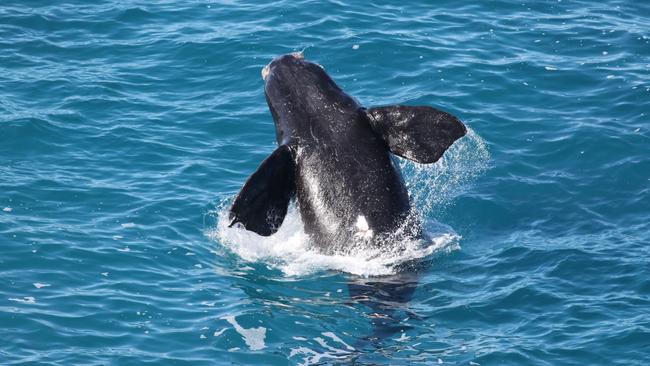
Head of Bight
Want to see a whale? Stand at the top of a 90m limestone cliff with the Nullarbor at your back and witness some wild ocean on SA’s Far West coast. (Just make sure it’s between June and October. It’s a long drive to get the date wrong). Head of Bight also offers a pretty amazing drive along the coastline.
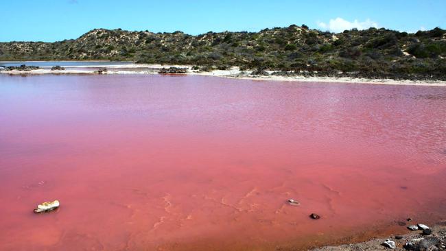
Tailem Bend’s pink lake
After Lake Eyre floods, it’s known for going pink. But that’s a really, really long drive (and doesn’t happen very often) so if you want pink water that’s a little closer, get on the Princes Highway. Between Tailem Bend and Meningie you’ll find another pink lake, made that shade by the algae. We’d advise against swimming. The brighter the day, the better the colour.
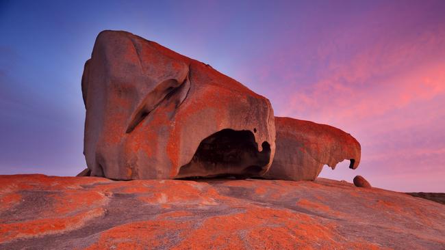
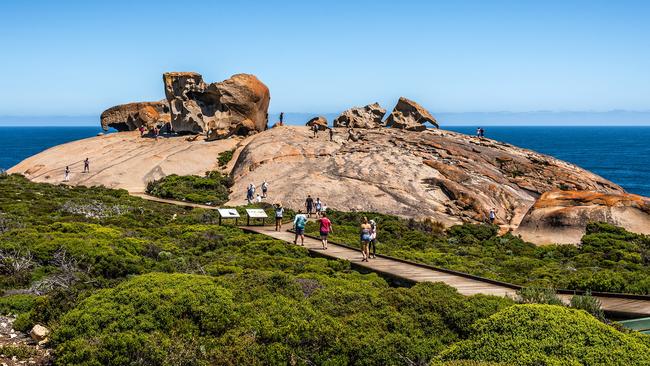
Remarkable Rocks
They resemble a giant child’s bizarre cast-off toys – eroded by wind, rain and sea spray for millions of years, you’ll find them on Kangaroo Island, in Flinders Chase National Park. A little advice – if you’re going to go, hang around until sunset. The lichen on the rocks make for great photos – as any number of pics from SA Tourism show …
Pool of Siloam
No, not the one from the Bible, but one that’s apparently seven times as salty as the ocean. You’ll find it in Beachport, in SA’s South-East. It’s remarkably buoyant and also allegedly has healing properties and relieves sufferers of arthritis and rheumatism. Some websites say.
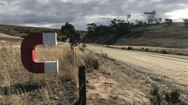
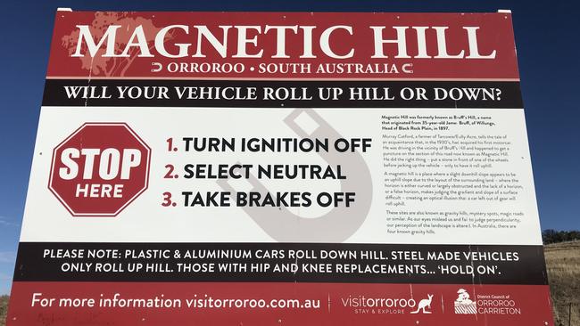
Magnetic Hill
Near Orroroo, in South Australia’s north, it’s said that at Magnetic Hill your car will roll up the hill, not down. The optical illusion (the layout of hills around you make it look like the slight downhill slope is actually uphill) doesn’t always work very well.
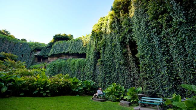
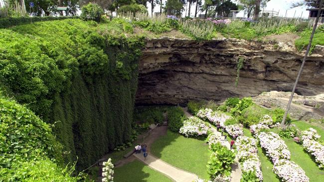
Umpherston Sinkhole
One of the most fascinating spots in SA, the sinkhole in Mt Gambier was a cave once. The cave roof collapsed, and it was turned into an extraordinary garden by James Umpherston in the 1880s. It’s hard to get just how impressive this is from photos. If you go, make sure you go twice – once at night – and feed the possums, which live in the limestone rock shelves. Just fruit – no bread.
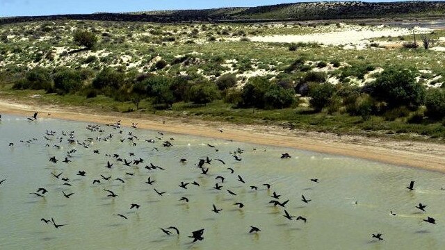
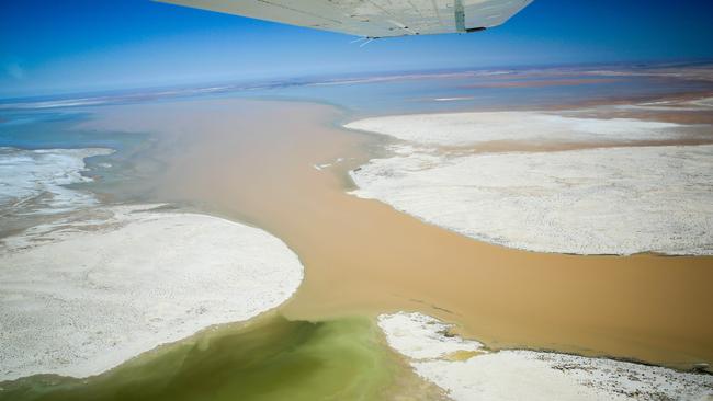
Kati Thanda – Lake Eyre
At 15 metres below sea level, the salt lake – officially called Kati Thanda – Lake Eyre – is the lowest point in Australia – but looks pretty amazing when it floods. The Lake Eyre Basin covers a sixth of the continent, and on those very rare occasions when it fills – which is about once a century – it becomes the largest lake in the country. It has over the past few years flooded after heavy rains in the eastern parts of Australia. That’s when it teems with wildlife.
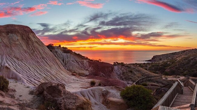
Hallett Cove’s ice age
No, it’s not just another suburb of Adelaide – it’s one of the country’s most extraordinary geological sites. The northern cliff tops contain the best record of an Australian ice age about 280m years ago, showing Permian glaciation, and are of international significance. You can literally see the changes the country has gone through over millions of years.
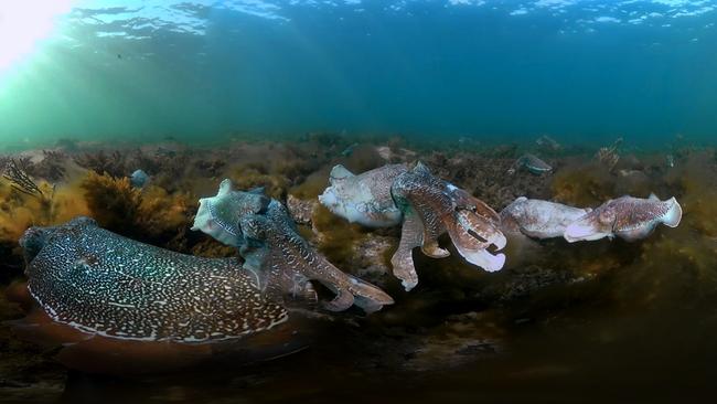
Whyalla’s giant cuttlefish
Technically not a place but citizens of the sea – however between May and August these cuttlefish gather in one place to breed – False Bay, near Whyalla. Their spawning area is designated as a sanctuary zone. Where they come from – and where the hatchlings go – is a mystery.
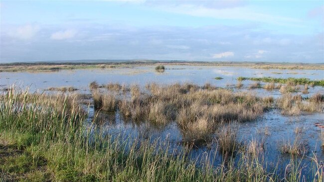
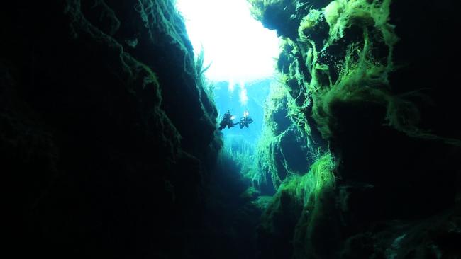
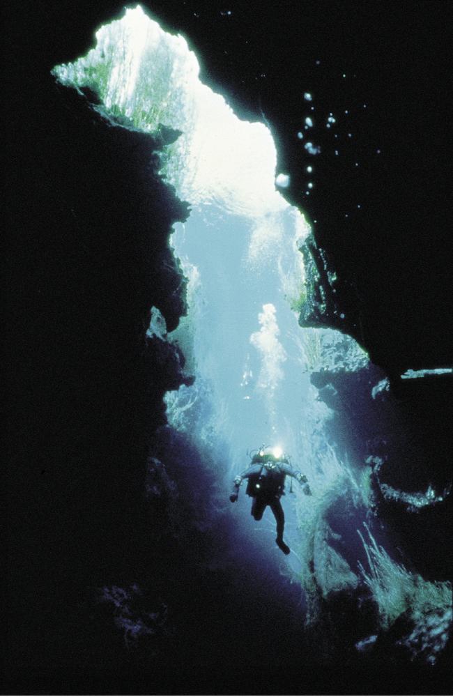
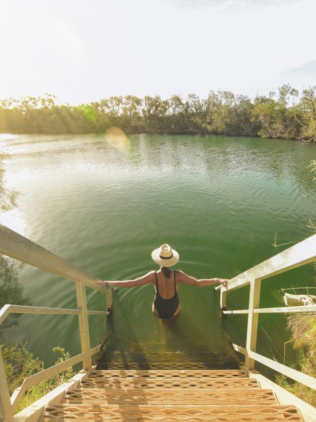
Piccaninnie Ponds
Above Piccaninnie Ponds, near Mt Gambier, it’s a flat wetlands area of reeds, birds and other wildlife. But beneath the surface is an extraordinary network of limestone caves, including a 100m sinkhole known as The Chasm. There’s even (mainly online) rumours of a second cave below that. Cave diving is regulated in South Australia, and can be dangerous.
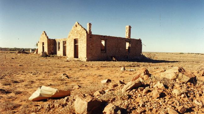
Farina
Nope, it’s not the cover of Midnight Oil’s Diesel and Dust album (that’s in Burra) – it’s the ghost town of Farina. A good six or seven hours drive due north of Adelaide along the Oodnadatta Track will get you to this once-busy, now-ruined town on the old Ghan railway alignment. The nearest people now live at Farina Station. There’s now a push to restore some of the old buildings. It’s a stark and desolate place – but rich in history.
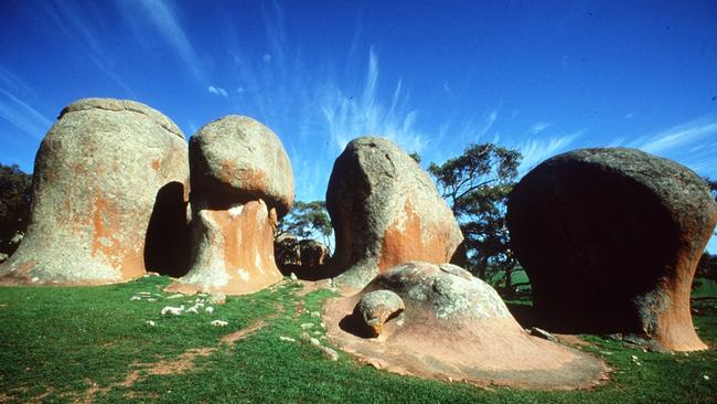
Murphy’s Haystacks
One of the true geological oddities of South Australia, Murphy’s Haystacks are inselberg rock formations that emerge from the middle of a wheat field. The wind-worn pink granite boulders are estimated to be more than 1500 million years old (no, not a typo) and you’ll find them on the Eyre Peninsula between Streaky Bay and Port Kenny.
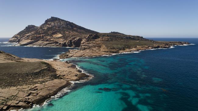
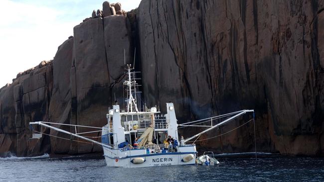
Pearson Island
It’s a 238-metre-high piece of granite that sticks almost 100m above the sea. Just off Flinders Island, it’s part of the Pearson Isles – windswept, cold places with nothing between them and Antarctica but waves but home to rock wallaby, seals, birds and no introduced species, and the occasional scientific expedition.
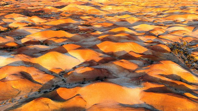
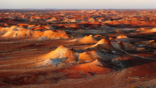
The Painted Desert
The result of the erosion on the residue left over from an age-old inland sea, the different colours make for spectacular views. In the Arckaringa Hills, northeast of Coober Pedy, deep in SA’s Outback, the terrain is an example of Breakaway territory. It looks even more amazing at sunset or sunrise. Because of the fragility of the rock formations, entry is restricted; it’s accessible only by air. Or the internet.
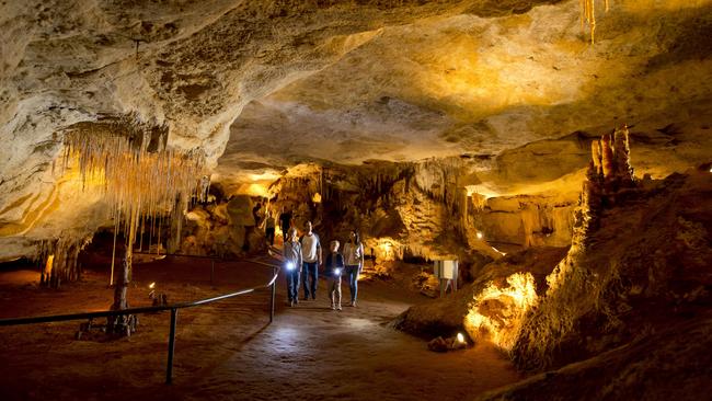
Naracoorte Caves
The staggering cave system at Naracoorte – which also include some pretty amazing megafauna skeleton and fossil finds – is great to visit on really hot days. The national park has 26 different caves, from easy-to-traverse (read, you can take the kids) to more complicated ones (read, no, you can’t). It’s a bit of a drive, but if you’re in the area, highly worthwhile.
Irrwanyere / Witjira National Park
On the edge of the Simpson Desert in the Witjira National Park lie these 60 or so artesian thermal springs, called Irrwanyere – otherwise known as Dalhousie Springs – ranging in temperature from 38-43C. If you’re going to go, you’ll want to stay for a day or two. It’s almost in the utter middle of Australia – about 180km north of north east of Oodnadatta.
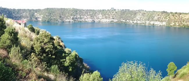
Mt Gambier’s Blue Lake
One of South Australia’s best-known spots, Mount Gambier’s Blue Lake, which sits in an dormant volcano, turns into its remarkable turquoise blue colour from November to March, when it changes back to steel blue. How? It’s something about the changing temperature of the water, the limestone aquifer and calcites … there are any number of scientific explanations here. All most of us want to do is stare at it.
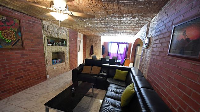
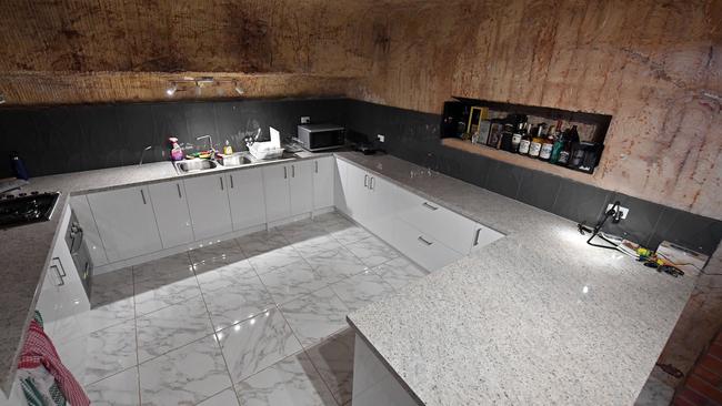
The underground homes of Coober Pedy
Maybe in the future when climate change has claimed our country, we’ll all be living in underground dugouts. At least the people of Coober Pedy can stay cool, in a desert town where the average January high is 36.4C.
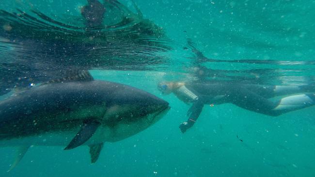
Port Lincoln tuna
You’ve heard of swimming with sharks at Port Lincoln. But why swim with sharks when you can swim with tuna? Later, you might even eat its brother.
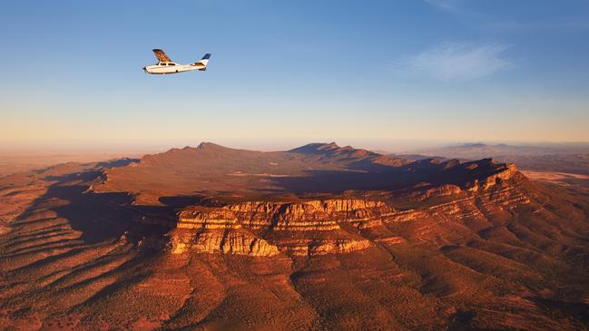
Ikara / Wilpena Pound
Nature’s own amphitheatre, it’s actually two mountain ranges joined at the southern end. Ikara means “meeting place” and is in the heart of the Ikara-Flinders Ranges National Park.
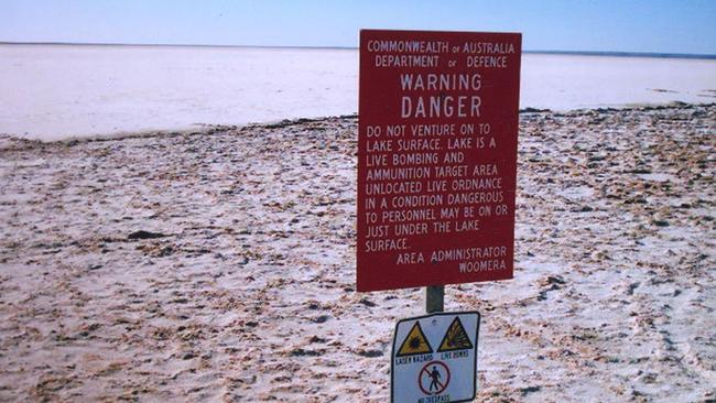
Woomera Prohibited Area
It’s essentially the largest firing-range in the world – where the defence force tests its “war matériel”. About 127,000 square kilometres, geologists say it has the potential for $35bn worth of iron ore, gold and uranium projects in the area. Travel throughout is heavily restricted but is allowed in some parts.
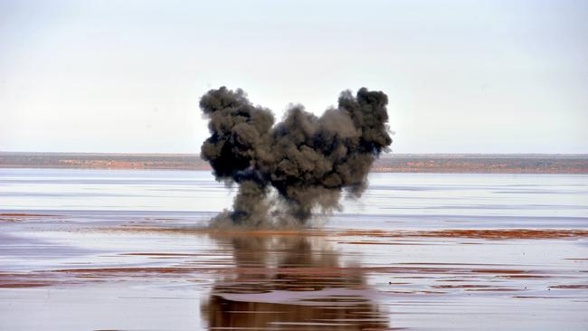
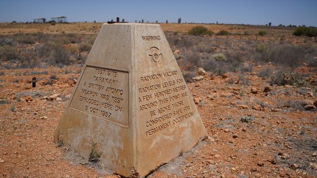
Maralinga
The darkest chapter in South Australia’s – and the UK’s history? Maralinga – within the Woomera Prohibited Area – was the site of the British Government’s secret nuclear weapons tests in the 1950s, and was contaminated with radiation. The indigenous Maralinga Tjarutja people were awarded $13.5m in 1994, the site was cleaned up and handed back to them, but debate continues over their long-term health – and those of exposed veterans, who didn’t win compo.
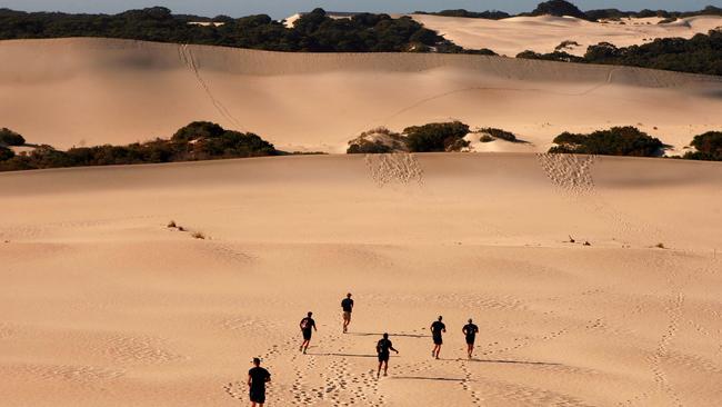
Kangaroo Island’s Little Sahara
It’s two square kilometres of eroded limestone – a little desert right in the middle of bushlands on Kangaroo Island. And it’s great for sandboarding.
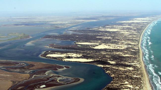
The Coorong
It’s 140km of lagoon, the mouth of the Murray, the extension of Lake Alexandrina and Lake Albert – a vast stretch of sand lying between the ocean and the lagoon behind it. Seen only from the air can you get a real picture of how amazing it is.
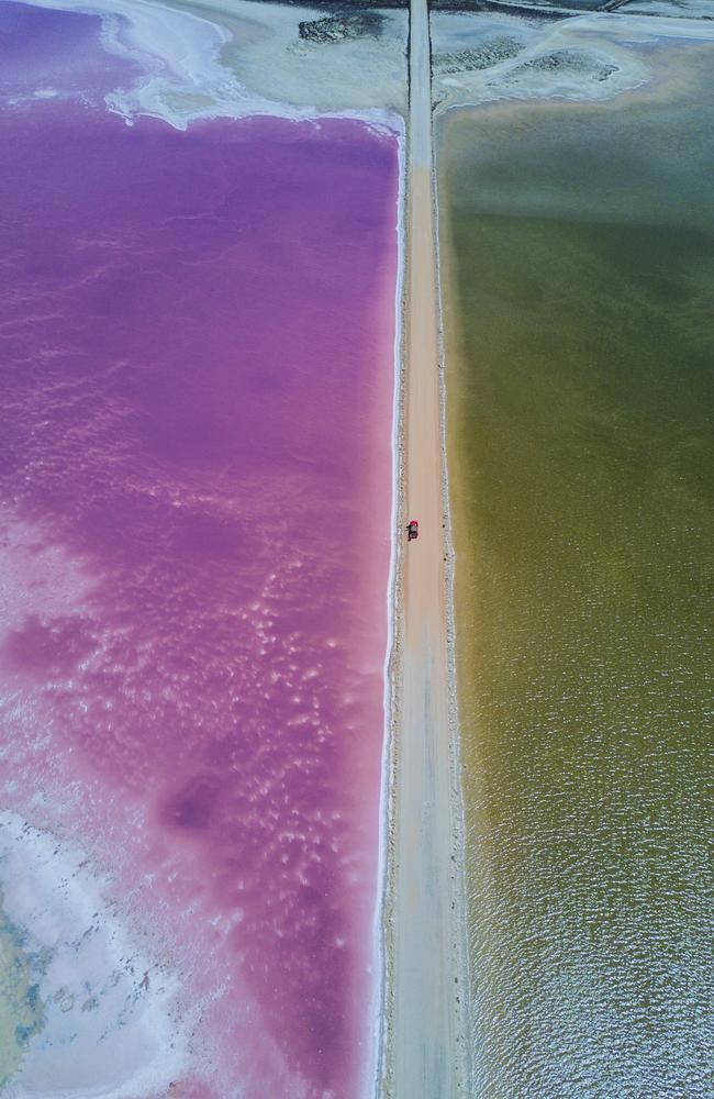
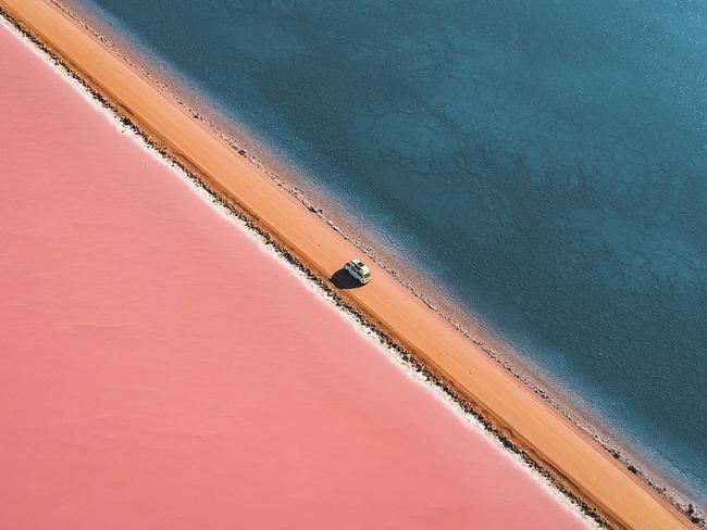
Lake Macdonnell
About 15km south of Penong, on the Far West Coast, lies the stunning pink salt lake of Port MacDonnell.
Turned pink by the salt-eating algae, it’s even pinker on a clear day. On the other side of the causeway is Green Lake, with Blue Lake past the small bridge. It’s one of SA’s most often Instagrammed spots, with reason.

The ‘Cinderella rule’ is the hack your sex life has been waiting for
When do you turn into a pumpkin?

Review: JW Marriott Auckland, New Zealand
With its chic, luxurious rooms, excellent food and drink offerings, and strong focus on wellness, this hotel will have you checking out feeling relaxed and refreshed.