
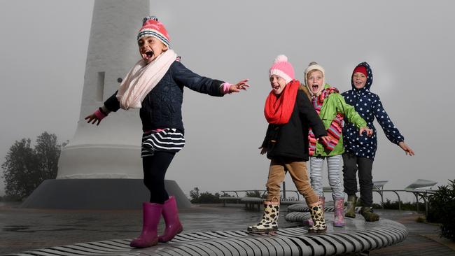
Snow likely to fall close to sea level in Australia’s south east
RESIDENTS in some of the biggest cities in Australia are likely to see snow this week as gusty Antarctic winds hit and temperatures plummet.

RESIDENTS in some of Australia’s biggest cities are likely to see snow this week as the strongest winter storm this year sweeps in.
The freezing conditions are being caused by an area of low pressure to the south of Adelaide, bringing gusty Antarctic winds and below average temperatures.

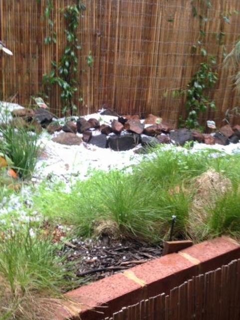
The weather system lashed southern WA over the weekend causing widespread hail storms and cold temperatures, leaving some areas of Perth looking more like the Australian alps.
Conditions in the west have eased but the slow moving low is intensifying as it moves east.
Here’s what you need to know.
SOUTH AUSTRALIA
People in South Australia will be next in the firing line with the weather likely to deteriorate this morning.
By sunrise tomorrow temperatures across the state will be well below average with snowfalls forecast down to 500m, with possible falls over the Adelaide Hills tomorrow and into Wednesday.
Adelaide will only reach a maximum of 11C tomorrow with local heavy falls, the chance of a thunderstorm and possible small hail.
A severe weather warning for damaging winds is current for people in the Mount Lofty Ranges, Lower Eyre Peninsula, Kangaroo Island and parts of the Adelaide Metropolitan, Eastern Eyre Peninsula, Yorke Peninsula, Murraylands and Lower South East districts.
VICTORIA
Victorians will be the next to feel the effects of the wintry blast with temperatures set to plummet tomorrow with snow expected in the higher elevated suburbs of Melbourne.
The Bureau of Meteorology has already issued a severe weather warning for damaging winds for people in the North Central, North East, South West, Central, West and South Gippsland and East Gippsland forecast districts.
Melbourne is heading for a top of just 13 tomorrow, with the chance of hail and thunder and snow falling above 400m.
Snow is possible above 300 metres during Wednesday.
The cold conditions will continue with top temperatures not expected to rise above 15C for the next 7 days.
The states ski fields can expect up to 50cm of snow over the coming days.

TASMANIA
Weather conditions in Tasmania are expected to worsen later today and into tomorrow with heavy rain and snow expected for most of the state.
Rain totals in the north could total 100mm over the next few days as the low pressure system moves in from the south west.
A number of flood warnings are in place.
Snow levels will lower on Tuesday and Wednesday with snow possible down to sea level and into the suburbs of Hobart.
Hobart is expecting a top of 8C on Wednesday with possible hail and snow above 200 metres.

NEW SOUTH WALES AND THE ACT
Winds have already picked up in southern parts with a severe weather warning issued for people in the South Coast, Snowy Mountains and parts of the Illawarra, southern Tablelands, South West Slopes and Australian Capital Territory Forecast Districts.
Winds averaging 60 to 70km/h with peak gusts in excess of 90km/h are likely to develop this morning.
Blizzards may develop Monday evening in areas above 1700 metres.
Snow is also expected to develop along the NSW ranges later tomorrow and into Wednesday falling above 600m.
Areas around Canberra and Orange can expect to see some snowfalls.
Sydney will escape the worst of the weather although temperatures on Wednesday will only reach 14C, but with the wind chill factor it will feel much colder.
Snow is likely to the west of Sydney in the Blue Mountains.


‘Too early to make an assessment’: Frost hits winter crops
Plummeting morning temperatures and frost has swept through parts of southern NSW and Victoria, with farmers now waiting to assess the damage.

Huge variations in winter rainfall across Victoria
It’s proved to be a winter for discontent for large areas of southeastern Australia where only isolated pockets have recorded their average rainfall.