
Goulburn River peaks: How the floods are impacting farmers
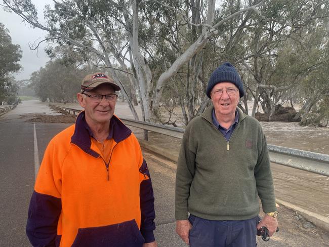
Farmers along the swollen Campaspe River past Barnadown are preparing for more flooding as the river swells. We speak to farmers on the ground.
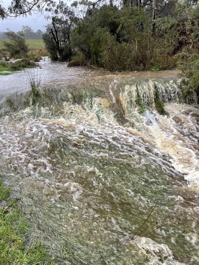
Locals in Central Victoria say water levels are peaking about 1.5 metres higher than the devastating floods of 2011.
But they are more fearful of things to come as the second spillway at Lake Eppalock overflows.
“The water is unbelievable — it is the biggest flood of all time in this area,” said John Kennedy, who has lived on his farm near Barnadown, south of Elmore, his whole life.
Mr Kennedy and wife Gabrielle produce wheat and canola crops and sheep on both sides of the Campaspe River
“Our stock are all okay, but I don’t know about our crops because they are on the other side of the river and we can’t get to them,” Mr Kennedy said. “Walking in the crops you can feel it squelching under your feet.
Mr Kennedy, whose family has owned the farm since 1892, said damage during the 2011 floods was horrific, sympathising with those further downstream in Rochester and Echuca.
“We lost some fences last time and we built them higher up but the water has still got them,” he said.
“But we can’t complain, we are OK but there are some people who’s homes will be inundated and they have been evacuated.”
Lifetime local Bill Read, who runs 40 cattle near the Campaspe River, said he estimated the river was 1.5 metres higher than 2011 with more to come.
“Last time a lot of hay bales were washed away, but there’s not as many cut this year because it’s been too wet,” he said. “Most people will be okay, but it will be worse for Rochester.”
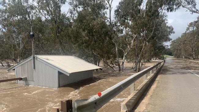
1.30pm: Farmers along the swollen Campaspe River past Barnadown are preparing for more flooding as the river swells.
Some crops on Campaspe River flats are under water while hay bales have been swept downstream towards Elmore.
John Parsons, who runs a fat lamb operation near Elmore-Barnadown Rd, said the floodwaters were the highest he had seen in his life.
“I have lived here for all my life,” he said “We had the floods in 2011 and some in the early 1970s but this is the highest I have seen the floodwater in my life.”
Several hectares of river flats west of the Campaspe River are inundated, flooding crops such as irrigated lucerne.
“Lucenre doesn’t like having wet feet and so those crops could be destroyed,” Mr Parsons said.
“But you won’t know until the water recedes, but this water will be here for days.”
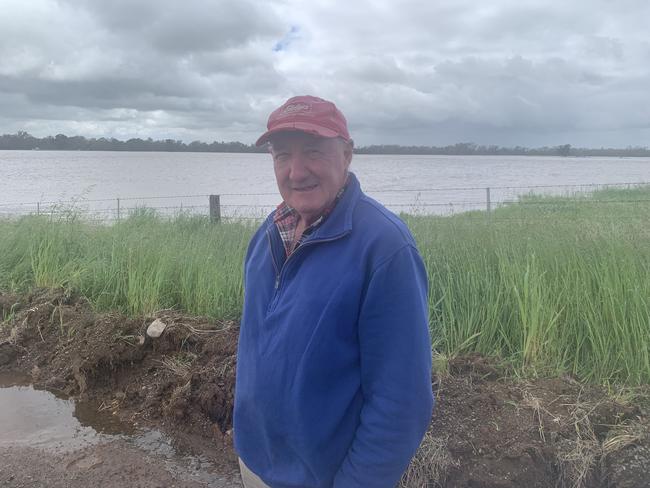
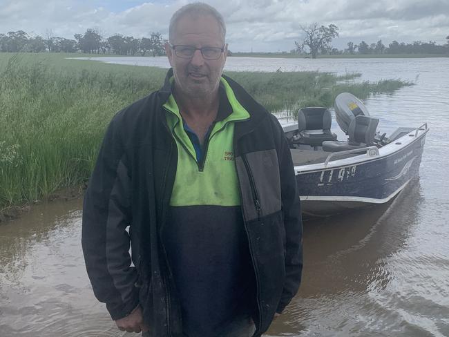
Andrew Shotton, who leases a property west of Elmore, was helping a friend whose property was coping the brunt of the floods.
With water rising towards a house on a hill, Mr Shotton was boating across the floodwaters to help his friend prepare his property.
“I’ve lived in the area all my life and it is the most flooded I’ve seen,” Mr Shotton said.
“My farmland is west of Elmore and pretty well protected from flooding.”
Mr Shotton and Mr Parsons said wheat and barely crops in the Campaspe region looked pretty good despite the heavy rain.
“Everyone has prepared as best they can, moving stock, but we won’t know about the crops until we get in to see.
“Some heavy canola has gone over and we will have to see about the lucerne.
“But visually everything thing looks pretty good, but we won’t know for sure.”
Both Mr Shotton and Mr Parsons said farmers were preparing for more rain next week, with 1-5mm forecast for Sunday across the southern half of Victoria.
“In 2007 we had six or seven inches in a day, but that was to end the drought,” he said
“But now everything is so full and has been for weeks,” Mr Shotton said.
“The ground is so wet, there is no where for it to go.”
11am: Central Victorian farmers are preparing for a flood larger than 2011
Waterlogged paddocks and roads scattered across the region with farmers watching the swollen river race past.
Tim and Liz Harrington own and mange about 1000 acres of sheep and cattle country on the Goornong-Axedale Rd, 20 minutes from Bendigo.
Mr Harrington said the 2022 floods were larger than those seen just over a decade ago.
“It is a strong event, without question,” he said.
“It is evolving so quickly.”
Fuelled by flows from Lake Eppalock, the Campaspe river now stretches hundreds of metres wide at some points, looking more like the Murray River than the smaller tributary it usually is.
With the Campaspe at such a height the Harringtons have moved their stock to higher ground, removed their electrical riverside pumps and devices and cut fences in preparation for the floods.
“We have been watching the VicEmergency App and we and we are happy with where we are,” Ms Harrington said.
“We have known this is coming for the last two weeks.
“We won’t know the damage until we know what’s underneath and see what electrical or fence damage there is.”
10.15: How the rivers are tracking
The Goulburn River peaked at 2am today, reaching 8.2m on the gauge at Seymour, before dropping back to 7.9m at 6am.
The Department of Environment, Land, Water and Planning’s water data website shows the river’s daily flow surged from 15,000 megalitres on Wednesday to a massive 103,737 megalitres last night.
Further upstream at Yea the local gauge reinforced that the worst may be over, dropping from a peak of 3.5m at 2am to 3.2m by 6am.
Seymour CFA captain Sean Kerris said the brigade had been supporting SES volunteers with sand bagging properties and removing fallen trees from roads.
Emergency Management Victoria reported last night that 288 properties were affected by the flood, with 263 of those with water above floor level.
“This flood has exceeded the levels recorded in the May 1974 flood which reached a height of 7.64m.
The Goulburn River at Murchison was still rising this morning, while the flow at Shepparton had lifted slightly, from about 26,000ML/day on Wednesday to 29,000ML/day this morning.
Thursday: ‘Uncharted territory’: Victorian farmers react to wet weather
Some parts of Victoria have received more than 80mm of rain overnight with authorities on high alert for flooding today.
According to Bureau of Meteorology, the biggest rain in the 24 hours to 9am today was in the North East, central and Mallee regions with several centres topping 50mm – two inches on the old scale.
Puckapunyal recorded 83mm in the 24-hour period with Mangalore measuring 73mm.
Swan Hill recorded 71mm and Bendigo 62mm followed by Mt William (60mm), Echuca (55mm), Kerang (52mm), Mortlake (49mm), Redesdale (49mm), Lake Eildon (46mm), Mildura (44mm) and Westmere (42mm).
Kyabram recorded 39mm while Tatura measured 36mm and Charlton and Longerenong each recorded 31mm.
The biggest falls since 9am have been in central and northern Victoria, with a further 25mm falling at Bendigo by 2pm, 20mm at Redesdale and Mangalore, and 18.4mm at Shepparton.
Prairie farmer and former Victorian Farmers Federation president Peter Tuohey said the rising waters presented a range of immediate and short-term issues for farmers.
These included moving livestock to dry and protected areas due to risk of drowning and future health concerns, to crop loss and damage, weed growth within crops and roads failing to be graded due to ongoing wet weather.
He said around 70mm had fallen on his property since Wednesday morning, following the 30mm last week.
“There is so much water flowing through the Loddon, Avoca and Serpentine waterways. The Murray is full and everything is already as wet as you can get,” he said.
“There have been a lot of warnings and we are as prepared as can be. But some people cannot do everything at once and sometimes there is not a lot you can do.
“People have no control over the cropping and the roads. There’ll be flooded out crops and yield damage. A lot of stock was isolated in the 2010 and 2011 events and there will likely be some stock isolated this time.”
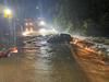
Near Rochester, where locals have been sandbagging houses and businesses, farmer Rod Fiedler said he had recorded 80mm overnight with another 10-20mm falling by lunchtime.
He said his immediate concern was livestock becoming lame in the soft ground.
“We learnt from the 2010 and 2011 floods to be more proactive and have plans ready. The hay is unlikely going to happen now, we might try to get some silage, but there is more rain coming next week and this rain hasn’t stopped yet,” he said.
At Swan Hill, third-generation dairy farmer Matt Glowrey said the 70mm recorded on his property since yesterday morning was pushing his operation into “uncharted territory” following 100mm earlier this month.
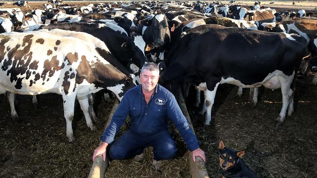
Mr Glowrey has been on the property for 30 years and has not witnessed the current ongoing, unseasonal rain.
“We have had isolated downfalls that were bigger in terms of water and that cause a few days of pain, but not consistently week after week,” he said.
“Like everyone we are trying to get winter crops off as silage before we start planting summer crops and the gap is rapidly closing, and that has not happened before in the 30 years I have been here.
“There is a lot of internal water we are dealing with. We have been getting 17mm to 20mm, things start getting dry and then it will rain again.
“We have these ongoing wet patches and some paddocks are heavily affected.
“Getting cows’ consistency of grass is the biggest concern, we have been managing the paddocks for six to eight weeks now and spreading the cattle out.”
The wettest places in Victoria so far this October include Redesdale, which has recorded 137mm in the past 13 days, followed by Bendigo (133mm), Swan Hill (110mm), Charlton (87mm), Birchip (85mm), Kerang (82mm), Echuca (79mm), Stawell (78mm) and Rutherglen (77mm).
In NSW, Nowra has measured 157mm for the month so far, with Braidwood picking up 116mm, Dubbo 107mm, Bourke 106mm, Moss Vale 91mm and Wellington 90mm.
Wednesday: Heavy rains, wild winds to hit Victoria
As Victorians brace for wild weather predicted to lash the state over coming days, authorities have warned that flash flooding could isolate some rural communities for up to three days.
A rain band moving into the state on Wednesday and intensifying on Thursday and Friday is expected to dump up to 100mm across parts of northern Victoria.
Mildura, Bendigo, Shepparton, Seymour, Maryborough, Ballarat and Geelong residents have been warned to be on high alert.
The Bureau of Meteorology has issued severe weather warnings for the Central, Mallee, Northern Country, North Central and North East regions of Victoria. As well as parts of East Gippsland, South West, West and South Gippsland and the Wimmera.
The State Emergency Service has issued warnings for an increased risk of landslides and debris, including trees and powerlines, to fall across roads with wind gusts to potentially reach 90 to 100 km/h tomorrow.
Some residents have already lost power and others are sandbagging to prepare for rising waters.
The predicted falls will further swell waterways and, along with water already streaming into full catchments and substantial snowmelt, moderate to high levels of flooding are forecast for some parts of Victoria, southwest NSW and Tasmania.

Victorian Premier Daniel Andrews said “even a minor amount of rain would be a real risk in terms of flooding.”
“But it’s not a minor rain event that we are forecasting. There will be significant rainfall in certain parts of the state, and that’ll pose a flooding risk to communities in lots of different places,” he said.
He said the Australian Defence Forces were on standby to assist if required.
Seven helicopters are ready to drop emergency supplies, including a stockpile of 200 generators, to stranded residents.
Emergency Services are particularly concerned about major flooding of the Wimmera, Campaspe, Avoca and Loddon rivers and surrounding catchments.
Watch-and-act flood warnings have been issued for several rivers.
There are active flood warnings placed on the Murray, Snowy, Kiewa, Goulburn, Loddon and Avoca rivers, along with a gale warning for Central and East Gippsland and strong wind warnings for Port Phillip and the Central Coast.
The BOM has also issued a warning for sheep graziers, in the North Central and Central forecast districts, that cold temperatures, rain and north easterly presented the “risk of losses of lambs and sheep exposed to these conditions.”
BOM senior forecaster Matt Thomas said a cold front, bringing with it gusty winds, was beginning to move into Victoria.
He said Shepparton, Castlemaine and Bendigo would be among the hardest hit communities.
“Tomorrow is a big day. We are expecting totals of around 70 to 80mm, perhaps 100mm in some locations,” he said.
“That has the potential to cause large river rises going up to moderate flood level.”
Emergency Management Victoria Deputy Commissioner Chris Stephenson said that preparing for emergencies, particularly in low-lying and flood-prone areas, “is a shared responsibility”.
“You need to make sure that you are prepared for up to 72 hours of potential isolation,” he said.
“This includes ensuring any required medication is available, pets are provided for and neighbours are kept in mind.
“These are important steps because we need our first responders to actually respond to those vulnerable people, those people that need them most”.
Heavy rainfall increases the potential for landslides and debris across roads.
SES chief operation officer Tim Widbusch has asked people to avoid driving in the northern parts of Victoria and not to camp near waterways.
“With the weather systems that we’re about to see over the next 24 to 48 hours, we are asking Victorians to be flood ready,” he said.
“Victorians need to be prepared for flooding that’s likely to appear for another six to eight weeks, on and off, as we continue to see these rain events roll through.”
A landslide warning has been issued for parts of the Bogong-High Plains Road at Bogong Village.
Meanwhile, the Dartmouth Dam spilt for the first time in 26 years recently and Lake Eildon is close to spilling for the first time in nearly three decades.
Melbourne Water predicts the Thomson Dam could spill for the first time in 30 years this coming weekend.

Join the conversation
‘It’s certainly been morale boosting’: Rain brings change of fortunes
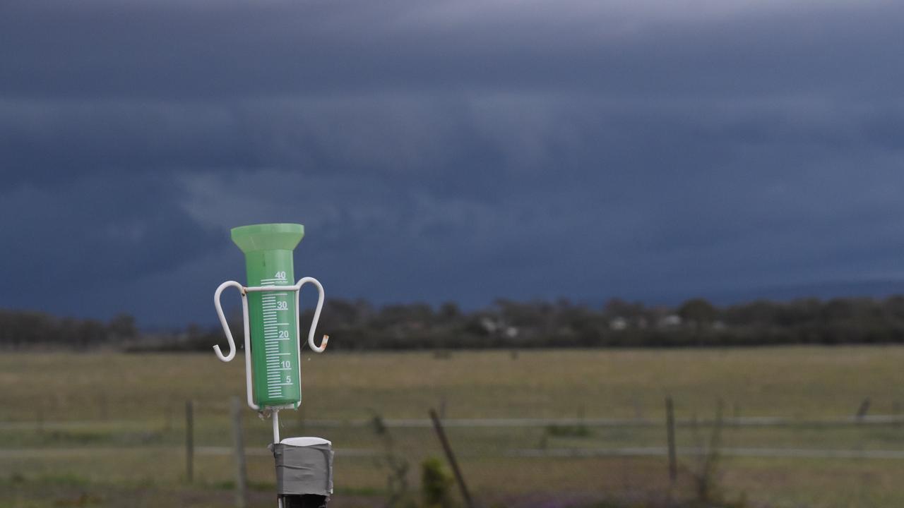
Kate Paterson has tipped 30mm from her rain gauge, bringing an end to a long dry period at Nulla Vale.
Read more
Farmers welcome much needed rain
Widespread rain has brought welcome relief to southeastern Australia, with falls of up to 90mm measured in Victoria’s drought-stricken Western District.
Read more