
Record year: Where the rain fell during 2022
Rain delivered both hope and despair to communities across Australia during 2022. See our interactive list of where the rain fell — and who missed out.

Century-old rainfall records were smashed as a third-successive La Nina year delivered both hope and despair across Australia during 2022.
An analysis by The Weekly Times of 208 Bureau of Meteorology weather stations across the nation showed 193, or all but a handful, recorded a wetter-than-average year with 91 measuring one-and-a-half times their normal totals and 14 recording more than double.
The biggest rain, compared to the long-term average, was in NSW which accounted for the top 10 leaderboard placings. Nowra on the NSW south coast took out the No. 1 position with 2535mm of rain for the year – or almost three times its normal average of 872mm.
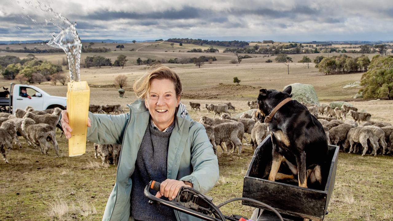
Moss Vale, in the Southern Highlands, came in at No. 2 with 1858mm, representing 274 per cent of its 679mm calendar-year average, while further inland Ivanhoe rounded out the major placings with 591mm, or 254 per cent of its average, followed by Wilcannia (664mm or 253 per cent), Condobolin (945mm or 235 per cent), Tibooburra (425mm or 233 per cent), Lake Cargelligo (950mm or 225 per cent), Broken Hill (559mm or 225 per cent), Griffith (851mm or 215 per cent) and Albury (1265mm or 209 per cent).
It’s the third successive year Condobolin has appeared in the top 10 list having received 789mm (196 per cent) in 2021 and 670mm (167 per cent) in 2020. Nowra also topped the charts in 2020 with 1673mm (192 per cent) – the same year Moss Vale came in at No. 2 with 1186mm (175 per cent).
For Lake Cargelligo, it was the wettest year since records were first kept in 1889. Weather station records were also broken at Nowra, Moss Vale, Wilcannia, Condobolin, Lake Cargelligo, Griffith and Albury.
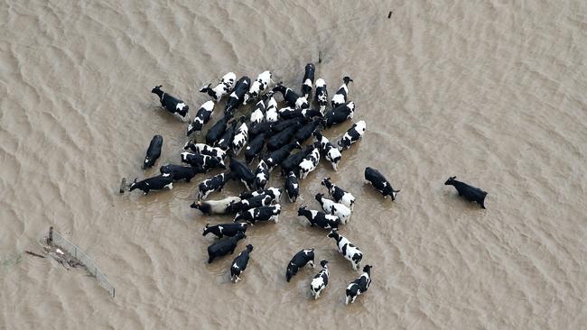
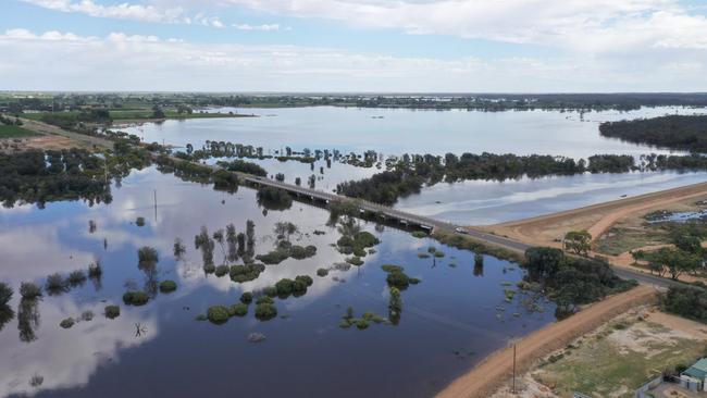
The year was punctuated by floods which engulfed parts of Queensland, NSW, Victoria and Tasmania, causing loss of life and significant damage to crops and property. The worst-affected regions were in the NSW Northern Rivers, Central West and Sydney Basin. In Victoria during spring, floodwaters swamped parts of central and northern Victoria, as well as areas of Gippsland. Parts of Queensland, Tasmania and, more recently, South Australia were also badly affected.
National Farmers’ Federation president David Jochinke said 2022 would remembered as “one of the most exhausting years” for farmers who were forced to contend with “a diversity of challenges”.
Mr Jochinke, who farms north of Horsham in Victoria’s Wimmera region, said while there were “obviously some disasters out there” caused by flooding and too much rain farmers on a whole had benefited from a better-than-average season.
He said wetter conditions throughout spring, coupled with a lack of sunshine to finish crops, meant many grain growers would be still harvesting well into the new year.
Mr Jochinke said harvest on his farm traditionally wrapped up before the new year, however, “we are still two to three weeks off finishing … it’s the latest we’ve ever gone on main crop”. He said the wet had caused logistic issues for farmers with two harvesters in his district having to be removed from bogs by crane.
“I’ve never seen anything like it,” he said.
In Victoria, the wettest centres compared to the long-term average during 2022 were in the Mallee and Wimmera grain growing regions with Swan Hill picking up 609mm (203 per cent), Horsham 670mm (184 per cent), Mildura 510mm (178 per cent) and Ouyen 578mm (176 per cent).
While conditions in southeast Australia have dried out in the past month, with Horsham recording just 2.2mm of rain during December ahead of Nhill (3.8mm), Warracknabeal (4.2mm), Kerang (4.6mm) and Swan Hill (4.8mm), there has been a strong start to the wet season in Northern Australia.
In the Northern Territory, Victoria River Downs recorded 372mm during December while Tennant Creek picked up 286mm and Daly Waters measured 141mm. In Queensland, Weipa – on Cape York Peninsula – recorded 353mm for the month ahead of Cairns (312mm) and Normanton (237mm).
The wet conditions in the north are set to intensify in the coming week with the BOM predicting upwards of 300mm for parts of northern WA and 200mm-plus for the western half of Cape York.
Looking further ahead into 2023, the Bureau of Meteorology’s most recent El Nino-Southern Oscillation outlook, released on December 20, remains at La Nina levels, with some signs of it weakening.
According to the BOM while indices in the tropical Pacific Ocean remained near La Nina thresholds over the previous fortnight, cool sea surface temperature anomalies had decreased. That, along with a significant warming of sub-surface temperatures, has many models predicting a return to neutral ENSO conditions by February.

Weather wrap: Where the rain fell
Longed for follow up rain has graced some areas but left others untouched across south-eastern Australia as the failed autumn break continues to take its toll on farmers.
‘It’s certainly been morale boosting’: Rain brings change of fortunes
Kate Paterson has tipped 30mm from her rain gauge, bringing an end to a long dry period at Nulla Vale.