
Forecast hot weather sign of El Nino ‘starting to bite’, Bureau of Meteorology says
THIS weekend’s heatwave across southeast Australia is the first clear sign El Nino is “starting to bite”, the Bureau of Meteorology says.
THIS weekend’s heatwave across southeast Australia is the first clear sign the El Nino weather pattern “is really starting to bite”, the Bureau of Meteorology says.
Scientists have long claimed this year’s El Nino — which sees warmer sea surface temperatures in parts of the Pacific Ocean leading to hotter temperatures and reduced rainfall in parts of eastern Australia — as the strongest since 1997.
RELATED COVERAGE:
BOM senior forecaster Scott Williams today told The Weekly Times that forecast hot weather across southeast Australia over the next five days — the mercury is expected to nudge 40C in parts of Victoria’s Mallee — was the “first real extended warm spell” of the current El Nino which is expected to last until next autumn.
“There is not really any moisture over the continent,” Mr Williams said.
“You look up northwards over the continent and over even the Indian Ocean — Indonesia and that area — there has just been no cloud, no activity at all. It really is indicative of what we typically see in an El Nino situation.”
Mr Williams said this weekend’s forecast temperatures were “not quite a record” for this time of year. In October 2006, Mildura recorded 40.2C and Melbourne 36.6C.
“However, we are close,” he said.
Mr Williams said the “very warm, well above-average temperatures” would persist across Victoria until Tuesday afternoon.
“When it does end, we’re only expecting less than a couple of millimetres in showers in the south and nothing in the north,” he said. “It really won’t be a producer of rain.”
Cooler conditions from Tuesday afternoon are only expected to last three days before another slightly weaker high pressure system crosses the state.
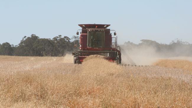
Mr Williams said the “exceptionally warm conditions”, coupled with “unfortunately no rain to speak of at all”, were a blow for the state’s grain growers struggling from a drier-than-average start to spring.
He said there was little chance of rain for parts of inland Victoria for “at least the next week”.
“We’ll just have to wait and see what happens beyond that time but at this stage it is looking pretty grim so far as the rain outlook goes,” Mr Williams said.
“There will be a little bit of relief on Sunday in southern Victoria as we see some sea breezes behind a very weak front that slips through Bass Strait, but inland there is no relief from the heat whatsoever.”
Huge variations in winter rainfall across Victoria
It’s proved to be a winter for discontent for large areas of southeastern Australia where only isolated pockets have recorded their average rainfall.
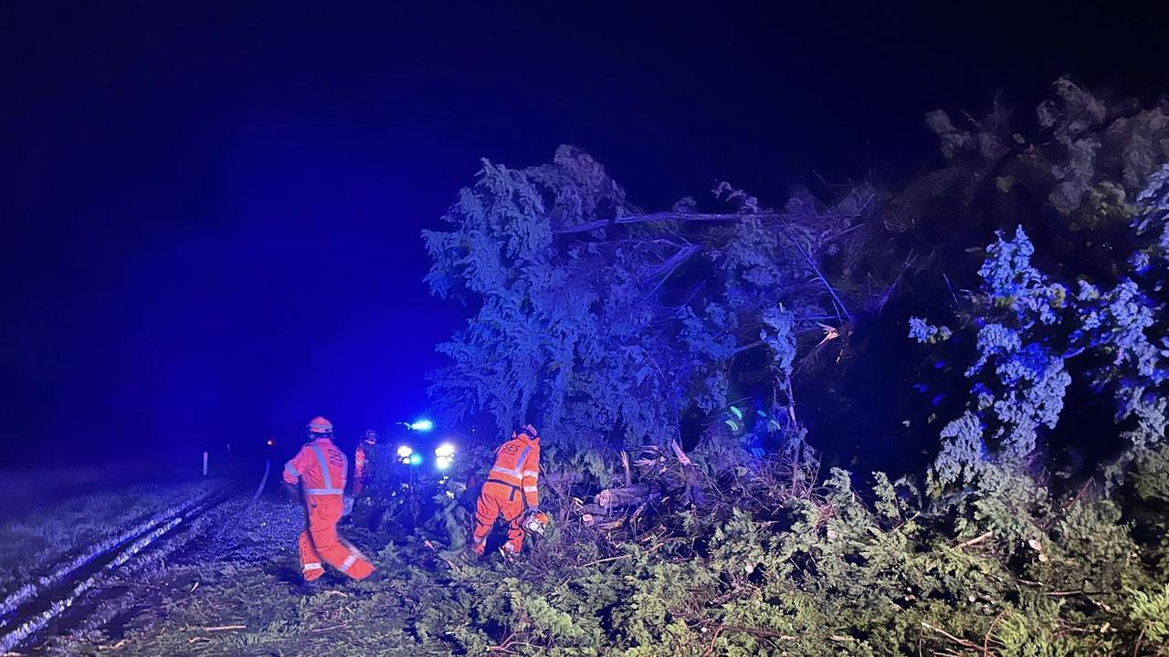
‘I missed 40 hours of milking’: Wild weather hits farmers
Victorian dairy farmers are facing mastitis issues and production losses after extreme weather downed power lines across the state.