
Climate model forecasts dry winter, but La Nina wet spring
Climate models predict the Indian Ocean may cool farmers hopes of a wet winter, but also point to a La Nina delivering spring rain.
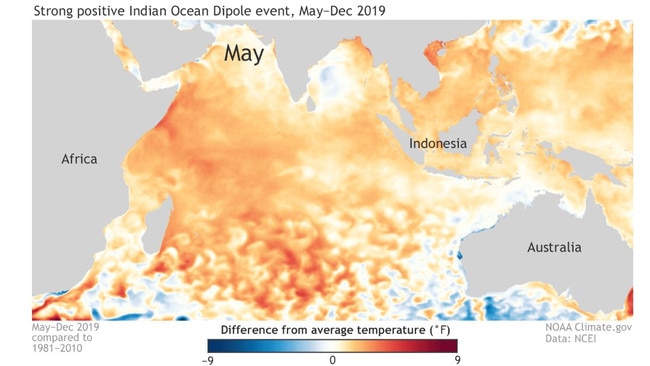
A powerful positive Indian Ocean Dipole event is developing that could curb southeast Australian winter rainfall, according to global climatic models.
The Australian Bureau of Meteorology reports the IOD index has already risen to 0.57, well above the 0.4 threshold that is used to call a positive event, with five global models predicting it will soar to 1.2 by July.
The IOD moves into positive territory when the ocean off Western Australia’s northwest coast is markedly cooler that the Indian Ocean off Africa.
Cooler water leads to reduced moisture in the air flow that often streams across the continent into southeast Australia.
The last time a strongly positive IOD hit was in 2019, suppressing southeast Australian winter rainfall.
At this stage the BOM is leaving its IOD outlook at neutral range, given the low reliability of forecasts at this time of year, but has stated “atmospheric indicators in the eastern Indian Ocean may be consistent with a developing positive IOD”.
Japan’s Agency for Marine-Earth Science and Technology, whose scientists first developed the IOD model as a predictive tool, stated last week that “a positive Indian Ocean Dipole will develop in the boreal spring and persist in the boreal summer (Australia’s winter)”.
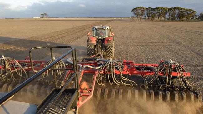
Grain growers say that while the models are useful, their main focus is on the moisture they already have banked in the ground, given how unreliable the models are, especially at this time of year.
Minyip grower Ryan Milgate, who like many Wimmera growers has started sowing this week, said adjusting crop plantings in response to climate models was “fraught with danger”, especially at this time of year.
“Generally the reliability of climate forecasts in autumn is quite low, at a time when we need them most,” Mr Milgate said.
“I’m more focused on my (three) soil moisture probes.”
Fellow grain grower Craig Henderson said the only adjustment he had made was putting more fertiliser “upfront because they’re talking of a La Nina”, but even if rainfall was below average “we still have a high probability of getting average yields” on the back of soil moisture reserves.
US and Japanese models point to a La Nina developing in August.
The Japanese team’s latest SINTEX-F ensemble model run “predicts that the El Niño will further weaken and a La Niña Modoki will develop in the boreal autumn. However, there is a large uncertainty in the occurrence timing and amplitude”.
The US National Oceanic and Atmospheric Administration says a transition from El Niño to ENSO-neutral is likely by April-June 2024 (85 per cent chance), with the odds of La Niña developing by June-August set at 60 per cent, with the probability rising to 80 per cent or more after that.
However the BOM’s latest forecast states: “Oceanic and atmospheric indicators are now indicative of neutral ENSO (El Niño–Southern Oscillation).
“Sea surface temperatures (SSTs) in the central Pacific have been steadily cooling since December 2023. There has been substantial cooling over the last fortnight, with the NINO3.4 index now within the historical thresholds for the neutral phase of ENSO.”


Mud hampers stock feeding, but farmers welcome rain
Winter rain has helped to ease drought conditions but muddy paddocks are taking a toll. See how much has fallen in the past seven days.

Rain brings relief, but wild weather makes lambing tough
Showers brought some relief this week, but farmers say conditions remain challenging, with below-average rainfall, cold temperatures and wild winds hitting lambing season. See where the rain fell.