
Bureau of Meteorology increases forecast of wetter-than-average La Nina
The Bureau of Meteorology says there are early signs of a La Nina weather pattern — associated with above-average spring rain — forming.

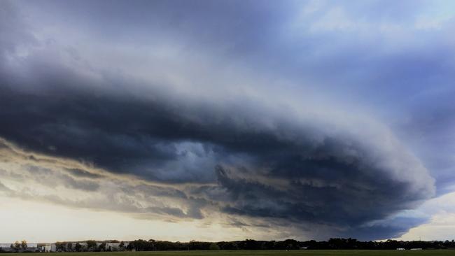
SOUTHEAST Australia could be in for a spring fling, with early signs of a wetter-than-average La Nina weather pattern forming.
A La Nina pattern is typically associated with above-average spring rainfall in eastern, central, and northern Australia.
The Bureau of Meteorology last week said while both the El Nino-Southern Oscillation and Indian Ocean Diopole remained neutral, cooling in the tropical Pacific Ocean had continued “and the majority of models anticipate this cooling will be close to the threshold for La Nina by early spring”.
As a consequence, the BOM has upgraded its ENSO Outlook to La Nina Watch, which means the chance of La Nina forming this year is about 50 per cent — double the average likelihood.
Three models point to a La Nina forming by late winter while another two suggest thresholds could be met by early spring.
The most recent significant La Nina years were in 2010 and 2011 — the third-wettest and second-wettest calendar years on record in Australia. April 2010 to March 2012 was Australia’s wettest 24-month period on record.
In 2010, a dry June was followed by nine months of significantly higher-than-average rainfall, resulting in significant flooding in Victoria, southeast Queensland, NSW, northwest Western Australia and eastern Tasmania.
Among the flooding hot spots in Victoria were Charlton which recorded 169mm of rain in January 2011 — more than five times its normal monthly average — resulting in the flooding of more than 400 homes. In the same month, 160mm fell at Kerang — almost seven times its month average — causing widespread flooding that affected almost 4000 residents.
MORE

‘Every time they forecast rain, we get more than predicted’
Victorian farmers have welcomed vital late-season rain, with forecasts promising more to boost crops and pastures after a dry spell. Relief is finally on the way.

The areas where above average rainfall is an 80 per cent chance
The nation’s weather forecaster has released its predictions for above average rainfall for some areas coming into spring. See the sweet spots.