Large hailstones, heavy rain, strong winds wreak havoc in Melbourne
Emergency services received hundreds of calls for help after fierce storms swept the state, with Melbourne’s southeast suburbs around Narre Warren among the worst hit.

Emergency service crews have received hundreds of calls for help after wild weather brought down trees and damaged buildings across Melbourne and Victoria.
Broadford in central Victoria was among the worst hit areas overnight, alongside Lang Lang southeast of Melbourne and Hampton Park in the city’s southeast.
In the 24 hours to about 7.30am, the State Emergency Service received 860 calls for help, mostly for fallen trees and building damage.
POWER PLANTS BACK AFTER HEATWAVE OUTAGES
TRAINER DARREN WEIR ARRESTED, GUN SEIZED
FESTIVAL ORGANISERS TOLD TO CLEAN UP ACT OR SHUT DOWN
The wild weather hit Melbourne on Wednesday evening, bringing large hailstones, heavy rain and strong winds.
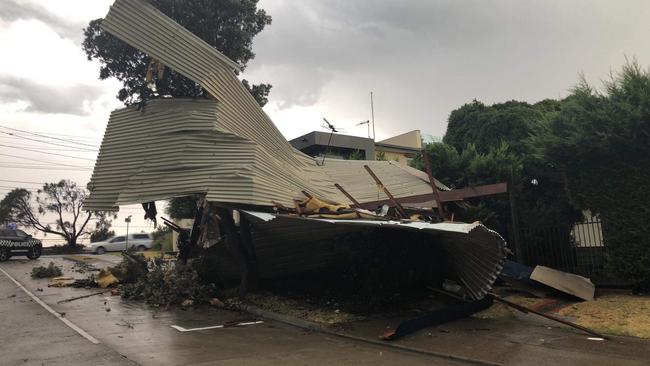
The roof of at least one property, in the beachside suburb of Aspendale, was ripped off during the storms, with neighbours saying it was the second time this had occurred in their street.
It came as fire crews battled two out-of-control bushfires in Gippsland, believed to have been started by lightning strikes, at Thomson and Walhalla.
A watch and act was downgraded around 9.30 this morning for the Thomson Jordan Divide Rd blaze.
Residents in Aberfeldy, O’Keefe, Sullivans, The Junction, Thomson, Toner and Toombon have been warned to keep checking with emergency services.
EARLIER
As of 9.15pm, the State Emergency Service had received 819 calls for help, including 320 for fallen trees, 259 for building damage and 13 for flooding.
The worst hit area was Brookfield, west of Melton, with 34 call outs.
Emergency crews were called to Kiandra Close about 5.30pm.
Neighbours said it is the second time a roof in the street had been ripped off.
There were no reports of injury.
Drivers were warned to avoid travelling near the intersection of South Gippsland and Bass highways near Lang Lang, as SES teams work to remove trees from the road on Wednesday night.
A VicRoads spokesman urged drivers to steer clear of the road until SES volunteers had cleared the area.
Melton, Campbellfield, Lang Lang, Narre Warren, Carrum Downs and Hampton Park were badly affected, with the Narre Warren SES unit attending to the most call outs.
Gusts of 111km/h were recorded in Hopetoun and 94km/h at Moorabbin Airport and Laverton.
The Bureau of Meteorology said 14mm fell in Melton South in 10 minutes.
Keilor saw 12mm fall in 30 minutes.
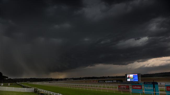
Lightning strikes shut down the Mornington twilight horse racing after only three races.
Dramatic photos posted on Twitter captured a dust storm sweeping through Melton.
@BOM_Vic dust storm coming over melton right now pic.twitter.com/EpuW9hSAud
— Paul jones (@M_TownBallers) January 30, 2019
Updated Severe Thunderstorm Warning issued for #Victoria. Large hail, damaging winds and heavy rain still affecting central and eastern parts of the State. Latest warning at https://t.co/SO9DGJyJkp pic.twitter.com/Elrgfi8QAs
— Bureau of Meteorology, Victoria (@BOM_Vic) January 30, 2019
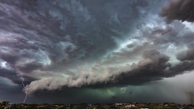
Amazing lightning show tonight just as work finished!! #melbourneweather #melbweather #Melbourne @BOM_Vic pic.twitter.com/pZbR1KQnJI
— Bonnie 💕 (@missjakku) January 30, 2019
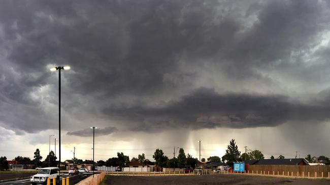
Angry sky!! @theheraldsun pic.twitter.com/HGLenXGy8V
— Andrew Mansell (@AndrewMansell75) January 30, 2019
On Wednesday afternoon, storms were detected in Belgrave, Camberwell, Caulfield, Frankston, Lang Lang, Melton and waters off Brighton beach, moving in a south easterly direction.
Earlier storms hit Dandenong, Glen Waverley and Williamstown, Koo Wee Rup, Pakenham and South Pakenham, Caulfield, Craigieburn, Footscray, Melbourne’s CBD, Melton, Pakenham and Ringwood, St Albans and Werribee.
Commuters travelling on the Pakenham line experienced major delays after a tree fell on tracks between Hallam and Narre Warren stations.
Part of the Cranbourne line was suspended due to an overhead power fault near Lynbrook.
WHAT a picture!
— 3AW Melbourne (@3AW693) January 30, 2019
We've just been sent this from Aspendale beach. pic.twitter.com/rXPc1OuXQs
@3AW693 we have storm damage roof off Kiandra close asoendale pic.twitter.com/eLe0ZYkqLF
— jshep (@janesheppard2) January 30, 2019
Hail in Ringwood right now #weather #janesweather #abcweather @weatherzone @JaneBunn @abcmelbourne @abcnews pic.twitter.com/2Gcx8Tkqkd
— Jono Ingram (@jonoingram) January 30, 2019
Little flood #Frankston #MelbWeather pic.twitter.com/GWI9ETuBiA
— tom (@tomwoodau) January 30, 2019
Storms hit Greensborough, Rowville, Sydenham, Portarlington, the area north of Ballan and northeast of Sunbury about 4.50pm.
Heavy hail was reported in Rowville.
BOM issued a severe weather warning for the city’s west, eastern suburbs and the Mornington Peninsula, as a cool change swept in from the west after Melbourne reached temperatures of 37C.
Firefighters were on high alert amid soaring temperatures across the state.
A total fire ban was declared for the Mallee, Wimmera and South West districts on Wednesday as temperatures in the northwest of the state climbed to 40C.
Slightly concerning #melbweather pic.twitter.com/C0NYmvStoF
— Michael 🌴 (@MichaelHBF) January 30, 2019
Marge, the rains are here.... #melbweather pic.twitter.com/Khan1do2CS
— Wolf, yes that is my name. (@wolfcat) January 30, 2019
Well that came out of nowhere#melbweather #melbourneweather pic.twitter.com/3zrYCNPVur
— Charlotte Buckingham (@CC_Buckingham) January 30, 2019
Belting down with bits of hail. #melbweather pic.twitter.com/RRg0bAKr9n
— pseudomorph (@pseudomorph) January 30, 2019
I guess the cool change has come #melbweather pic.twitter.com/hzjc8EctpU
— Sia Nas (@sianassongs) January 30, 2019
@BOM_Vic cool change approx 4:45pm and dust Melton Vic pic.twitter.com/wxl8RpLo0q
— Liz Gehrig (@LizGehrig) January 30, 2019
@BOM_Vic dust storm coming over melton right now pic.twitter.com/EpuW9hSAud
— Paul jones (@M_TownBallers) January 30, 2019
A severe thunderstorm warning was issued for parts of the Northern Country, North East and South Gippsland districts. The Strathbogie Ranges recorded 25mm before 9am on Wednesday.
Firefighters battled five “going” blazes, which means they don’t have containment lines around them, during the day, including at Timbarra in the East Gippsland region.
“In terms of the fire-affected areas, they’re going to see that wind change coming through during the early hours of Thursday, so between about 5am and 8am,” said Bureau of Meteorology senior forecaster Michael Efron.
“Fortunately, that wind change doesn’t look particularly strong through there and it will actually bring cooler conditions as well, so it should make conditions more favourable.”
A State Control Centre spokesman said authorities were well-prepared after days of relatively favourable conditions but lightning could make the situation worse.
Originally published as Large hailstones, heavy rain, strong winds wreak havoc in Melbourne

