
Severe weather warning in place for much of SA as the state braces for thunderstorms
With power towers down, Olympic Dam losing operational power and thousands across the state without electricity, much of the state has been pummelled by a severe storm.
BHP will be unable to mine from its Olympic Dam site for at least five to seven days after power towers connected to the operation were knocked out by storms late on Thursday, sources told The Advertiser.
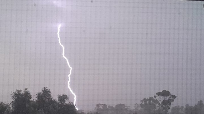
Eight towers connected to the mining operation in the Far North are not functioning, as vast swathes of the state were hit by 250,000 lightning strikes amid warnings of serious thunderstorms.
It’s been confirmed that both the Davenport to Olympic Dam and Davenport to Pimba transmission lines have towers down – two towers down on the Olympic Dam and five towers down on the Pimba Line.
Olympic Dam has limited on-site generation with generation currently focused on stabilising and prioritising key surface infrastructure, including the smelter, to maintain a care and maintenance operation for up to seven days.
A spokesperson for BHP confirmed the storms had “caused structural damage to transmission lines, including the two lines that supply Olympic Dam and Roxby Downs’’. BHP did not comment on how long mining operations would be disrupted.
“ElectraNet crews are working to restore power as soon as possible, and we are working with them to better understand the scale of the impact and recovery timelines,’’ the spokesperson said. “In the interim, back-up generation and business continuity plans are in place.”
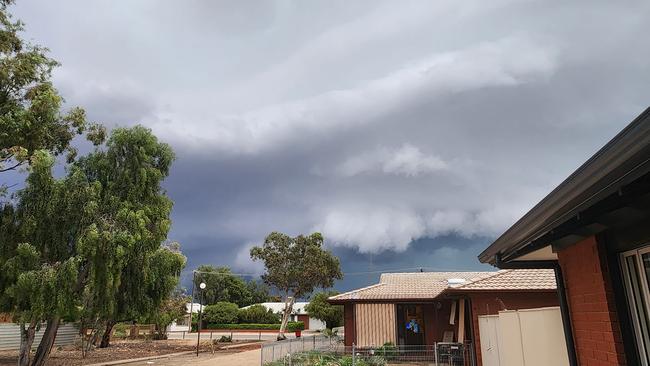
Just after 8pm the Bureau of Meteorology issued a severe thunderstorm warning for “damaging, locally destructive winds, large hailstones and heavy rainfall” that “may lead to flash flooding”.
The warning applied to the Flinders, Mid North and Riverland and parts of the Adelaide, Mount Lofty Ranges, Eastern Eyre Peninsula,Yorke Peninsula, Murraylands, and North East and North West pastoral districts.
“A deep low pressure system is moving across the south of SA, with a warm and humid air mass ahead of it, supporting the development of severe thunderstorms this evening,” the Bureau said.
High winds were recorded including a 137km/h gust at Port Pirie around 7pm, 129km/h at Olympic Dam Airport about 6pm, 113km/hat Tarcoola about 4.30pm and 101km/h at Woomera about 5.45pm.
At 9pm, SA Power Networks said there were 60 outages affecting more than 22,000 customers.
Close to 3500 of those were around Kadina and Wallaroo, with another 2000 around Moonta Bay and Port Hughes. Parts of the Mid North and Riverland were also affected by the widespread outages.
The SES issued a severe weather watch and act message for large parts of the state, saying people’s safety could be threatened. It advised people to stay indoors and away from windows during storms and not to travel “unless absolutely necessary”.
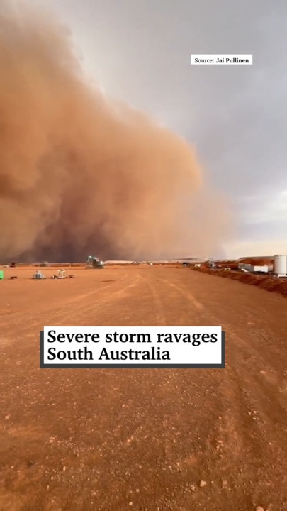
Roanne Scholz posted to social media an ominous picture of storms in the Gawler Ranges. “This is what it looks from the ground. Hail come with it. And it was very tornado-like,” she wrote.
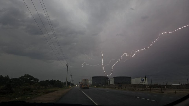
The Whyalla Storm Chasers page posted spectacular images of lightning strikes taken outside the town. The Advertiser attempted to contact BHP for comment.
LIVE WEATHER MAP
Hit the Play button to see how the weather will develop over coming hours
ADELAIDE RAIN RADAR
FORECAST FOR ADELAIDE
Friday, October 18: Mostly cloudy. Showers, mostly morning (1-6mm). Fresh NW/SW winds Min – 15. Max – 20.
Saturday, October 19: Mostly sunny. S/SW winds Min – 10. Max – 22.
Sunday, October 20: Mostly sunny. NE winds tending SW Min – 10. Max – 25.
Monday, October 21: Mostly sunny. E/NE winds Min – 15. Max – 31.
Tuesday, October 22: Cloudy. Late shower. NE winds tending SW Min – 19. Max – 25.
Wednesday, October 23: Partly cloudy. Late shower. SE/SW winds Min – 12. Max – 21.

Originally published as Severe weather warning in place for much of SA as the state braces for thunderstorms
Join the conversation

Man framed baby brother for gruesome attack, court told
There’s been explosive testimony in a trial for a man accused of a bloody axe attack, with his brother - whom the defence has argued is the real culprit - telling him to “take his own life”.
Read more

‘Hunting ground’: Cop crackdown uncovers child sex offender breaches
Police have charged a number of registered child sex offenders for breaching strict conditions, including contact with children.
Read more