
Record rain and river peaks as big wet rolls on
Flood-ravaged areas of Victoria and NSW are bracing for more rain and rising waters as the body of a young woman was found near Gulgong.
Widespread torrential downpours have hammered already sodden areas of Victoria, while authorities have predicted an increased risk of flash flooding in some regions of the state over coming days.
Meanwhile, the body of a young woman has been found in high water near Gulgong, as regions across NSW brace for increased rain and rising waters and Moree and Lismore are again inundated with floodwaters.
NSW is a state under siege, as residents are warned of a flood risk in “every corner” of NSW and Sydney sits in the eye of the storm.
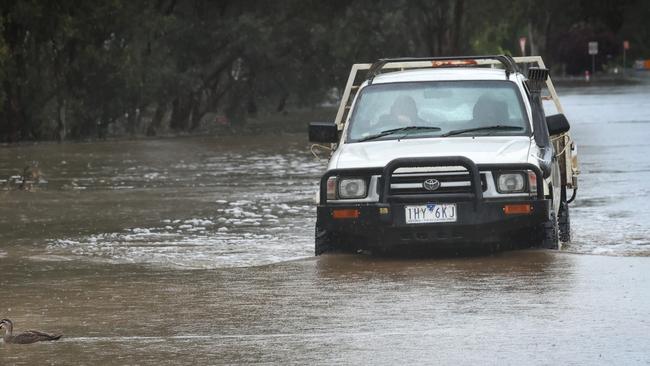
Meanwhile, widespread thunderstorms dropped rain bombs of 40mm to 60mm across western, northern and central Victoria over the weekend, with 35mm drenching flood-stricken Echuca residents in the 24 hours to 9am Monday.
The town has already received three times its October average with forecasters now expecting previous average October rainfall records to fall state wide.
Also, SES chief Tim Wiebusch said the Murray River might have peaked at 94.9m at the Port of Echuca.
“We are already seeing major flooding. And this morning we’ve seen it reach a level of 94.9 metres, which is what the Bureau has now forecast as the potential peak,” he said. “We might see a very small rise above that. But again it is intended to stay steady at that level for several days.”
Shepparton had 8.4mm from 11.30pm on Sunday, with the Goulburn River steady at a height of 10.5m.
The western and central districts are predicted to experience falls of 10mm to 30mm today as a low-pressure system moves west to east.
However, Bureau of Meteorology meteorologist Miriam Bradbury said “if thunderstorms hit we could easily see those totals moving up through that mark”.
The current rainfall is a confluence of two low-pressure systems entering the state from NSW, dragging tropical moisture and humidity down from Queensland.
“Therefore any showers or storms that do develop have the potential to dump a lot of rainfall,” Ms Bradbury said.
“We are expecting further river rises in coming days as this second system moves across, it is very difficult though to say exactly where and how much they will rise given the catchments are quite broad and the number of tributaries feeding into the main water river systems.”
She said while showers will ease off in the western and northern districts later in the week, Gippsland was predicted to receive 25mm with the “possibility of falls quite a bit higher”.
The predicted rain will further swell waterways and, along with water already streaming into catchments and substantial snowmelt, authorities said flood warnings were likely to increase in intensity and number over coming days as water moves through water systems.
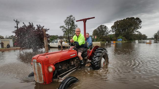
Murray River communities from Shepparton to Swan Hill, Robinvale and Mildura have all been placed on flood alert and further rain in the coming days threatens to bring floods back to recovering towns north of Melbourne.
There are 67 active emergency warnings across Victoria. These include major flood warnings for the Murray, Edward and Loddon rivers, and minor to moderate flood warnings placed on the Wimmera, Campaspe, Ovens, King, Werribee, Snowy, Barwon, Goulburn and Kiewa rivers and several creeks.
Along with an evacuate immediately warning already on Echuca, a move to higher ground warning has been issued for the Loddon River from Loddon Weir to Kerang and not safe to return warnings for Bunbartha and Kerang.


Disgraced cotton king jailed: $8.7m fraud rocks water program
A former Australian Cotton Farmer of the Year was jailed on Wednesday after pleading guilty to defrauding millions from a water efficiency program.

Animal welfare plan deadline revealed
Limiting sheep dog use is just one of the parts of new animal welfare plans which producers must complete to keep access to markets. This is what you need to know.