
Andrews’ Government blocks fuel load maps
The Andrews’ Government has ignored freedom of information requests and calls from Parliaments Upper House to release forest fuel-load maps.
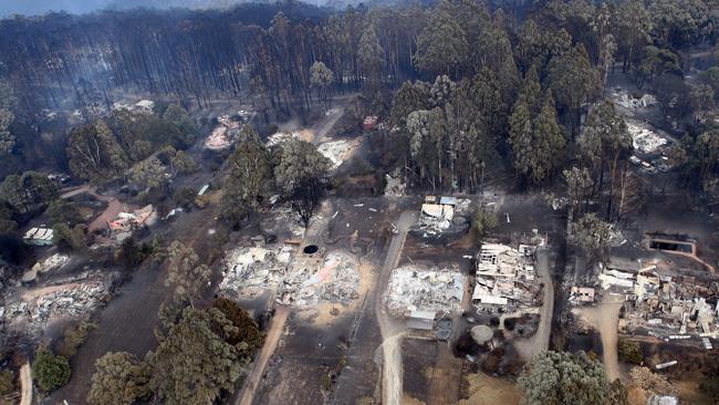
Premier Daniel Andrews, his ministers and bureaucrats have refused repeated calls to release maps showing the dangerous build-up of forest fuel loads across Victoria and abandoned the Black Saturday Royal Commission’s calls to conduct planned burns on at least 5 per cent of public land annually, equal to 385,000ha.
AUGUST 2018:
The Weekly Times asks the Department of Environment, Land, Water and Planning to forest fuel load data in tonnes per hectare, given the Government had cut back planned burns.
SEPTEMBER 3, 2018:
DELWP responds by stating: “fuel load data is only published to Business Level Data (and internal system) which means it is only available to internal DELWP users”.
SEPTEMBER 16, 2019:
Dry conditions prompt The Weekly Times to lodge a Freedom of Information with DELWP requesting fuel load maps for the previous five years, which DELWP states will cost $1294.80 to process. The Weekly Times winds back the request to just one fuel load map covering Victoria’s East Central zone, which covers Kinglake and Healesville, where the February 2009 Black Saturday Kilmore East and Murrindindi fires merged to burn out 169,542ha, killing 119 people and destroying 1242 homes
OCTOBER 24, 2019:
DELWP releases the map, which shows the build-up of fuel loads across Black Saturday’s fire zones had reached extreme levels.
NOVEMBER 21,2019:
The Weekly Times asked for the fuel load maps for East Gippsland and the North East, given fires have sprung up in these areas. But DELWP’s media team states “We act on the advice of fire experts who have advised that fuel load maps shouldn’t be released at this time”.
NOVEMBER 27, 2019:
Parliament’s Upper House passes a motion requiring the Premier to release: “fuel load maps produced by the Victorian Government in the last three financial years, including the most recently produced maps” by December 11.
DECEMBER 11, 2019:
Then Attorney-General Jill Hennessy responds by stating she needed more time and: “the Government was in the process of collating and considering the relevant documents”.
FEBRUARY 2020:
Premier Daniel Andrews states “we’re not going to provide every arsonist in Victoria with a to-do list”. Bushfire scientists label the Premier’s comments as illogical and argue arsonist don’t go around doing risk assessments before lighting fires and its powerlines that have been linked to the state’s most catastrophic bushfires. University of Melbourne bushfire scientist Kevin Tolhurst said the premier’s claim was “ludicrous”, given the summer’s bushfires were started by lightning.

Fuel for thought in petrol policy
Farmers say a Coalition plan to cut fuel excise will help regional motorists at a time of mounting pricing pressures.
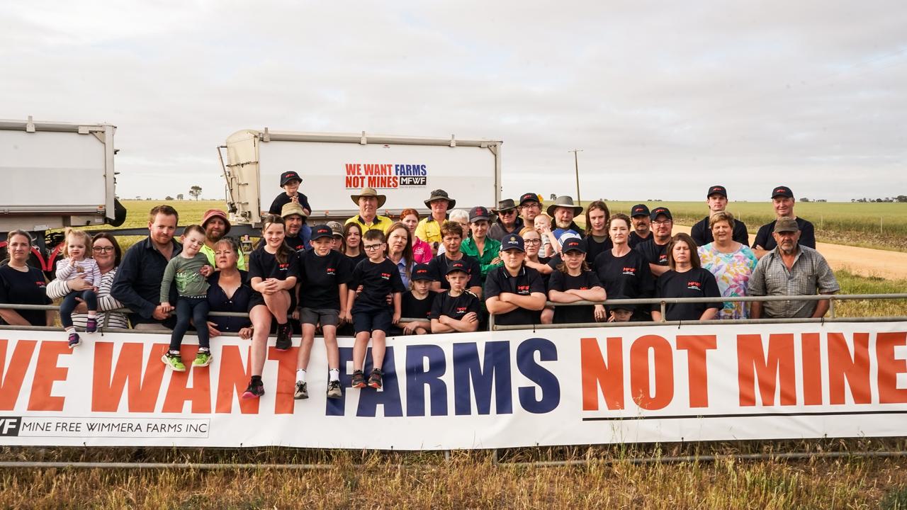
Farmers unite on mineral sands ahead of federal election
Victorian and interstate farming groups are collaborating for one clear message ahead of the federal election regarding mining, transmission lines and renewables.