
Rain set to smash entire country over coming days
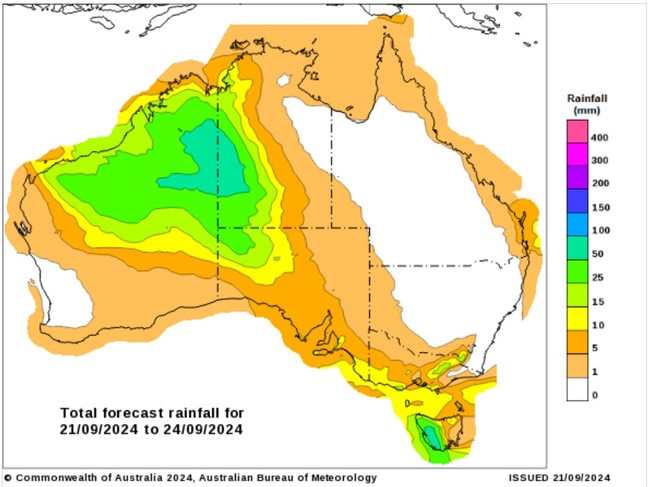
Australia is set to be drenched with rain over the coming week, with some areas expected to receive up to a month’s worth of rainfall in just days.


Every Australian state is set to receive a drenching over the next week, with some areas expected to cop a month’s worth of rainfall in just a few days.
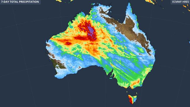
A surge of tropical moisture is forecast to cause showers across the nation from the weekend until the end of next week, according to Weatherzone.
Tasmania, parts of the outback and Queensland have gotten a good soaking overnight as huge rain bands move across the country.
The Apple Isle got a soaking Friday, with Warra in the state’s northwest recording 28mm of rain and the state hosting nine of the wettest gauges.
The whole western half of the state is forecast to receive more rain on Saturday, sparking minor flood warnings along the River Derwent below Meadowbank Dam, the Styx River and the Tyenna River.
In remote Western Australia, Halls Creek and Fitzroy Creek have gotten a few millimetres as the rain band looks to settle in.
The Bureau of Meteorology forecasts unseasonal showers and thunderstorms over the weekend, and into Monday, may bring consecutive days of moderate rainfall over the Sturt Creek District, Sandy and Tanami Desert catchments, which are in flood watch.
Widespread rainfall totals of 10-25 mm on Saturday, 20-40mm on Sunday and 30-45mm on Monday are forecast with isolated daily falls in excess of 70mm possible.
Roads are likely to flood and some communities and homesteads are likely to become isolated.
In Queensland, areas around Hervey Bay have received more than 25mm in the 24 hours to Saturday morning.
Rain and thunderstorms will increase over the north of Western Australia over Saturday and Sunday as this moisture feeds into a deepening area of low pressure.
“This wet and stormy weather will then spread over central Australia on Monday before forming a broad rainband that will drench southeastern and eastern Australia,” a Weatherzone spokesman said.
“Some areas in WA and the Northern Territory that typically receive 20-50 mm of rain in September could pick up about 50-100 mm from this event.”
Some of the falls are expected to be concentrated over next Thursday and Friday.

Over the weekend, the Bureau of Meteorology expects several showers in southeast Queensland, as a low pressure trough moves off the east coast over Saturday.
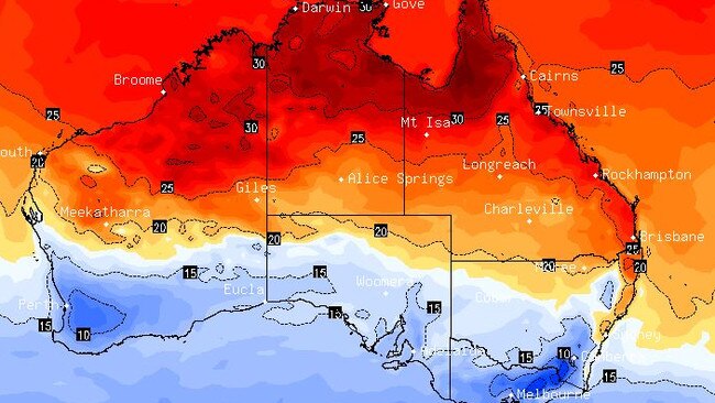
Meteorologist Miriam Bradbury said the eastern and northern parts of the Sunshine State would experience a warm day as maximum temperatures climbed into the 30s - particularly around Townsville, Weipa, Mount Isa and Cairns.
Inland temperatures would be slightly below average, she said.
NSW is forecast to experience “patchy” morning frost across parts of the South Western Slopes - with some showers likely around areas like Albury.
“Sydney is heading for a mostly sunny (day) … tops of 25C tomorrow,” Ms Bradbury said.
“Down in Canberra - 16C and partly cloudy.”
Another cold front would lead to continued showers and gusty winds in the country’s southeast, mainly concentrated on the south Victorian coast.
Melbourne is set to experience showers, with maximum temperatures of 17C.
The bureau has forecast showers over the weekend for Adelaide, which will peak at temperatures of 17C and 19C over Saturday and Sunday respectively.
Those falls are expected to ease by Sunday.
Ms Bradbury said storms would persist in northern and inland Western Australia over the weekend, but drier conditions through the more southern districts.
Perth will remain sunny and not climb beyond a maximum temperature of 25C over Saturday.
In the Northern Territory, Ms Bradbury said there were chances of showers and thunderstorms across western parts of the Top End which could “push into the Kimberley, Pilbara and northern interior of WA” as the pressure deepens.
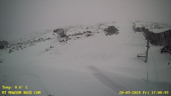
The sweeping showers come as the Tasmanian ski town of Mt Mawson, an hour-and-a-half out of Hobart, was blanketed by snow over the past few days.
Peter Davis from the Southern Tasmanian Ski Association on Thursday announced the ski tow would run over the weekend after an estimated 20cm of snow fell overnight.
Originally published as Rain set to smash entire country over coming days
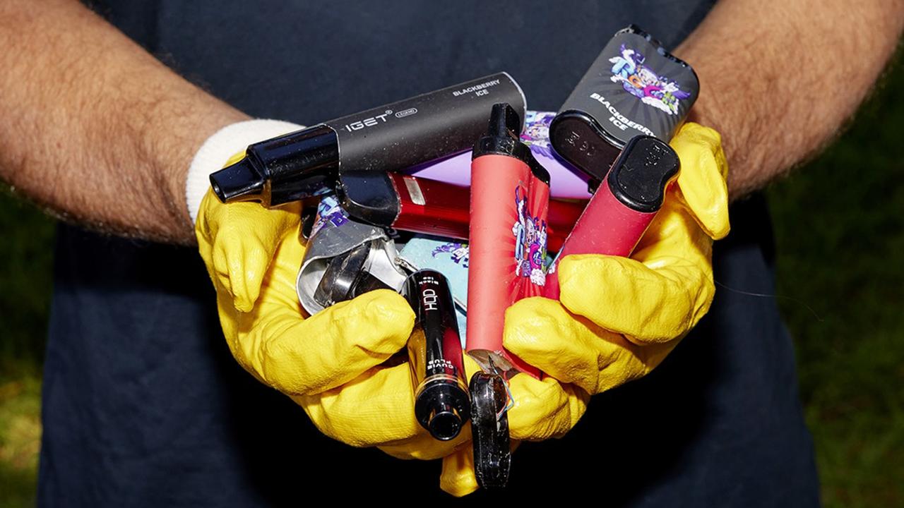
‘Hazardous’: 140 per cent spike on ‘toxic’ item in Aussie trash
Alarming new data has revealed the dangerous items Aussies are throwing in their bins that is spreading across the country.

Gross reason fans locked out of pop star gig
Fans of a pop-rock icon have been left out in the cold after a nasty issue forced a much-anticipated concert to be cancelled.