
Millions brace as severe weather smashes NSW Central Coast, Sydney
Trees have been torn up, roads flooded, and hundreds of calls for help made as wild weather smashed Sydney and parts of NSW, with warnings more is on the way.
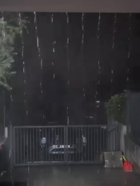
Trees have been torn up, roads are closed, and thousands remain without power as heavy rain and blistering winds rip through Sydney and NSW’s Central Coast.
Emergency services and SES crews have been deployed across the city, with more than a month’s rain expected to smash parts of the state within just days.
The NSW SES received more than 350 calls through Sunday night, including 60 calls in metro Sydney as trees were ripped up and strewn across streets, as residents faced leaking rooves and other damage to their properties.
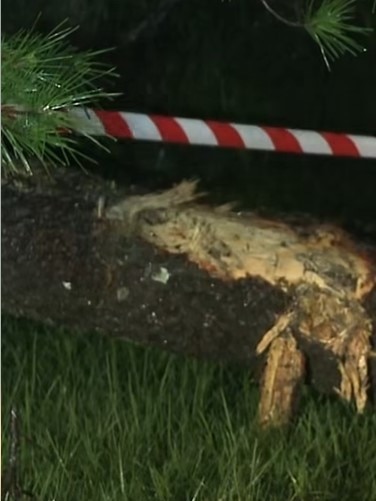
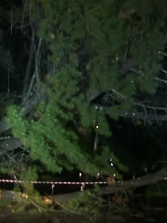
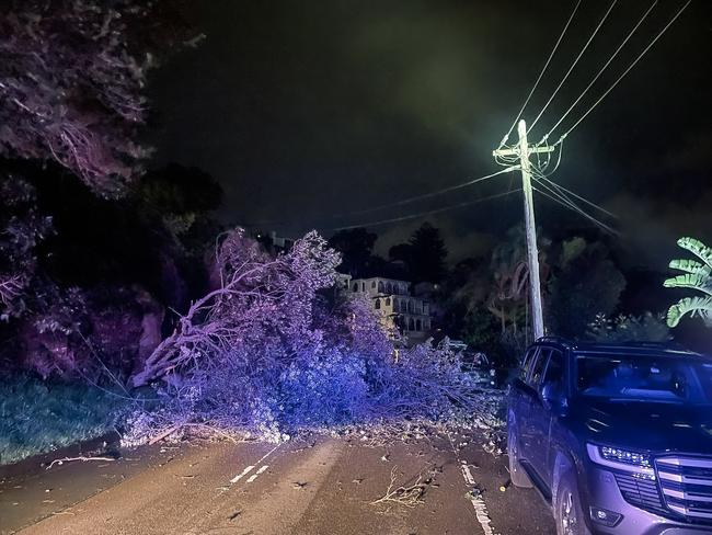
The SES were called to Taronga Rd in Terrey Hills after a large tree fell and landed on a car, requiring crews to clear the tree and roadway.
“There were seven flood rescues overnight - all of these were in Northern NSW, particularly in Gosford and Wyong, for people driving vehicles into floodwaters,” an SES spokesman told NewsWire.
“Everyone (was) retrieved safely.”
A tree has brought down power lines on Peronne Ave in Clontarf, with residents urged to stay at least 8m away from the wreckage as Ausgrid and emergeny services work to restore power.
More than 2200 people are currently without power across Sydney and the Central Coast.
Hundreds of people have been impacted in Sydney suburbs Allawah, Beacon Hill, Frenchs Forest, Narraweena, and Oxford Falls. Nearly 800 have been impacted in Kincumber and Macmasters Beach.
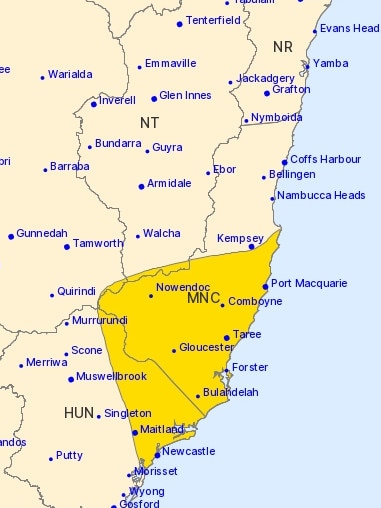
The Bureau of Meteorology has issued severe weather warnings for parts of the Mid North Coast, Hunter region, and Sydney, with blistering winds reaching speeds in excess of 100km/h in the Hunter and Mid North Coast.
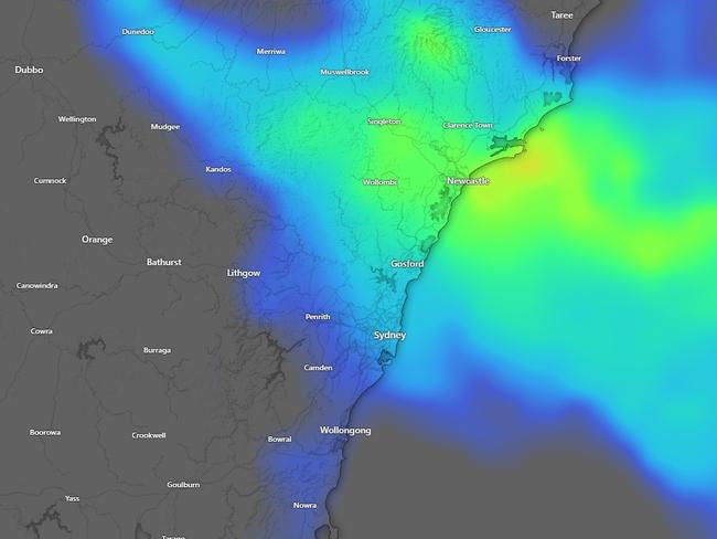
The Bureau’s senior meteorologist Angus Hines said while the rain was starting out “quite patchy and intermittent”, conditions ramped up on Sunday evening and more than 100mm of rain smashed the Central Coast, including 121mm in Wyee and 117mm in Dora Creek.
The heaviest falls in Sydney have been in the city’s north, with 70mm recorded at Wairunga and 62mm in Pearl Beach.
The wild weather is expected to stick around for several days, with heavy rainfall and dangerous surf conditions stretching from the Newcastle to Port Macquarie districts.
“A weather system over the Hunter region is forecast to move north to the Mid North Coast today (Monday), bringing heavy rainfall and strong winds to the coast,” an SES spokesman said.
“This will linger along the coast for several days, bringing sustained heavy rainfall.
“Isolated falls of up to 180mm in 24 hours are possible, and could cause significant flash flooding.”
There’s no end in sight for the wet weather, Mr Hines said, with rain and dangerous winds and surf conditions expected until Saturday.
“It will be a prolonged period of wet weather for NSW and it’s rain expected to fall across the same regions for several days in a row,” he said.
“Having that much rain three or four days in a row can lead to significant flood impacts (and) road closures.”
The ongoing rain has already triggered flash flooding, including the Wakehurst Parkway between North Narrabeen and Oxford Falls and The Esplanade in Narrabeen, which have both been closed due to flash flooding.
“Motorists can use Pittwater Rd and Warringah Rd instead,” a LiveTraffic NSW statement read.
“Never drive through floodwater, avoid the area, use an alternative route.”
Originally published as Millions brace as severe weather smashes NSW Central Coast, Sydney
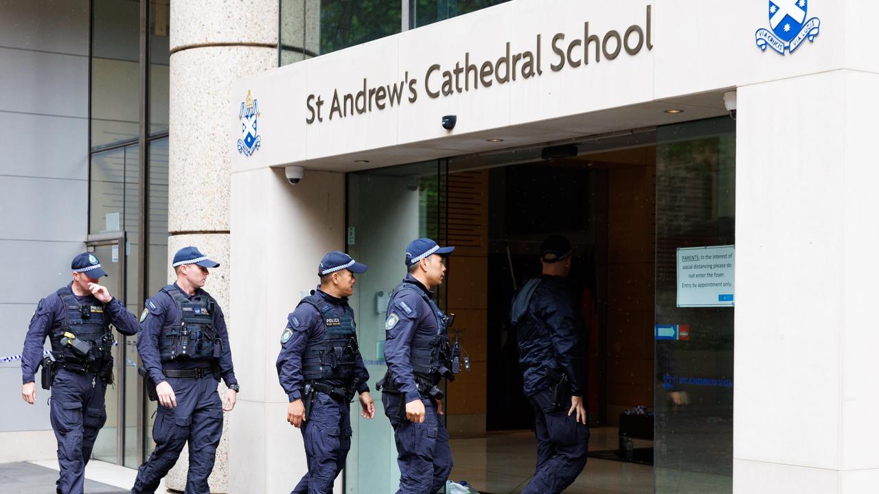
Sydney school plunged into lockdown
The school where water polo coach Lilie James was murdered was plunged into lockdown on Monday after reports a ‘disorientated’ man had threatened staff.

Pro-EU mayor, nationalist historian set for Polish presidential runoff
Pro-EU mayor, nationalist historian set for Polish presidential runoff