
Drones set to become farmer’s friend in crippling drought battle
AUTONOMOUS drones could help farmers produce more crops with less water, writes TONY FAWCETT.
DRONES are set to become the farmer’s friend in the battle against crippling drought.
Against a backdrop of vast areas of parched Australian farmland, research by Monash University engineers into moisture mapping by autonomous drones offers promise of practical relief.
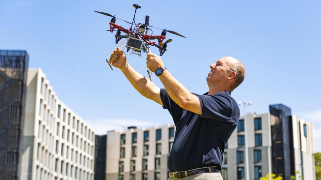
Aiming to make every drop of water count, a research team led by Monash University’s Professor Jeff Walker has spent the past two years developing a drone-based autonomous soil moisture mapping system for irrigated paddocks.
The system has been largely proven with field trials on farms in Victoria and Tasmania using optical mapping, and now the team is experimenting with more accurate and detailed microwave sensors.
SUNITAFE’S CARDROSS FARM RECEIVES FUNDING BOOST FOR AGTECH
RURAL GRADUATES CHART CAREERS IN AGRIBUSINESS BANKING
DOOKIE EVENT ENGAGES SECONDARY STUDENTS IN AG SCIENCE
It’s hoped moisture content in soils up to 15cm deep will be able to be accurately monitored, providing farmers with exact figures on how much more they need to successfully grow particular crops.
“We need to be more efficient with the water we use,” says Professor Walker, the university’s head of civil engineering.
“The days of ‘oh, let’s just run our irrigator because I think it looks a bit dry’ are probably coming to an end.
“We need to ensure we are delivering just the right amount of water to optimise our water use and optimise our yield from our crops.
“You can’t do that unless you know how much water is needed or how wet your soil is to start with. Technologies like this can really help in solving the problem.”
Professor Walker, whose global soil moisture research has previously involved him working with NASA, believes we need to produce 60 per cent more food with the same amount of land and water.
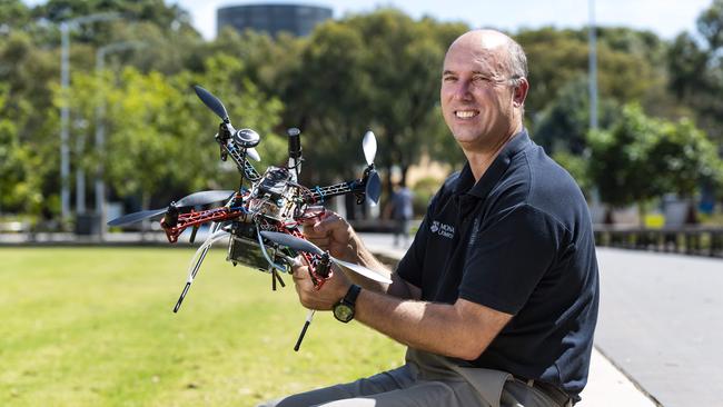
Midway through this year he expects to begin trialling a new drone fitted with microwave sensing equipment.
If successful, it could open the way for reasonably priced off-the-shelf moisture-sensing drones being available to farmers. So far, there is minimal interest from commercial groups but he is confident that will quickly change if the team can show the feasibility and keep costs low.
Drones with optical sensors, he says, now can be bought for a few hundred dollars because they are in such huge demand but currently there are no commercially available microwave drone systems.
“If we can demonstrate the feasibility and mainstream that technology then the cost can come down into the ballpark where it can be affordable,” he says.
The keys are reliability, price and simplicity.
“If they (farmers) have got to go and get a licence to fly a drone and learn how to use detailed software, they don’t have time for that.
“Where we are coming from is basically making it as simple as you can … select the paddocks that you are interested in, press the go-button, so to speak, and it does it. And there’s your map.”
Past research with satellite, aircraft and optical mapping drones convinced him drones using microwave moisture-sensing equipment are the way to go for farmers.
Satellites, he says, are fine to map moisture soil globally or regionally but can’t show “what’s happening on a particular farm or in a particular paddock, or even down to a part of a paddock”.
Aircraft are too expensive and optical mapping does not provide enough detailed information. A current obstacle, however, is that regulations forbid the use of autonomous drones.
He believes this project’s successful demonstration will encourage change, that regulations will catch up with technology. In this regard, he believes university research can have a definite advantage over commercial bodies.
“The thing with universities is that we are not driven by profits and commercial liabilities directly, so we can do things that might fail, or which might have a longer lead time to market,” he says.
“We can tinker around the edges and when this becomes legal, and I think at some point it probably will, within some guidelines and frameworks, then we demonstrate it’s possible.”
MOISTURE UNDER THE MICROSCOPE
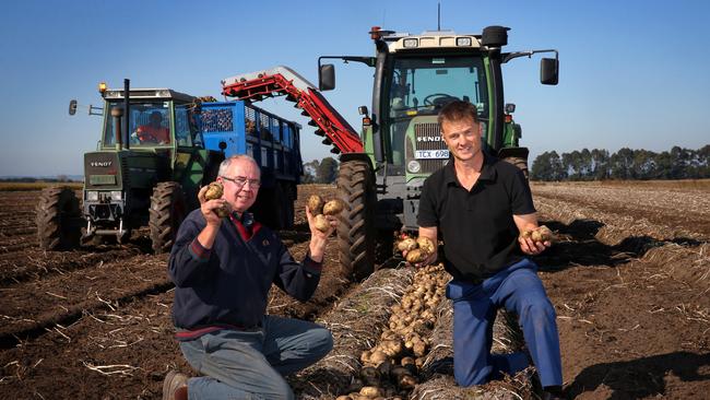
One who has had a close-up look at the Monash drone project is Cora Lyn potato farmer Wayne Tymensen (pictured) whose property is one of two (the other is in Tasmania) that is the focus for research.
For two years the team has had a research station on his property, analysing moisture content in quadrants of a trial paddock growing various crops at different times of the year.
Wayne already monitors his own property’s moisture content via eight probes in each paddock that provide readings at depths of 20cm, 30cm, 40cm and 60cm but says the benefits of the Monash program could vastly simplify the process.
Wayne’s probes currently monitor moisture every four hours and he goes out daily or weekly with a laptop computer to record a month’s worth of readings.
“I’m hoping Jeff’s thing will also give us evaporation so we can get an instant reading of where it’s at all the time,” he says.
“If you can get an instant reading on your computer of the all-over moisture in every part of all your paddocks, rather than just where your probes are located, it will be quite incredible.”
From the editor
MORE needs to be done to excite young people — particularly rural youth — about the huge opportunities in food and fibre, writes CAMILLE SMITH.
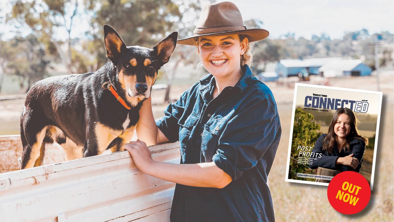
Tail to tell in ConnectED mag
COOTAMUNDRA teen Abbey Bailey is spreading the word about the importance of agriculture. Read Abbey’s story in ConnectED, the magazine that puts agriculture education and rural students on the agenda.