
Big rain delivers $1b bonus to WA grain farmers
A WEEKEND downpour has literally delivered a $1 billion dollar bonus to Western Australia’s grain growers.

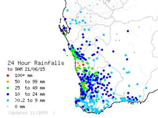
WESTERN Australia’s weekend downpour — dumping up to 120mm on some farms — has literally delivered a $1 billion dollar bonus to grain growers.
While Perth had more than 46mm over the weekend — and 89mm for the week to 9am today — much of the agricultural area, from Kalbarri to Esperance and inland to Southern Cross received similar heavy falls.
Eneabba topped the state for the week, where farmers will be bogged out after receiving 120mm in the downpours, which began late last week and intensified over the weekend.
Southern Cross, 370km east of Perth, considered the eastern extremity of the Wheatbelt, had 31mm to 9am this morning.
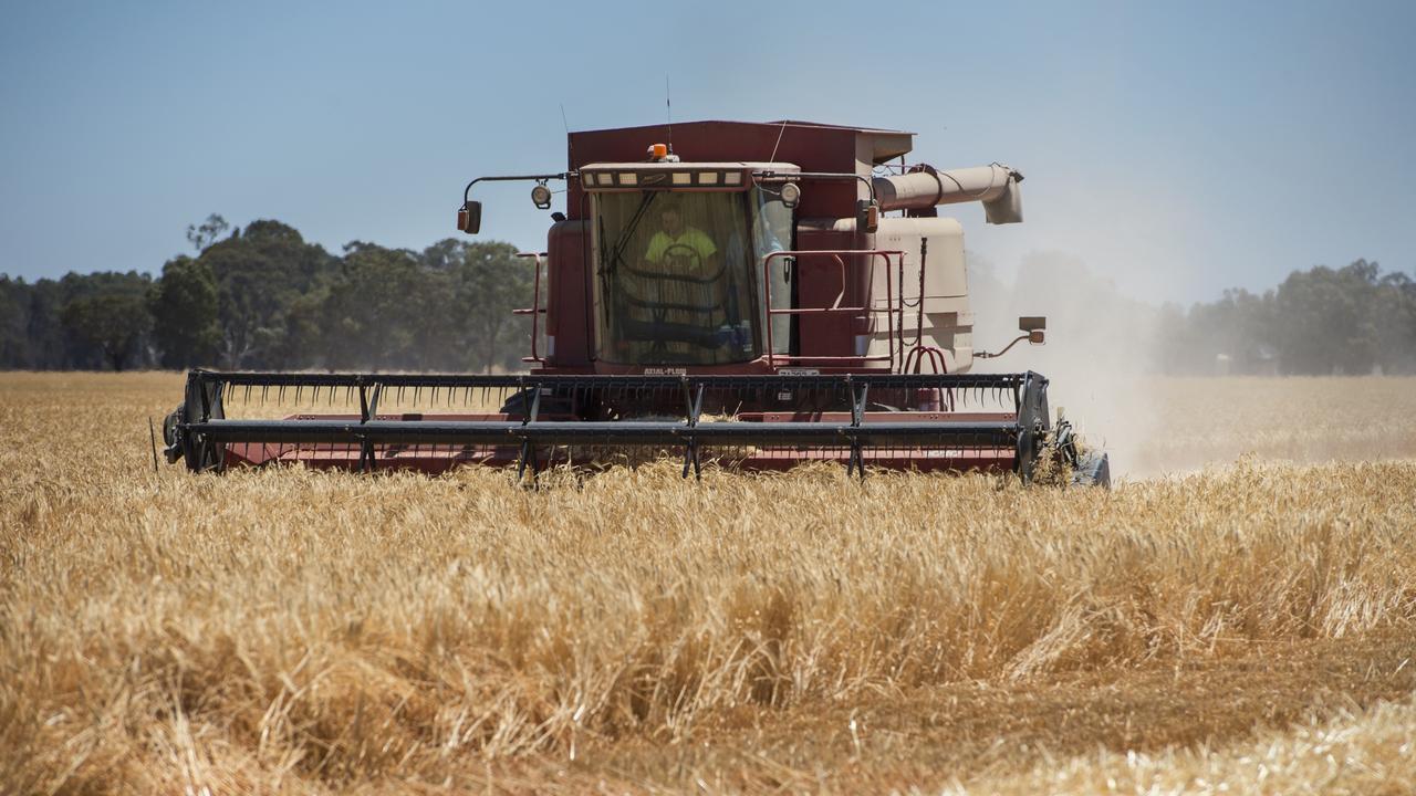
The rain has come at a crucial time for farmers, whose crops were starting to feel the pinch after a promising start to the season had started to dry up.
Roleystone, in the Hills, southeast of the city, had the heaviest fall with 57mm to 9am Sunday morning and Pemberton, with 44mm, had the highest fall to 9am Monday.

Perth had 33mm — and a further 13mm to 9am Monday — Gosnells 44, Swanbourne 37mm with Pickering Brook, in the Hills, recording 46mm.
The rainfall in the metro area lifts the June total for Perth over 100mm, though it still remains well short of the June average of 174mm, and there is little rain on the horizon in the next week, with cold, dry conditions expected to set in till at least Sunday.
In the Central West (for the week), Eneabba, had 120mm, Kalbarri had 65mm, Coorow had 56mm, Badgingarra 58mm, Geraldton 42mm, Port Denison 47mm and Dongara 49mm.
In the Central Wheatbelt, Ballidu, 60mm, Cadoux 64mm and Koorda 50mm also had big falls, with Cowcowing 49mm, Bencubbin 38mm, Dalwallinu 51mm and Merredin 44mm.
In the Great Southern, Katanning 66mm, Cuballing 54mm, Bannister 41mm, Narrogin 52mm, and Kukerin, 50mm, all had decent weekend rainfall.
In the South West, falls were lighter in the 24 hours to 9am Sunday, but the region was lashed on Sunday with heavy rain and strong winds, with falls up o 40mm in many centres
Rainfall for the week included: Acton Park, 69mm, Pemberton 65mm, Manjimup 60mm, Jarrahwood, 58mm, Walpole, 59mm, Shannon 51mm and Windy Harbour 61mm.
Cape Leeuwin recorded a wind gust of 102km/h at 10.25pm Sunday.
On the South Coast, Salmon Gums had 48mm, Albany 25mm, Denmark 44, Esperance 31mm, Hopetoun 34mm and inland, Borden 35mm.
While Sunday’s severe weather has eased and contracted to the far south coast, there are more showers forecast for Perth for Monday.
Perth can expect a typical wintry day with morning shower or two, a 50 per cent
chance of rain and a Maximum of just 16C.
The cold front will bring icy temperatures to Perth and the South West over the next 48 hours with Perth expecting an overnight low of just 3C tonight going into Tuesday morning.
There is a chance of snow on the peaks in the Stirling and Porongorup Ranges in the Great Southern.
The Bureau of Meteorology cancelled the Severe Weather Warning early Monday for much of the south of the state, but wintry conditions will remain along the south coast.
A warning has been issued for sheep graziers in the southern half for likely stock losses exposed to freezing winds.
“A low pressure system south of the state is now sliding to the southeast well away from the south coast. Showers and thunderstorms are still likely, particularly between Walpole and Esperance, but damaging and locally destructive winds are no longer expected,’’ the Bureau said.
“A vigorous and cold southerly flow will persist about the southern districts during Monday and into Tuesday as a high pressure system develops to the west of the state.’’
“Dangerous surf conditions which could cause some beach erosion are still expected, mainly between Cape Naturaliste and Albany. Tides will be higher than normal along the south coast between Augusta and Israelite Bay.
“The last reported significant wind gust was 102km/h at Cape Leeuwin at 10.25pm Sunday evening.
“The immediate threat of severe weather has passed, but the situation will continue to be monitored and further warnings issued if necessary.
To date, DFES has received minimal calls for assistance.
If your home has been badly damaged by a storm, call the SES on 132 500. In a life-threatening situation call 000

Mice inflict grain pain
A mice outbreak is causing havoc across summer cropping areas. Here’s what’s being affected.
Saudi Arabia a barley saviour
After losing China as a market, a large volume of Australian barley has found a home.