Water released from dam as Brisbane prepares for possible flood
By Savannah Meacham, Adrian Black and William Davis
Further flash flooding is possible across Brisbane as water is released from saturated catchments, with the bureau warning residents to prepare for more heavy falls in the coming days.
Water from Wivenhoe Dam began to be released into the Brisbane River from about noon on Tuesday.
Releases from Somerset Dam – which flows into Wivenhoe – were ongoing, and could cause water levels to rise by more than half a metre by Thursday.

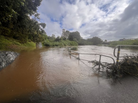
Flooding at Wolverhampton Bridge at Kedron Brook.Credit: Anna Campbell
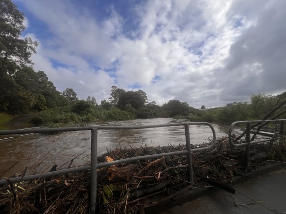
Images shared with Brisbane Times revealed flash flooding over the Wolverhampton Bridge spanning Kedron Brook in Stafford on Tuesday morning.
“If the Wolverhampton bridge had been built back better, people from Grange Forest could still access the shops,” Anna Campbell from Queensland Walks said.
“If the bridge and paths were made more flood-resilient, the neighbourhood that uses this bridge every day for school or shopping would have access.

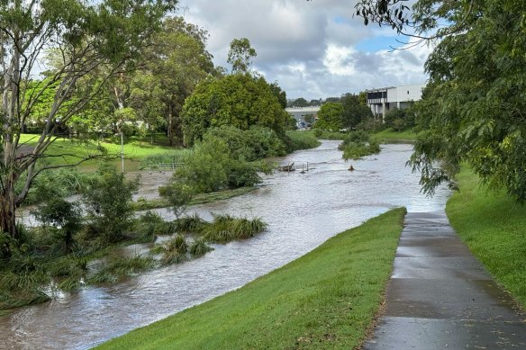
Flooding at Kedron Brook, near Stafford’s Hickey Park, just after 8am on Tuesday.Credit: Stephen Amos
“So many people stopping today and not getting through.”
More than 127 millimetres of rain fell in Brisbane on Monday night, with 61mm recorded in the CBD, while other areas around the south-east received up to 100mm.
It came as a severe storm swept across parts of Ipswich, Somerset, the Lockyer Valley, Brisbane City and Moreton Bay about 2am on Tuesday, bringing heavy rain and flooding.
Police warned drivers to avoid Gympie Road as westbound lanes near Strathpine Road in Bald Hills were flooded.
Since midday on Monday, the State Emergency Service received 78 calls for help, with the majority being for sandbags and tarping on the Fraser Coast, Sunshine Coast and in Brisbane.
The agency said five of those came after midnight in the Moreton Bay and Somerset region.
The Bureau of Meteorology said the wet weather leading up to the festive season was due to a low-pressure system off the central Queensland coast near Mackay and a coastal trough bringing moist and unstable conditions.
Areas from Mackay down to Brisbane were expected to receive the most rain on Tuesday, as thunderstorms and a widespread deluge struck the coast.
A weather bureau warning for possible minor flooding was also issued for parts of the Brisbane River.
Water was already above the minor flood level at Linville and Devon Hills. The river was also rising at Gregor Creek, and could burst its banks.
“Over the next three or four days, there could be widespread falls of 50 millimetres to 100 millimetres and isolated falls up to and exceeding 250 millimetres,” Dean Narramore from the bureau said.
Elsewhere, relief was arriving for some sunbaked Australians after several states sweated through one of the hottest December days in years.
Parts of Queensland, Victoria, NSW and South Australia topped 45C on Monday, while the Northern Territory faced severe to extreme heatwave conditions for much of the next three days.

Flooding at Wolverhampton Bridge at Kedron Brook.Credit: Anna Campbell
“It’s very hot out there,” Narramore said.
Queensland’s Urandangi recorded a maximum of 46.4C.
Extreme fire danger warnings remained in place with high bushfire risks expected across Australia’s south-east.
Mount Lofty Ranges in eastern South Australia and most of western and central Victoria, including Melbourne, were under extreme fire danger warnings.
“These hot, dry, windy conditions are likely to lead to extreme fire dangers,” Narramore said.
“That means that if fires do get going in this weather, they’re likely to be uncontrollable and uncontainable.”
Alice Springs reached 41.9C just before 3pm, before the mercury fell 15C in just over 90 minutes.
Melbourne fell short of its forecast high of 41C, with the temperature topping out at 39.4C.
A cool front reached Adelaide and western Victoria by 2pm on Monday, but the heat will remain for the rest of the week in Queensland and the NT.
With AAP