This was published 9 months ago
The ‘polar-powered storm’ bringing snow and bitter temperatures to NSW
By Caitlin Fitzsimmons and Angus Dalton
The east coast of Australia is getting a dose of proper winter as a cold front moving north from Tasmania ushers Antarctic winds and snow to NSW.
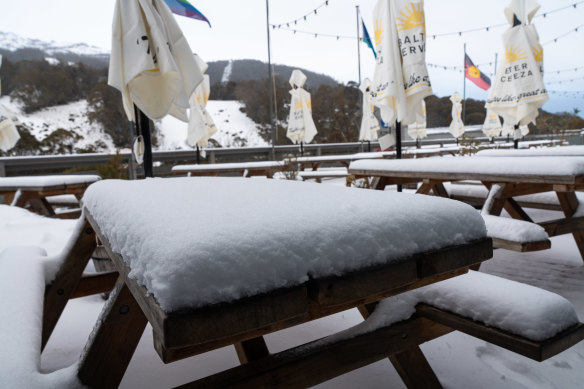
The polar blast delivered a welcome dump of snow to skifields after a lacklustre start to the season, while snowmen have cropped up after an icy dusting in Oberon, three hours west of Sydney.
Christie Johnson from the Bureau of Meteorology said there was snow as far north as Barrington Tops on the Mid North Coast of NSW, and morning frost in southern Queensland.
“There are some places across NSW and southern Queensland that had their coldest morning of the year [on Monday] morning, and for places like the Gold Coast and a couple of other places in Queensland it was the coldest morning in a couple of years,” Johnson said.
A low-pressure system swirling off the east coast of Tasmania and moving past Gippsland into NSW is summoning the wintry weather and sending snowstorms across skifields.
The Antarctic air mass could deliver snow as far north as Queensland this week, according to the bureau.

Skiers are rejoicing amid a welcome snowstorm at Thredbo on Tuesday.Credit: Thredbo Resort
Perisher reported a 12-centimetre dusting overnight and expects a metre of snowfall to build up over the week as the low-pressure system and atmospheric moisture summon the perfect conditions for snow.
In the past 24 hours, Charlotte Pass reported 25 centimetres of snowfall, Selwyn Snow Resort reported 30 centimetres and Thredbo had 9 centimetres. Thredbo expects between 60 and 82 centimetres to fall over the coming days as the “polar-powered storm” continues.
Sydney hit a high of 15 degrees on Tuesday afternoon, but Johnson said the strong southerly winds meant the “feels like” factor would be significantly cooler.

A healthy layer of snowfall builds up at Thredbo on Tuesday.Credit: Thredbo Resort
At 2pm the feels like temperature was a biting 6.8 degrees, less than half of the air temperature. Mid-July is the coldest time of year on average.
The cold snap comes against a backdrop of higher-than-usual global temperatures.
Last week the European Union’s Copernicus Climate Change Service reported that June was 1.5 degrees Celsius above pre-industrial levels, and the 12-month average temperature up to June 2024 reached 1.64 degrees Celsius above pre-industrial levels.
However, Professor Lesley Hughes from the Climate Council said this did not mean that the planet had exceeded the 1.5 degrees of warning set by the Paris Agreement.
“Usually, that would be measured over a 20-30 year timeframe, rather than just one year of data,” she said.
“We’ve just had 13 straight months of record temperatures of air temperatures, and we’ve had 15 straight months of record ocean temperatures. These are the sort of trends that we sort of expect but dread with climate change, but we will need a longer run to be sure.”
The Morning Edition newsletter is our guide to the day’s most important and interesting stories, analysis and insights. Sign up here.