A person has been rescued from floodwaters in Sydney’s south and emergency services responded to hundreds of calls for help as the city braces for more storms, flash flooding and a month’s worth of rain in two days.
The NSW State Emergency Services (SES) is urging Sydneysiders to avoid driving where possible after responding to 216 incidents across the state in the past 24 hours.

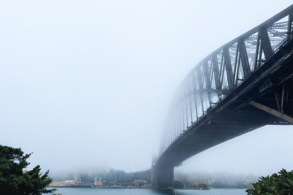
The view from the Rocks towards Sydney Harbour on Saturday morning, as the city braces for a month’s worth of rain in 48 hours. Credit: Danielle Smith.
“With catchments already wet and soil moisture high from rainfall earlier this week, several roads are already inundated by floodwaters, so people should avoid unnecessary travel in the rain,” acting assistant commissioner Paul McQueen said.
There were 140 incidents requiring an SES response in metropolitan Sydney from Friday into Saturday morning, including the successful rescue of a person stuck in a vehicle submerged in floodwaters on Ida Street in Sans Souci on Friday night.
Other callouts were for leaking roofs, fallen trees, flash flooding and requests for sandbags.
Transport authorities have issued a general wet weather alert for Sydney’s train system, with trains running slow on several lines due to track work.
Sydney’s CBD has copped 46 millimetres of rain since Friday morning, while the airport recorded 74 millimetres. The average rainfall for Sydney in November is around 85 millimetres.
The highest rainfall was recorded at Audley Weir in the Royal National Park, where 114 millimetres has fallen since 9am on Friday.
The Bureau of Meteorology is expecting an additional 10 to 35 millimetres of rain to fall on Sydney throughout Saturday, taking the total rainfall over two days beyond the 85 millimetres normally expected to fall in the city in the month.
“If you sum up what we had yesterday and what we could get today, [we’re] likely to see approximately a full November’s worth of rainfall over the course of about 48 hours,” senior meteorologist Angus Hines said.
Hines said the rain would likely intensify as the day goes on, falling heaviest in the afternoon before easing into spotted showers on Sunday.
Humid and wet conditions across Australia’s east coast are being driven by a low currently hanging over Victoria, which is pulling a swathe of hot tropical moisture down to the eastern states.
“We’re getting very humid conditions down from the tropics across eastern Australia, and that’s really what’s fuelling the band of cloud and rainfall,” Hines said. “It will continue today, but by tonight and then tomorrow morning, the majority of that [weather system] will push off the east coast and into the Tasman Sea.”
In addition to localised flash flooding, the SES is warning minor flooding could occur along the Colo and Macdonald rivers in the Hawkesbury-Nepean catchment.
Minor flood watches are also in place for the Castlereagh, Macquarie, Bogan, Lachlan, Tumut, Murrumbidgee and Queanbeyan rivers.
Get alerts on significant breaking news as happens. Sign up for our Breaking News Alert.