By Angus Dalton
A low-pressure system undergoing rapid intensification or “bombogenesis” off the east coast has triggered a severe weather warning for NSW from the Mid-North Coast to the Illawarra.
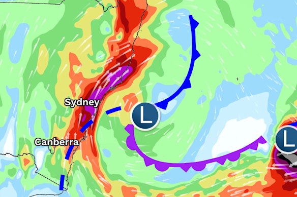
The system is expected to batter coastal cities including Sydney from Tuesday as a vigorous coastal low brings huge waves, torrential rain and gale-force gusts capable of ripping down trees and powerlines.

A vigorous coastal low will lash the NSW coast with high winds and thunderstorms from Tuesday.Credit: Bureau of Meteorology
The system will be dynamic, fast-moving and unlike recent storms, warned SES deputy commissioner Debbie Platz. The agency has deployed 395 volunteers across the coast and positioned high-clearance vehicles to Kiama, Albury, Hawkesbury, Maitland and Dungog.
Emergency vehicles and helicopters were also deployed to Taree, which is still reeling from May’s flood disaster.
“This is a time for our communities across NSW to be very vigilant and very prepared. We’re looking at thunderstorms, rain, strong winds, coastal erosion and damaging surf,” Platz said.
Platz urged people to download the Hazards Near Me app, secure outdoor furniture and trampolines, clear gutters and move vehicles away from large trees.

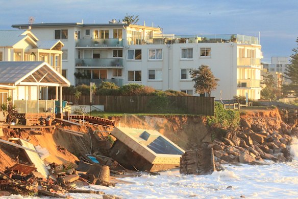
The fallout from an east coast low at Collaroy in 2016.Credit: Peter Rae
Showers will become heavier in the state’s north on Monday before the worst of the weather arrives on Tuesday into Wednesday. The bureau warned downpours of 200 millimetres may strike some areas, while gusts could reach 125km/h.
Over the weekend, meteorologists predicted NSW could be in for an east coast low, a severe weather system that once ripped the face off waterfront properties and stole the beach from Collaroy on Sydney’s northern beaches in 2016.
The current system is now unlikely to meet the threshold for an east coast low or “bomb cyclone”, but the vigorous coastal low will still unleash savage winds and rain across the northern coast, Hunter, Sydney and Wollongong regions over the next 48 hours.
Up to 140 millimetres of rain could lash Sydney over the next three days, and there’s a risk to boats and beaches from waves growing to five or six metres.

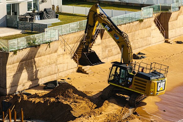
Collaroy has been trying to defend its beach using walls in the wake of the 2016 east coast low.Credit: Nick Moir
The bureau issued flood watch warnings for rivers across much of NSW.
“Some of that heavier rainfall could lead to riverine flooding,” Hayes said. “There is a flood warning out that covers most of those rivers, from basically the Hawkesbury and Nepean south to the Illawarra catchments.
“We could also see flash flooding away from the rivers themselves, given that there is the likelihood we will see at least some areas of quite heavy rainfall.”
The rapid intensification of the low into a fierce weather system, dubbed “bombogenesis” by meteorologists, is a rare event most often seen during winter.
“Over the next 24 hours or so, we will see the low form quite deep, quickly, and the central pressure dropping significantly, somewhere in the order of 20 to 30 hectopascals,” the bureau’s Daniel Hayes said.
That plunge in pressure easily meets the threshold for an east coast low, but another low-pressure system stewing further out to sea will interact with the coastal system, potentially siphoning off energy and reducing the potential for the wide-scale impacts that would define an east coast low.
Forecasting the interaction between the two low-pressure systems is tricky.
“The two can just dance around each other and both survive but pull energy out each other. Or they could merge, and you eventually get one system that’s stronger,” Hayes said.
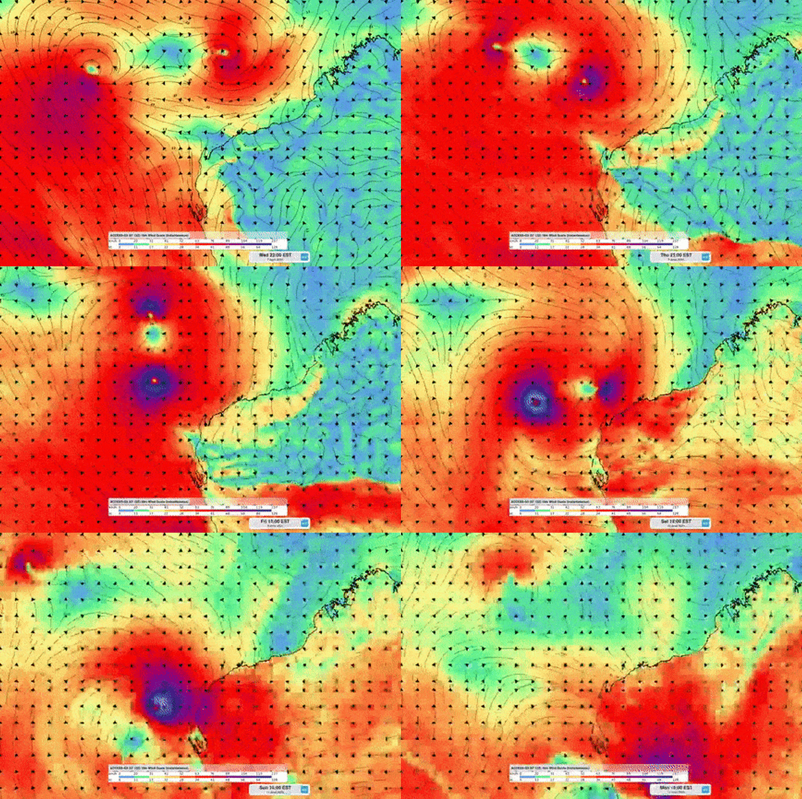
The two lows could undergo the Fujiwhara effect, where two systems rotate around each other, according to Weatherwatch meteorologist Anthony Cornelius. That would further complicate forecasting and may push the bad weather into three-day event, he said.

A previous example of the Fujiwhara effect from 2021, when Tropical Cyclone Seroja began to circle around another tropical low (both shown in purple) off WA.Credit: Weatherzone
Tropical warmth in the Coral Sea and unseasonably high temperatures in the Tasman, up to 2.5 degrees above average, is feeding more energy and moisture into the system. It contributed to downpours of 50 to 100 millimetres over parts of South East Queensland at the weekend.
Start the day with a summary of the day’s most important and interesting stories, analysis and insights. Sign up for our Morning Edition newsletter.