- Updated
- National
- NSW
- Extreme weather
Daredevils brave wild seas as Cyclone Alfred circles toward battered coast
By Angus Dalton
The brief doubling back of Cyclone Alfred gifted residents of NSW’s northern coast a brief reprieve from lashing rains and damaging winds, but the warnings remained clear: the time to prepare is almost over, and thousands must be ready to evacuate.
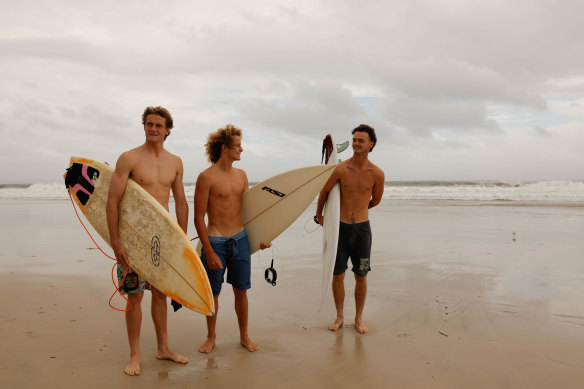
Daredevil surfers sprinted into the maelstrom of waves whipped up by an eight-foot swell and strong wind at Main Beach in Byron Bay and drew crowds so large there was a queue for the beach’s carpark on Thursday morning while the skies remained calm.

Spectators battered by waves at Brunswick Heads.Credit: Nick Moir
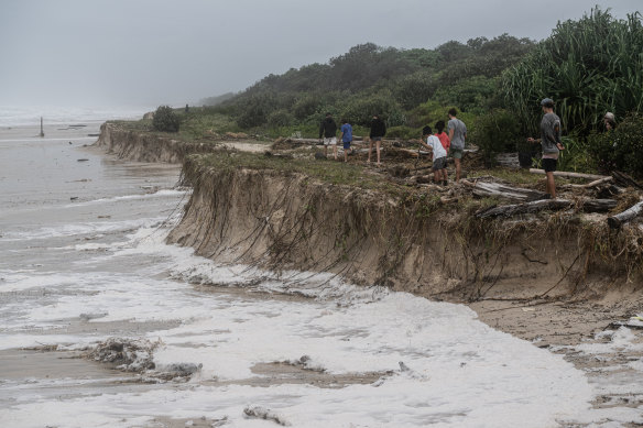
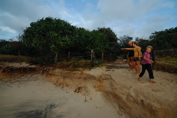
Waves have already eaten away sand at Brunswick Heads and Tallow Beach, south of Byron. Experts fear the slow-moving cyclone will generate destructive, long-lasting surf that could severely erode beaches and leave the coast more exposed to flooding.
“It’s a lot of [2022] flood vibes around the area; everyone’s kind of like, ‘okay, we’re in this again’, but it’s going to be a little different,” said Josh Davies, a resident of the Byron Bay area for 23 years.
“Everyone’s had at least four or five days’ notice. The biggest stress last time was that there was a lack of communication and very, very slow response from the army, the SES, the council, the government, it’s like they were scrambling.
“Now there’s plenty of communication ... it’s way better than being caught with your pants down.”

Coastal erosion at Brunswick Heads rockwall.Credit: Nick Moir
Water has started to flood Childe Street at Belongil Beach, a strip of luxury properties and high-end beach houses between the seething ocean and a swollen Belongil Creek.
The Belongil area has been issued with a “prepare to evacuate” flood warning, as have beachside enclaves from Kingscliff to Brunswick Heads, and most of Ballina, including the CBD. About 5pm the SES issued an emergency warning for Fingal Head and a raft of inland areas including Lismore, Kyogle and Uki, urging people to evacuate by 9pm.
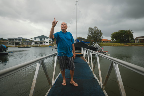
“It’s not going to flood,” 30-year Ballina resident Rex said, standing on a pontoon over the canal at the back of his home.
He experienced the floodwater that drowned Ballina in 2022 and lost a car to the torrents, but intends to stay as Cyclone Alfred sets in, now with an estimated landfall of Saturday morning.

Rex from West Ballina has lived in the Northern Rivers for 30 years. Credit: Danielle Smith
“We’ve had 100-kilometre winds, it hasn’t done much here. We’ve had 120km/h here, nothing. I’ve taken my flag down, that’s about it – the wind might’ve ripped it.”
Greg and Karen Armstrong seized the moment of calm on Thursday morning to survey violent seas from the headland near Sharpes Beach, where even at low tide, the surf was thrashing far higher up than usual.
The Lennox Head locals remember when Tropical Cyclone Nancy hit in 1990. They taped their windows and filled the bath with water but didn’t sustain major damage.
This time feels different. They’ve brought the balcony furniture inside and stocked up on food. They’re expecting to hunker down completely for at least two days when Alfred makes landfall.

Byron locals Julia Spicer with partner James Harvey and son Kitt, 9, check out the erosion at Tallow Beach Suffolk Park.Credit: Danielle Smith
“We’re gonna cop the winds pretty badly,” Greg said. “We’re worried about Lismore, we’re worried about Mullumbimby, we’re worried about West Ballina.”
Bike riders, joggers and spectators of the wild surf were forced to flee for cover at about 2pm when pre-cyclone weather returned to smash the coast with a deluge.

Surfers head out to capitalise on the cyclone’s booming waves.Credit: Danielle Smith
The Bureau of Meteorology has warned of possible 130km/h winds on Thursday evening and up to 200 millimetres of rain on Friday.
Start the day with a summary of the day’s most important and interesting stories, analysis and insights. Sign up for our Morning Edition newsletter.