- Updated
- National
- NSW
- NSW weather
This was published 1 year ago
Twenty Sydney SES rescues as storms lash the state and homes inundated
By Angus Dalton and Caitlin Fitzsimmons
The NSW State Emergency Service has carried out 20 flood rescues across Sydney, and there has been major disruptions to flights at Sydney Airport after a storm cell swept across the city on Christmas Eve.
The Bureau of Meteorology issued a severe thunderstorm warning about 5.30pm for Sydney, warning that heavy rainfall could lead to flash flooding near Sydney Airport and Randwick.

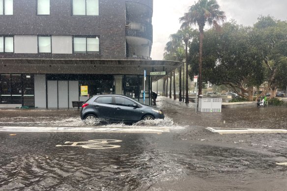
Bondi’s streets were inundated after storms lashed the city.Credit: Danielle Smith
The lashing rain from a slow-moving storm cell inundated the city and the eastern suburbs. The bureau noted 56 millimetres drummed down on Little Bay between 4 and 5pm.
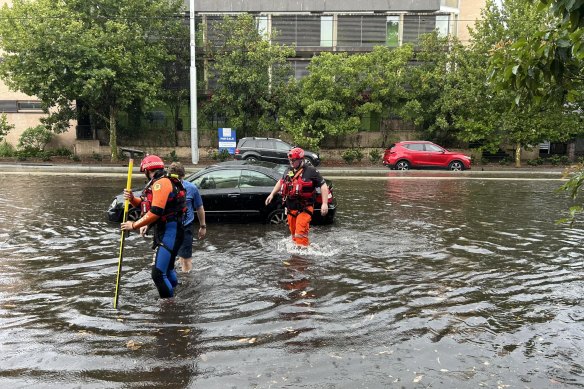
The SES made 20 flood rescues and responded to reports of 30 homes inundated in Pagewood, in Sydney’s east.
SES spokesperson Andrew Edmunds said the rescues mostly involved people trapped in their cars by floodwater in Mascot, Kensington, Botany, Rosebery and Malabar.
The SES responded to 94 other incidents in the last 24 hours involving flooded buildings, roads and homes.
The bureau cancelled the severe thunderstorm warning for Sydney after 7pm.
Flights were delayed by an hour on average due to the weather, and flash flooding on O’Riordan Street outside Sydney Airport caused traffic delays.
The airport continues to operate as normal, a spokesman said, but passengers should leave plenty of time to get to the airport and check the status of their flight through the evening.
Images posted to social media on Sunday afternoon show runways inundated with water after 64 millimetres of rain hammered the airport during the Christmas Eve rush.
The rain will persist across most of the state until Boxing Day, putting a dampener on the traditional Australian Christmas of backyard gatherings and picnics at the beach.
Dylan Bird, a meteorologist with the Bureau of Meteorology, said the wet and stormy weather would continue throughout Christmas Eve, Christmas Day and Boxing Day.
“It will potentially be even stormier [on Christmas Day] in Sydney and much of NSW, so it’s definitely looking like it will dampen the outdoor festivities,” Bird said.

Most of the flood rescues in Sydney involved people stuck in their cars due to rapidly rising water levels.Credit: NSW SES
The storms could dog sailors in the annual Sydney to Hobart yacht race, which starts at lunchtime on Boxing Day, and Bird said there was the potential for hail along the route.
Severe thunderstorm warnings remain in place for Mid-North Coast, the Northern Rivers, North Western Slopes, the Northern Tablelands, the South Coast and the Lower Western areas of the state.
Bird said this could include wind gusts greater than 90 km/h, large hail bigger than two centimetres in diameter and localised heavy rainfall with the risk of flash flooding.
In the New England and Northern Rivers regions, there was an additional risk of a “supercell thunderstorm”, which means it has a rotating core, bringing giant hail.

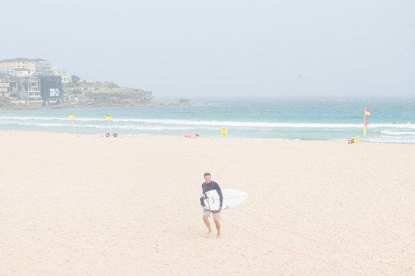
A swimmer braves the weather at Bondi Beach on Sunday.Credit: Flavio Brancaleone
SES commander Greg Swindells said isolated flash flooding was likely, but more widespread flooding in the state’s north was not expected.
Lismore in the Northern Rivers region is still recovering close to two years after it was devastated by severe floods.
“It’s natural to be anxious and having anxiety in regards to the weather,” Swindells said.
“I can assure you that the information that we have, we’re not expecting any riverine flooding.
“Our greatest risk here is for localised flash flooding, and also the hail and severe winds that we may see, particularly in the Northern Rivers.”
The NSW SES website has six flood warnings out, all at advice level, mostly on the South Coast including Bega, Bombala, Queanbeyan, Moruya and surrounds, Tumut River and Upper Murray River, and also Willara Crossing in north-western NSW.
Thunderstorms passed through the Sydney Basin, Illawarra and Central Coast earlier in the day on Sunday.
With AAP
Our Breaking News Alert will notify you of significant breaking news when it happens. Get it here.