This was published 1 year ago
‘Extraordinary’ sea temperatures spark summer drought, fire warnings
By Mike Foley
The weather gods are assembling the elements for a harsh drought this summer.
Experts warn climate drivers are hitting extreme levels, setting the scene for an El Nino weather cycle that typically brings heatwaves and bushfires to Australia’s east coast.

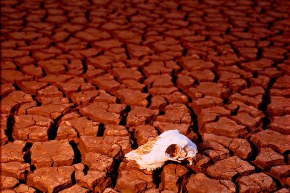
The climate drivers are in place for a strong El Nino event, which can bring drought and bushfires to east coast Australia.Credit: Louie Douvis
Professor Mark Howden, from the Australian National University’s Institute for Climate, Energy and Disaster Solutions, said temperatures were edging up towards uncharted territory in the eastern Pacific Ocean.
The El Nino weather pattern occurs when sea temperatures in the central and eastern Pacific Ocean heat up. This disrupts typical ocean currents and trade winds and brings colder water to the east coast of Australia, meaning less evaporation and rain and a significant rise in the risk of drought, heatwaves and bushfires.
The flipside is a La Nina cycle, which tends to bring wet conditions like the record rain and floods seen across NSW, Victoria and Queensland over the past three years.
While the Bureau of Meteorology has taken a relatively cautious approach – issuing an “alert” for likely El Nino conditions without formally declaring the start of a cycle – Howden said it was “very, very clear that we’ve got an El Nino”.
“Most of the other big institutes like NOAA [National Oceanic and Atmospheric Administration] in the US – their conclusion [earlier this month] was more than a 90 per cent chance of an El Nino. And things have firmed up since then.”
Howden said “extraordinary” temperatures were being recorded in the surface waters of the eastern Pacific along the South American coastline, which, coupled with a large mass of warm water below, indicated the likely formation of an El Nino event.
UNSW Canberra climate scientist Sarah Perkins-Kirkpatrick said every fortnight, when the bureau releases its updates on El Nino drivers, “the climate model predictions of an El Nino have gotten only stronger”.
“On top of that, the international climate models are ... all saying that by next month, at the very least, we’ll be in El Nino thresholds that will only strengthen as spring goes on,” Perkins said.
Howden said conditions were also in place to potentially kick off a positive phase of the Indian Ocean Dipole, a climate cycle that can add fuel to an El Nino event.
“That’s where you have cold water into the ocean in north-west Australia, and then warm water out into the Indian Ocean, and that tends to bring less moisture across the continent to the east coast,” he said.
However, while most severe heatwaves, droughts and bushfires materialise during El Nino years, some El Ninos can deliver relatively mild summers and about average rainfall.
CSIRO Climate Science Centre research director Dr Jaci Brown said while the signals indicated an El Nino would occur, it was not guaranteed – nor was it possible to predict how strong it might be.
But she said the climate drivers would probably remain in place, raising the possibility of a future El Nino.
“There is a small chance it won’t come off, but then we’ll still be primed for it the year following,” she said.
“I think the more important message is that it’s not going to be a La Nina.
“We’ve just had three La Ninas in a row, we’re not going to have a fourth and we’re very confident that the signals are not there.
“That will be a huge relief for a lot of people.”
Australia’s average temperature has risen by 1.47 degrees since 1910. Howden, Perkins-Kirkpatrick and Brown said climate change was contributing to the intensity of weather events including El Ninos by adding more energy to the atmosphere to fuel winds, currents, evaporation and other climate drivers.
Cut through the noise of federal politics with news, views and expert analysis from Jacqueline Maley. Subscribers can sign up to our weekly Inside Politics newsletter here.