
Houses blacked out as storm lashes South Australia
THOUSANDS of homes are already without power across South Australia, and Victoria is bracing for extreme weather as well.
Technology
Don't miss out on the headlines from Technology. Followed categories will be added to My News.
AN EXTREME weather event has struck South Australia, leaving 2400 homes in Port Augusta without power, along with hundreds of others around the state.
Rainfall records are expected to fall, flash-flooding is feared and high winds threaten chaos as South Australia is drenched on the first day of summer on Friday.
The State Emergency Service is readying for rainfall that may exceed 100mm in some areas and has sandbags on offer on Thursday evening to guard properties against flooding at its Campbelltown, Northfield, Lynton and Mount Barker sites.
Meanwhile, Victoria is bracing for three months’ worth of rain in three days, with an army of 5000 volunteers standing by. Experts have warned the downpour there could match the rain produced by the cyclones that ravaged north Queensland, the Herald Sun reports.
“It poses a threat to life,” said weather bureau senior meteorologist Scott Williams.
“There will be a massive ammount of lightning, there will be roads cut, floodwaters.”
More than 300mm of rain will fall across all parts of the state, starting in western Victoria and arriving in Melbourne by midday.
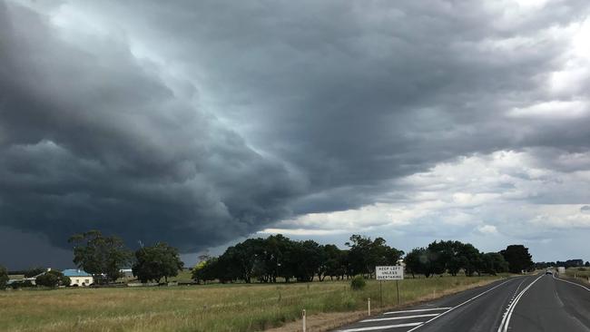
Already on Thursday evening large swathes of South Australia were hit by extreme weather with the roof of a shearing shed blown off by wind in Wattle Range East.
The SES have already been required to provide sandbags to flash flooding in areas as far apart as Berri and Christie Downs.
More than 3,000 properties across the state are without power as trees and tree branches knock down power lines.
The Bureau of Meteorology says that while intense storm systems are not uncommon at this time of year, the rainfall associated with this system is likely to break records and continue into the weekend.
It is also warning of thunderstorms, bringing damaging winds and heavy rain for much of SA — West Coast, Eastern Eyre Peninsula, Flinders, Mid North, Riverland, Murraylands, Upper South East, Lower South East, North West Pastoral and parts of Yorke Peninsula and North East Pastoral districts.
The real rain will hit on Friday, with daily falls of around 50mm of rain. Total rainfalls until Saturday may reach up to 100mm.
Rivers and creeks may rise in these catchment areas:
Flinders Ranges Rivers and Creeks
Broughton River
Light and Wakefield Rivers
Angas and Bremer Rivers
Torrens and metropolitan rivers and creeks
Gawler River
Onkaparinga River
Lake Frome
Danggali Rivers and Creeks
River Murray Murraylands
River Murray Riverlands
Eastern Eyre Peninsula
Yorke Peninsula
Port Lincoln’s CBD was underwater this morning after heavy rain dumped on the town.
Senior BOM meteorologist Matt Collopy said that “we could see some areas that get a couple of months’ worth of summer rain in only a day or two, which is very unusual at this time of year”.
“It’s not unusual to see thunderstorms, but this sort of widespread rain and widespread thunderstorm activity is unusual,” he said of a weather event caused by the combination of an upper low-pressure system and high humidity.
“We are particularly concerned about northwestern parts of the state, as well as the South-East.”
The bureau was expecting “falls of up to 40-70mm and even up to 100mm over parts of South Australia, particularly in the eastern border districts”.
Adelaide is expected to wake to heavy rain lasting from around 3am until 9am. The rain band will be followed by thunderstorms with potentially destructive winds of a strength the bureau fears could match that of “super cell activity”.
Super cells are the intense thunderstorms associated with extreme weather incidents such as tornadoes.
The eastern Eyre Peninsula, the Flinders Ranges, the Mid North, Mt Lofty Ranges, southern pastoral districts, the Riverland and the Murraylands are all on flood watch.
Adelaide reached 39.4C on Wednesday, our hottest day since March.
A lightning band started a blaze that burnt through around 45ha in Monarto South.
Then we endured another hot, humid evening as the mercury hovered above 24C.
SES Commander Derren Halliday said crews were on standby across the state and that “we want people to be very aware of this flash-flooding risk and the risk of people being trapped in and around fast-flowing water”.
“What we don’t want is a tragedy,” he said.
“From what the bureau has been describing, a large part of the state is at risk.
“Keep the kids away from the water, don’t drive through flooded roads and make sure you’ve got contingencies. If it is raining heavily, plan a bit more time to travel and travel in a safe manner.
“We ask people not to park under trees, be very mindful on the Hills’ faces and out on country roads that there can be trees down on the roads in front of them
“Take that extra care and look after each other.”
Anyone needing assistance from the SES during storms and floods should call 132 500.
If lives are in danger, they should call 000.
Originally published as Houses blacked out as storm lashes South Australia
Man mauled by shark at popular beach
A man in his 20s has been flown to hospital after being attacked by a shark at a popular Aussie tourist destination.
Cyclone less than 24hrs away from Aus
A tropical low sitting off the east coast of Australia is less than 24 hours from forming into a category 2 tropical cyclone – and could make its way towards millions.