‘Number of injuries reported’: two firefighters injured in Sydney grass fire
Two firefighters have been injured after a grass fire erupted in Sydney. More than 80 firefighters were sent in to tackle the out-of-control blaze.
Environment
Don't miss out on the headlines from Environment. Followed categories will be added to My News.
Firefighters have been left injured following an out-of-control grassfire that threatened homes in Sydney’s south west.
The blaze erupted just before 2pm at a former amusement park at Horningsea Park on Wednesday, with thousands of residents warned to seek shelter.
More than 80 firefighters were sent in to tackle the blaze along Camden Valley Way in Liverpool towards Edmonson Park, as well as 20 fire trucks including Fire and Rescue NSW Bushfire Tankers and a Mobile Command Centre.
Two helicopters waterbombed the fire, which was fuelled by strong winds.
The fire spread across 12 hectares and damaged two buildings, including an abandoned home.
A number of caravans, trailers and outbuildings were also damaged in the blaze.
FRNSW Superintendent Gregory Wright reported two firefighters had been injured during the incident.
“We have had a number of injuries reported, including two firefighters — one with smoke inhalation and one with some soot or embers in their eye. They haven’t been transported,” Superintendent Wright said.
One firefighter was treated for smoke inhalation, while the other was hit in the eye by smoke debris.
Both firefighters were medically assessed at the scene, while a civilian was treated for chest pains in their home.
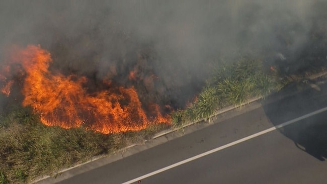

Mopping up operations are underway as of 6.20pm while spot fires are being extinguished at the scene.
An investigation has been launched to determine the cause of the fire.
The fire was treated as a 10th alarm fire, but was downgraded to an advice level late in the afternoon as people were urged to stay in their homes.
“We’ve just downgraded the fire to advice level, and we are telling people that to stay in their homes,” Superintendent Wright said.
“Don’t come out and look at the firefighters. Yes, it’s exciting, but for their safety, they should stay in their homes and watch from their windows.”
“Firefighters are on scene of a grass fire burning in the vicinity of Horningsea Park, the fire is burning in an easterly direction towards Edmondson Park,” the NSW RFS wrote on Facebook earlier on Wednesday afternoon.
“If you are in the Talarna Hill Drive to Jardine Drive area, you are in danger. It is now too late to leave. Seek shelter now inside a solid structure such as a house.
“Close all windows and doors and shelter in a room on the other side of the house from the approaching fire.”
Embers from the fires were reportedly threatening homes as dry, windy conditions hit much of the country.
Camden Valley Way and Bringelly Road have now reopened citybound from Leppington to Prestons after both directions were closed as a result of the fires.
All westbound lanes of Camden Valley Way remain closed as of 5.50pm from Talana Hill Drive to Cowpasture Road at Edmondson Park.
Emergency services remain on sight, with westbound motorists urged to seek an alternative route.
Trains are also running between Glenfield and Leppington on the T2 Inner West and Leppington Line after services came to a halt earlier on Wednesday.
However most T5 Cumberland Line services have been cancelled.

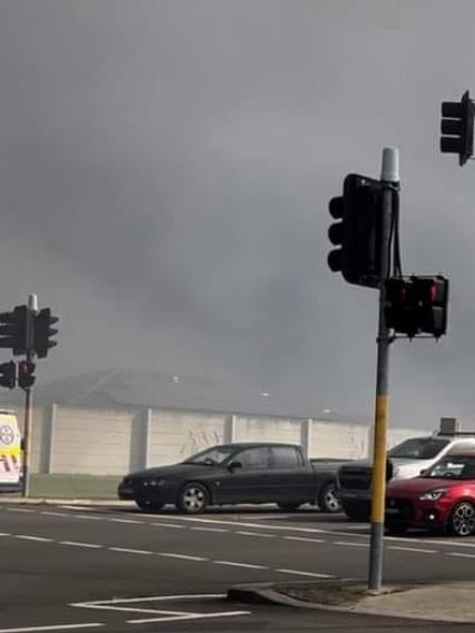
There was also a grassfire in Kanahooka, south of Wollongong, which is now under control.
All lanes of the M1 Princes Motorway have reopened after the fire.
UPDATE: The M1 Princes Mwy is now closed in both directions btwn Northcliffe Dr at Berkeley and Fowlers Rd at Dapto. Avoid the area. Use the Princes Hwy instead. pic.twitter.com/K0AX4V6qet
— Live Traffic NSW (@LiveTrafficNSW) August 28, 2024
A watch and act was also issued for Richardson Rd in Spring Farm, however firefighters have gained control of the fire.
“The fire is burning in a easterly direction towards the Mount Annan Gardens,” the NSWRFS wrote in a Facebook alert earlier on Wednesday.
“Those in the Mount Annan Gardens and surrounds should monitor conditions.
“If you are in the Mount Annan Gardens and surrounds, you should monitor conditions and be prepared to take action if required.”
WINTER BUSHFIRES HIT EARLIER IN THE DAY
The Rural Fire Service was called to a one-hectare grass fire at Yatte Yattah, near Lake Conjola, 170km south of Sydney on Wednesday morning.
That fire was being controlled as at 6.30am, according to information from the fire service.
About 30km north, firefighters have control of a small bushfire at Worrowing Heights, near Vincentia.
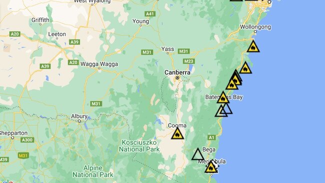
The encompassing Illawarra and Shoalhaven regions are in a state of high fire danger on Wednesday, as steady north-westerly 35 to 55km/h winds hit the area.
The Southern Ranges are also subject to a moderate fire danger warning.
The region is forecast for a maximum of 23C.
Rural Fire Service spokeswoman Victoria Quested said the unseasonable heat and strong winds were causing fires in the region.
The Yatte Yattah fire was likely caused by a downed power line about 5am on Wednesday.
Wind gusts of 80km/h were blowing through the site as firefighters arrived.
The cause of the Worrowing Heights fire that started Tuesday night was yet to be determined.
Ms Quested urged people in the region to take all the precautions they could by trimming overhanging trees and safely managing wood piles.
The Rural Fire Service had been called to multiple fires in the region in recent weeks that were caused by escaped private burns, she said.
There is not a total fire ban in place, but the fire service is warning people to be very cautious when burning off, and to check old piles so fires do not reignite.
“Fires can start any time of the year, and we need to prepare now. A lot of people have not been thinking about fire the past few years,” Ms Quested said.
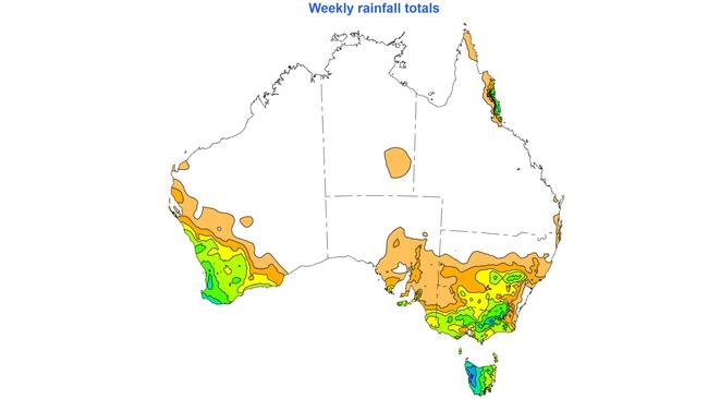
WARNING OVER DAMAGING WINDS
Strong winds have trapped two people after a tree fell on their car in Victoria’s southwest.
Emergency services are working to free the two occupants, who are believed to have been travelling along Main Road near Berrys Road in Gellibrand about 1.30pm on Wednesday afternoon.
Damaging winds have also brought power outages and trees down, with damaging wind warnings remaining in place across much of the country.
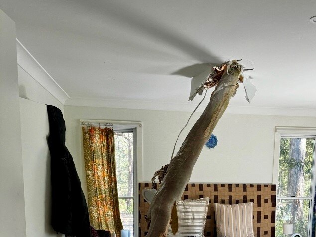
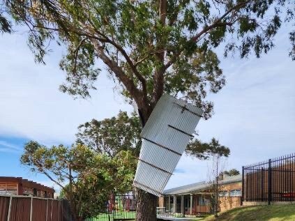
Wind gusts are expected to reach as high as 110km/h on Wednesday, according to Bureau of Meteorology senior meteorologist Angus Hines, with parts of Adelaide, Victoria, Tasmania and NSW set to experience gusts of up to 100km/h.
“Northern and western parts of Tasmania, including the islands, could see their winds blowing up to 110km/h, as well as the Illawara district in southern NSW and potentially some of the mountain tops throughout Victoria,” Mr Hines said.
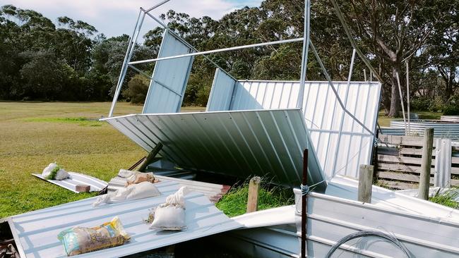
There have already been reports of trees and branches down, power outages, and damages to loose structures.
“Power outages remain possible today across the south eastern states, and damage to loose structures like outdoor furniture, rubbish bins, fences, and trampolines, all a possibility with the winds blowing through this strongly,” Mr Hines said.
“Much of central and southern Victoria will continue to see damaging wind gusts through the day on Wednesday easing off this evening.
“Southern NSW, including the Illawarra and parts of the Sydney area will also see wind gusts through this afternoon and this evening.”
Victorians were previously warned to “act now”, with people in the most heavily treed areas of the state have been asked to avoid travel as wind gusts were expected to bring down trees.
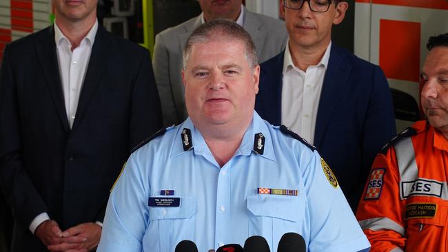
On Tuesday Victoria SES chief operations officer Tim Wiebusch said people across the state should act now to secure any loose items in yards.
“We all too often see outdoor settings, trampolines and the like becoming missiles in these events,” Mr Wiebusch said.
He has asked all Victorians to download the Vic Emergency App, which contains the latest advice issued by emergency services.
“Make sure you stay in tune with the warnings,” he said.
“That advice message provides all the latest information … around the wind phenomena, but also the coastal hazard warnings.
“As a result, we are asking Victorians to be alert on the roads, ensure that you are keeping an eye out for fallen trees and debris over the next 36 hours,” he said on Tuesday.
RAIN TO LASH SOUTHEAST
Bureau of Meteorology meteorologist Sarah Scully said cold fronts in the southeast of Australia were bringing wind, gusty showers and storms.
Victoria can expect windy conditions with showers on and south of the ranges, snow above 1200m and thunderstorms with small hail around the southwest coast and Central Coast.
Ms Scully warned that was also the same for bayside suburbs around Melbourne.
On Wednesday, Ms Scully said Melbourne would reach 18C, but it would be much cooler in Ballarat, which would peak at 13C.
Tasmania could also expect wind and widespread rain which would ease to showers across the northwest.
Ms Scully said there would also be a risk of thunderstorms and hail across the southern island as well with Hobart and Launceston reaching a high of 12C.
In Queensland, the north tropical coast could expect isolated showers while the rest of the state had dry and sunny conditions.
Ms Scully said maximum temperatures would be well above average.
“We’re forecasting 31C for Brisbane, which is 8C above the August average and even warmer than Cairns, forecasting 28C there,” she said.
NSW can expect dry and windy conditions on Wednesday, with some showers developing over the Southern Ranges and isolated showers in the Northern Ranges.
Severe Weather Warnings for damaging winds of 90-100km/h are current for parts of #WA, #SA, #Victoria, #Tasmania & #NSW. Gusts have the capacity to bring down trees, powerlines & damage property, so follow advice from your local emergency services. Latest: https://t.co/4W35o8iFmhhttps://t.co/JyFvl0XgZm
— Bureau of Meteorology, Australia (@BOM_au) August 26, 2024
“It is going to be noticeably windy, particularly for the Sydney metropolitan area and the Illawarra,” Ms Scully said.
“A maximum 28C for Sydney, much cooler for Canberra and 18C.”
South Australia will have a windy start to Wednesday but should ease by the early afternoon.
Ms Scully said there would be showers in the southern agricultural regions of SA, with Adelaide reaching a maximum temperature of 17C, but it will be much warmer inland.
Another cold front is expected to hit the southwest of Western Australia on Wednesday night otherwise it will be dry conditions throughout the day.
The southwest should have near average temperatures but it would be much warmer inland and in the northern parts of WA.
Perth can expect a high of 21C, while Karratha in the northwest of the state will reach a high of 35C.
northern Australia can expect warm and sunny conditions with humidity building in the northeast of the state, bringing a possible shower in northeast Arnhem Land.
Darwin will reach 34C, and 35C in Alice Springs.
Originally published as ‘Number of injuries reported’: two firefighters injured in Sydney grass fire


