
Warm start to winter after autumn ends with record-low temperatures
While minimum temperature records were broken in the last weekend of May, warmer days are set to usher in the start of winter.
A weekend of record-low temperatures and “giant-sized hail” in parts of the country will surprisingly usher in a “warm start to winter” this week.
Bureau of Meteorology meteorologist Sarah Scully said while a “number of May minimum records” were broken around the country, temperatures for most of the country would start to build from Wednesday.
“They will keep increasing on Thursday and by Friday we’re forecasting anywhere between 2 to 8C above the June average,” she said.
“It’s a good news story for central and eastern parts of the country which will have a mild to warm start to winter.”
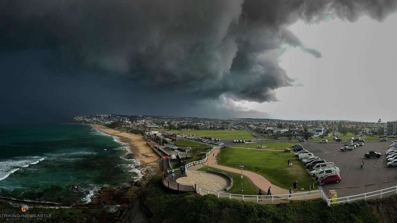
This comes after parts of the NSW Central Coast and Hunter were battered with severe thunderstorms and giant-sized hail on Friday.
The bureau classifies giant hail as being 5cm in diameter or larger, while large hail ranges from 2 to 5cm.
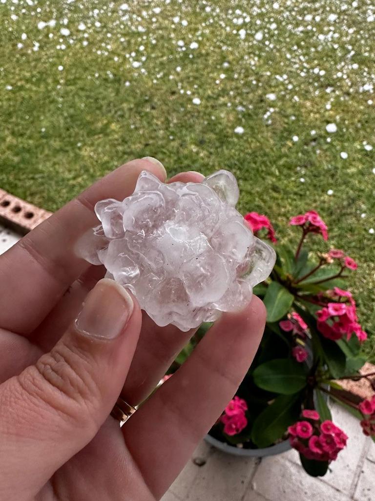

Newcastle residents reported mammoth 6cm hailstones, while several areas suffered power outages and required increased emergency services call-outs.
Clear skies and a very cold air mass over the weekend allowed temperatures to plummet, bringing very cold nights across southern, eastern and northern regions.
Several locations experienced their coldest May minimum temperatures on record, including in Sydney where the mercury in Bankstown fell to 0.7C.
“Maryborough in Queensland got down to 1.9C,” Ms Scully said.
“That’s pretty crazy, it’s just inland from Hervey Bay and just north of the Sunshine Coast.”
Temperatures at Perth airport dropped to 1.1C on Sunday, the city’s coldest May morning in 59 years, while Sydney’s Observatory Hill recorded 6.9C, its lowest in 24 years.
Multiple locations across Queensland, NSW, Western Australia and the Northern Territory all registered their chilliest May mornings in five to 11 years.
Ms Scully said we would continue to see “well-below average” minimum temperatures through central and Northern Australia until Thursday, ranging between 6 and 12C below average.
Despite the mercury dropping to unseasonably low levels, the chance of El Nino has contributed to the bureau’s long-term forecast for winter as likely being “drier and warmer than average”.
While much of the country can look forward to some warmer weather, the same cannot be said for Western Australia.
“The west has a cold front that’s going to be bringing showers and storms from Tuesday evening into Wednesday,” Ms Scully said.
“That will bring below average temperatures for southern WA.
“While the central and eastern parts of the country will be under the influence of northerly winds west of a trough, southern WA will be under the influence of much colder southerly winds.”
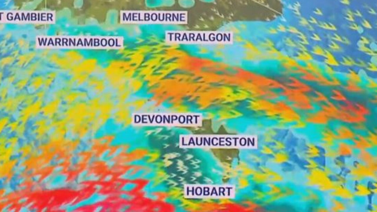
Tasmania and southern parts of Victoria could also be in for a dreary week ahead, bracing for strong winds and possible snow.
“It’s going to be really windy for Tassie this week,” Ms Scully said.
“Showery conditions and a series of cold fronts will push through throughout the week into parts of southern Victoria as well.
“There’s a series of cold fronts which have already started moving across Tasmania with the potential for small hail and snow, bringing wet and windy conditions.”
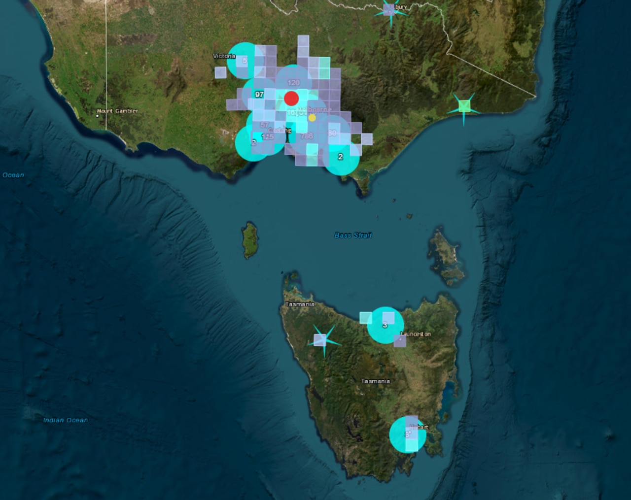
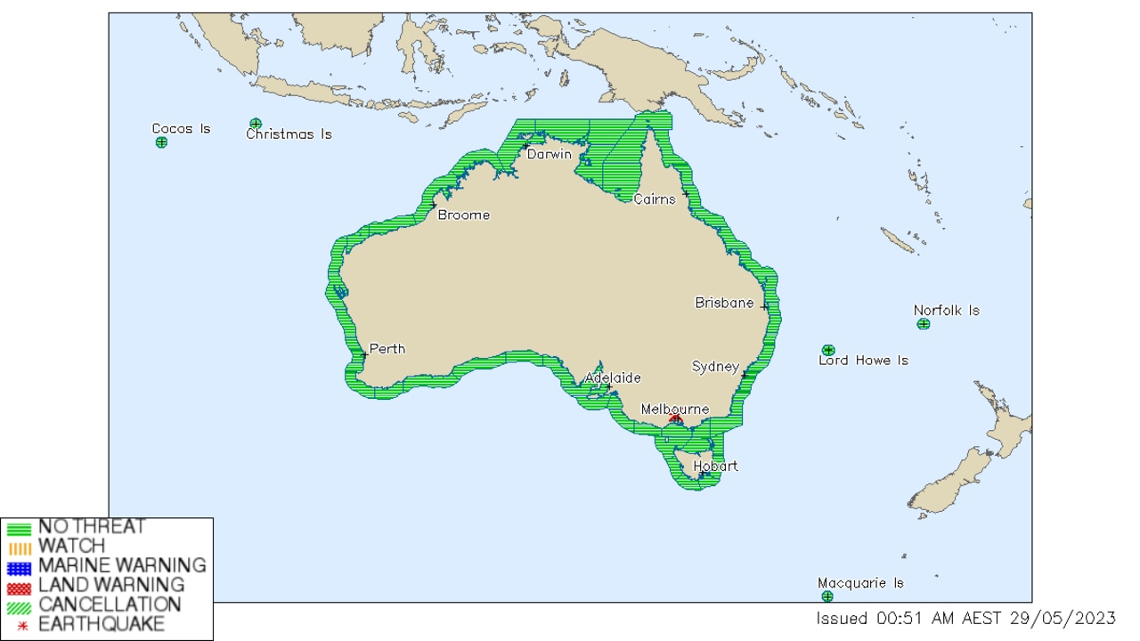
Victorians briefly trembled through a 3.8 magnitude earthquake about 11.40pm on Sunday, with the Joint Australian Tsunami Warning Centre declaring there was no threat to surrounding regions shortly after.
Looking to the week ahead, Melbourne can expect partly cloudy skies with some showers until Sunday, with temperatures staying fairly consistent between 9 and 19C each day.
Sydney will remain dry with some cloud until showers move in on Sunday. Temperatures will range from 9 to 23C.
Experiencing some smoke haze on Monday, Brisbane will continue to stay warm and sunny until showers move in at the weekend. Maximum temperatures will hover around 24C, while the mercury will dip to a low of 8C on Tuesday and Wednesday.
Adelaide can expect showers until Wednesday after which skies will remain partly cloudy before more rain moves across the city on the weekend.
Maximum temperatures will hover between 18 and 22C, warming midweek, while minimum temperatures will hang around between 12 and 15C.
Plenty of showers for Hobart with rain expected every day until Sunday. Minimum temperatures will drop as low as 4C on Friday, while maximum temperatures will range between 13 and 17C, peaking on Tuesday and Wednesday.
Canberra will have fairly mild weather, with some showers on Sunday and cloudy conditions expected throughout the week.
Minimum temperatures will dip to 3C on Tuesday, warming up to 6C on Thursday before dropping to 3C on Sunday. Maximum temperatures will range between 14 and 18C.
Perth is in for a very wet week, possibly having a break from the rain on Friday and Saturday, at which point minimum temperatures will drop as low as 6C.
Otherwise the city can expect maximum temperatures of 18 to 24C, peaking earlier in the week and gradually dropping until Sunday when the mercury will reach up to 20C.
Darwin, however, is in for a beautiful week of weather, with sunny skies earlier in the week and some slight cloud cover moving in from Thursday. Minimum and maximum temperatures will hover around 18 and 30C respectively.
More Coverage
Originally published as Warm start to winter after autumn ends with record-low temperatures

