
Unseasonable wet spell battering outback Australia enters NSW
An unusual weather pattern which dumped a months-worth of rain on outback Australia is making its way to Sydney and the southeast.
Environment
Don't miss out on the headlines from Environment. Followed categories will be added to My News.
Outback Queensland has been belted by record-breaking rains with some towns already copping 15 times their monthly rainfall in just a few days, as an icy blast sends temperatures plummeting.
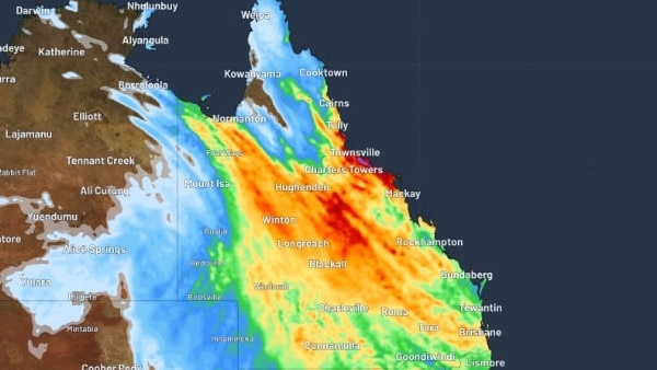
A northwest cloud band has spread heavy rains across western QLD since Friday, with regional towns such as Mt Isa and Cloncurry smashing monthly rain records between Sunday and Monday.
Mt Isa airport recorded a whopping 78.4mm over just 24 hours to Monday – about 13 times their monthly July average, breaking single-day rain records which began almost 100 years ago.
Cloncurry, east of Mt Isa, recorded about 15 times their monthly July average of just 4.3mm of rain after a staggering 64.4mm fell on the regional township in just 24-hours to Monday.
Bureau of Meteorology meteorologist Helen Reid said the state would continue to be belted by “unseasonable” rainfall as the weather system moved into the southeast of Australia.
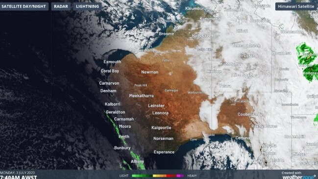
“Northern parts of Western Australia got some rainfall last week, moving into the Northern Territory and Central Australia. Now, Queensland is the next state to get some unseasonable rain,” she said.
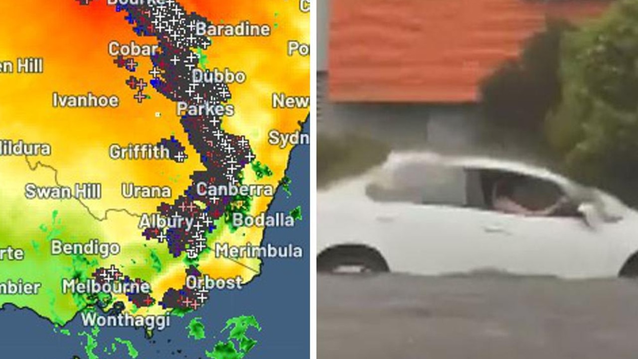
“Today, we are looking at that rainfall really contracting to the southeast and really moving into NSW and Victoria, but we‘re not expecting those rainfall figures to be quite so high in those southern states.”
Ms Reid said wet weather recorded in Sydney and NSW on Tuesday was “unusual” having come from the north of Australia and not from the south, resulting in a “grey and miserable day” in the city.
Weather Update: Weekly Weather Update. Find out what to expect across the country over the coming days. Video current at 1:30pm AEST, Monday 03 July 2023. For the latest forecasts and warnings go to our website https://t.co/4W35o8iFmh or the BOM Weather app. pic.twitter.com/N9hNurAOny
— Bureau of Meteorology, Australia (@BOM_au) July 3, 2023
“We do occasionally have these northwest clouds bands bringing through some rainfall, but it is unusual that it‘s been so widespread,” she said.
“Over the rest of July – and the next week or so – it is looking like things are returning to business as usual and things drying out again.
“That’s not to say that the weather system is not going to happen, but for the next week it’ll be more regular as this system shifts away.”
The wet weather comes after a record-breaking cold snap swept over much of the country throughout June.
Perth shivered through the coldest June in 50 years, with an average maximum temperature of just 17.4C.
This week, the Western Australian capital was forecast to reach just 16C on Tuesday and Wednesday.
Canberra – which recorded its coldest June day on record - will dip to minimum temperatures of just 3C.
Hobart, likewise, will dip to as low as 4C, while Adelaide will see temperatures as low as 7C.
In Sydney, residents woke to intermittent rains which helped drop temperatures to a maximum of 15C.
In the week ahead, Sydney will dip to minimum temperatures as low as 9C on Saturday.
Wednesday will be the hottest day with the only maximum temperature forecast to be above 20C.
Melbourne, smattered by up to 10mm of rain, will reach 12C on Tuesday, rising to 15C on Wednesday.
Low-level rain will continue there throughout the week, with minimum temps as low as 9C.
Originally published as Unseasonable wet spell battering outback Australia enters NSW

Horror hailstorm leaves family with $10k bill
A family of nine have been left devastated after their roof caved in and their house was decimated by golf-sized hailstones during a wild storm.
Shock death as storms smash southeast
Wild weather across Australia’s southeast this weekend has turned deadly – with police confirming a camper has died after being crushed by a falling tree.