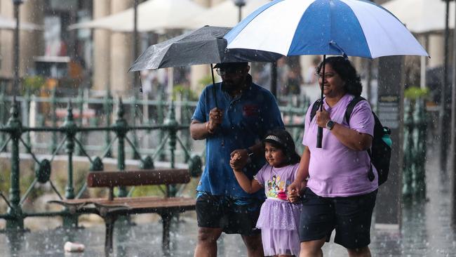
Victoria, NSW to be lashed by storms amid warning eastern states to stay wet for weeks
The state emergency service has received 337 requests for assistance and completed two rescues, as severe storms place one state on high alert.
Environment
Don't miss out on the headlines from Environment. Followed categories will be added to My News.
More than 337 requests for assistance have been made throughout Victoria, as the state battles a potentially life-threatening deluge of rain over the next 24 hours.
As of 9pm Sunday night, Victoria’s State Emergency Services (SES) has made two flood rescues across the states, with the busiest units located in Warrnambool (56 requests), Bendigo (32 requests), and Kerang (23 requests).
Photos shared on X showed entire streets in Kerang, a town on the Loddon River in northern Victoria, submerged by floodwaters.
https://twitter.com/scottie_bourne/status/1743908108186144955
https://twitter.com/IamRebekahLowe/status/1743901919725416659
At 7.43pm, the Bureau of Meteorology has issued a flood watch for Gippsland, Central and Northern Victoria, as a low pressure system moves eastwards across the state, with severe storms and heavy downpours set to continue on Monday.
The weather authority has warned “widespread rainfall” of more than 100mm will hit the flood watch areas from Sunday night, with the potential for isolated moderate flooding from Monday morning.
The deluge is forecast to remain until Tuesday, with the rains and showers expected to gradually ease throughout the day.
A severe thunderstorm warning for heavy rainfall, damaging winds and large hail stones has also been issued for residents in Mallee and parts of Northern Country and Wimmera forecast districts, including the possibility of flash flooding.
At 4.45pm, one rain meter at Warrnambool Airport recorded 43mm of rain in just one hour alone.
People have been urged not to drive through floodwaters, monitor forecast and warning, and be prepared to move to higher ground should flooding develop.
https://twitter.com/vicsesnews/status/1743929634801000940
A similar weather warning has also been issued for parts of NSW including Wagga Wagga and Deniliquin.
Victoria’s emergency management commissioner Rick Nugent on Saturday warned the state could receive totals of around 150mm of rain, but warned there could be upwards of 200mm across the state.
He urged Victorians to bunker down, “especially people staying in caravan parks and camping along creeks and waterways”.
The state’s rivers and creeks are already quite full after weeks of recent rain, increasing the chance of flash flooding.

Meanwhile, any hope of respite from the wet weather and severe storms that have lashed the country for weeks has been dispelled, with a new warning Australia’s eastern states are likely to face more weeks of wet weather and a meteorologist criticising a “common misconception” that an El Nino summer guaranteed dry conditions.
Sky News meteorologist Alison Osborne said there was a “high chance of above-average rain through northeastern and eastern Australia” before the conditions begin to dry out in February.
She said the “spiteful” positive Southern Annular Mode (SAM) – a ring of westerly winds that hug Antarctica – was promoting easterly winds and driving rains across Australia’s east coast.
“That is pretty difficult to predict in advance beyond a couple of weeks, but at the moment that has been a big driver of the rain and storm events through eastern Australia in particular,” she said.
“That thing has been wobbling positive since early December, and it’s likely to remain that way for at least the next two weeks.”

Ms Osborne’s warning of a wet January rings true for this weekend.
The Bureau of Meteorology had forecast “lingering” wet weather that would develop at the weekend and into next week.
The bureau’s senior meteorologist Angus Hines said widespread rainfall would hit areas of Tasmania, Victoria and “most of” NSW.
“When you combine the wet weather in the east and the south with the daily storms in the north, (you’ll be) pretty hard pressed to find parts of central and eastern Australia that have a dry three-day stretch ahead,” he said.
“Most of the country is lining up for some form of wet weather.”

The wet weather prediction comes despite an El Nino alert, which has been active since September.
However, Ms Osborne said it was a ”very commonly held misconception” that El Nino meant reduced rainfall in the summer months.
“The influence of rain from El Nino from November onwards is pretty marginal through eastern Australia,” she said.
In comparison, an La Nina alert was a stronger influence on rainfall patterns, leading to higher levels of precipitation and lower temperatures.
There is a deep-held belief that El Nino means a dry summer.... data below from The BOM shows that this is very often not the case - over 14 separate El Nino events, rain has been close to average over large parts of the nation. El Nino isn't a 'Magic' that turns the taps off. pic.twitter.com/0v26bJ9OdY
— Alison Osborne (@Alison_Osborne_) December 30, 2023
However from February, the moisture is predicted to dissipate, bringing “quite a high chance of above-average temperatures and quite a decent chance of temperature extremes through the northern tropics and the northwest”.
While the temperatures might not be as dramatic in areas across southeast NSW, Canberra and southern Queensland, Ms Osborne said “everywhere else is skewing normal or unusually warm”.
The threat of bushfires could also ramp up, as drier conditions take hold in February.
While the immediate threat is hampered for a time after it rains, with Ms Osborne noting “it’s pretty hard to light a wet match”, the rain could also encourage new vegetation growth that could promote fires once the heat and dry conditions return.
“If there is a swing back to drier-than-average conditions, combined with high heat, then that can change things quick quickly,” she said.
Originally published as Victoria, NSW to be lashed by storms amid warning eastern states to stay wet for weeks


