
Tasmanian scientist’s Earth Dynamics Geodetic Explorer mission selected by NASA
NASA is working on a satellite set to offer unprecedented access to mapping Antarctica’s ice sheets and more. Two Tasmanians have been offered a rare opportunity.
Tasmania
Don't miss out on the headlines from Tasmania. Followed categories will be added to My News.
Tasmanian Antarctic scientists have been selected by NASA to develop a satellite which monitors the dynamic shifts in Earth’s glaciers, sea-ice and vegetation.
Collaborating in an international team at the University of California in San Diego, University of Tasmania’s Australian Antarctic Program Partnership sea-ice remote sensing research associate Dr Alex Fraser and Australian Antarctic Division sea-ice physicist Dr Petra Heil are working on the Earth Dynamics Geodetic Explorer (EDGE) mission proposal.
It comes as NASA has selected four mission proposals, ranging from greenhouse gases to sea ice, to each receive $5m USD to create a mission concept study.
NASA will choose two proposals which will be launched in 2030 and 2032.
Dr Fraser said the team’s proposal includes a satellite which will measure Earth’s vegetation cover and frozen cryosphere.
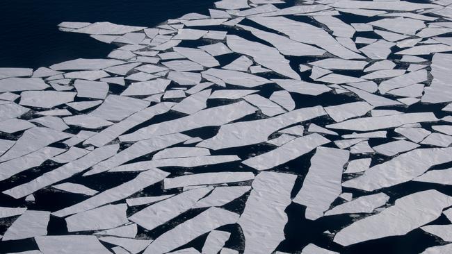
Using high-resolution satellite laser altimeters, scientists would be able to observe the three-dimensional structure of land-based ecosystems and the surface topography of glaciers, ice sheets and sea ice as it changes rapidly from human activity.

“Laser altimetry from space has become a key tool in our understanding of sea ice. Thanks to satellite laser altimetry, we have a much better understanding of the thickness of individual ice floes, as well as how far ocean waves can travel through ice in the marginal ice zone,” Dr Fraser said.
“The next-generation satellite instrument we want to build will have 40 laser beams, compared to the six beams in the current altimeter on NASA’s ICESat-2.
“Our EDGE satellite will be capable of measuring vertical differences with an accuracy of less than three centimetres from an orbit 390km above the Earth.
“For our Antarctic research, this will provide unprecedented year-round information about the thickness and roughness of sea ice in extremely high resolution.”
After working on the proposal alongside US-based partners for more than two years, Dr Heil said she was excited the EDGE mission passed the first hurdle.

“Despite recent progress in satellite altimetry, their sparse coverage and low repeat rates do not allow us to measure the short-term changes in the ice thickness, which are proxies for the dynamic changes to ice volume,” she said.
“An instrument with the capability of EDGE would revolutionise our understanding of the physics of the sea ice and give us a better grasp on the processes causing changes in its volume.
“The role of sea ice within the climate system is in the spotlight following the recent deficit in both Antarctic summer and winter sea-ice extent.”


‘Natural leader’: Popular police officer and footballer mourned
Sgt Adam “Rex” Eastley was a popular police officer and footballer. Read the tributes to the father of two young daughters.

Elderly pedestrian struck by vehicle dies after hospital battle
Police have confirmed a man who was struck by a vehicle in Hobart’s CBD more than a week ago has died in hospital.