
Tasmania weather update: Evacuation centre at New Norfolk due to flood risk
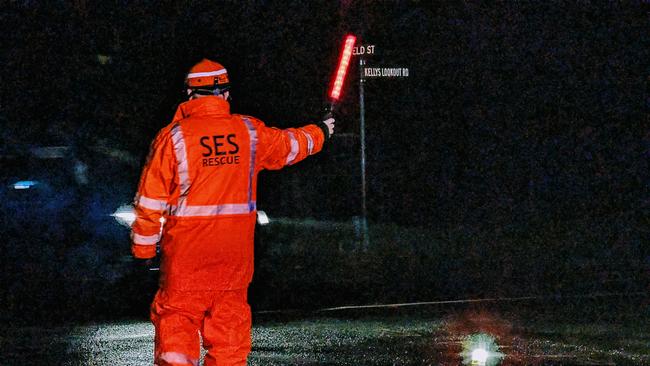
SES advice “could save your life”, Minister says as he warns of more dangerous situations to come. Photos from the flooding event impacting the Derwent Valley >>
Tasmania
Don't miss out on the headlines from Tasmania. Followed categories will be added to My News.
Wild weather continues to strike across Tasmania on Sunday, September 1. Here’s The Mercury’s rolling coverage with the latest.
‘More dangerous situations’ on the horizon: Minister
3.15pm: Police, Fire and Emergency Management Minister Felix Ellis has warned Tasmanians that the worst of the wild weather the state has experienced over the last few days is yet to come.
“Over the coming days, we will see more dangerous situations for Tasmanians, and it’s just so important that Tasmanians follow specific rules,” Mr Ellis said.
“Make sure that when you’re on our roads you’re driving to the conditions, but never enter flood waters.
“The number one cause of death in flooding is people driving through flood waters.
“It may look safe to do so — but the road itself may be washed away, and there may be swift and dangerous currents — so please heed the advice of emergency services; it could save your life.”
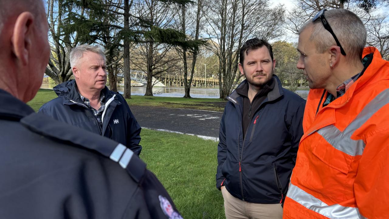
Premier Jeremy Rockliff said that the West Coast, Derwent Valley and Central Highlands municipalities were among the most impacted by the wild weather and had spoken to the mayors of those council areas.
“I have assured local mayors that we are ready for emergency assistance grants to provide to councils,” Mr Rockliff said.
“There’s no doubt going to be quite some damage when it comes to fallen trees and roads.”
Mr Rockliff said that emergency assistance grants were now available in affected areas of up to $250 for individuals and $1000 for families.
The flood damage includes the Styx River Bridge that had been under construction.
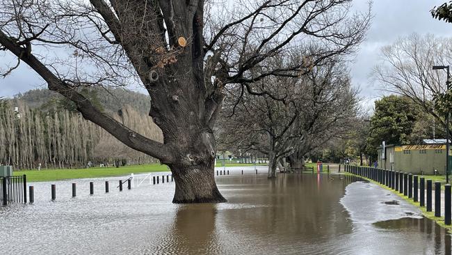
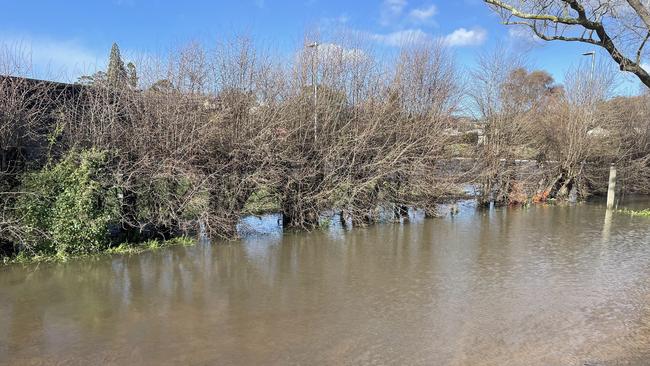
Further flood warnings at the state’s major waterways have been issued in addition to the emergency warning for communities along the Derwent River.
A monitor conditions alert for minor flooding for the Huon River has been issued with Harrisons Opening to Judbury and surrounds areas likely to be impacted.
The Meander River is also threat for moderate flooding that could impact: Deloraine, Reedy Marsh, Exton, Westbury, Quamby Bend, Hagley Selbourne, Strathbridge, Westwood, Carrick, Hadspen and surrounds.
Those living near the Mersey River in the state’s North-West are being urged to monitor conditions with Kimberly to Latrobe and surrounds likely to be affected.
Flood alert issued, winds set to increase after lull
2pm: The west coast has been warned to brace for abnormal high and damaging tides.
Authorities have issued a watch and act alert for Strahan and surrounds to monitor conditions with flooding in the Harbour, streams and rivers likely.
They warn lives could be at risk from flood waters.
Residents are asked to act on their flood emergency plan and to prepare their property if safe to do so.
If conditions worsen and it’s safe to do so, the SES has urged people to leave and go to the home of a family member or friend who is in a safe location.
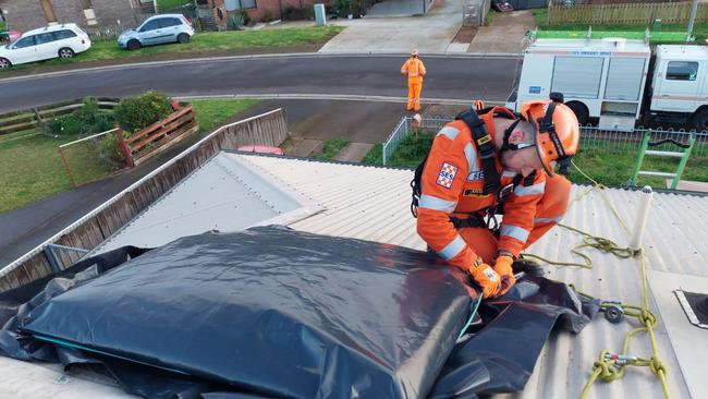
Additionally, Tasmania’s State Emergency Service is urging vigilance with severe weather conditions and flooding forecast for several areas.
An Emergency Warning to prepare to leave has already been issued for communities along the Derwent River between Meadowbank to Macquarie Plains and Styx River, Bushy Park to Macquarie Plains and surrounds in the south of the state.
Tasmania SES executive director Mick Lowe said there was a risk of properties in this area becoming inundated by flood waters and isolated due to roads becoming inaccessible.
He confirmed the SES had received 323 requests for help across the state in the past 24 hours.
Winds did ease over the morning however the threat of damaging gusts wasn’t over for most parts of the state throughout the day, he warned.
“This is a dynamic situation which is being closely monitored, and we need people to make good decisions and stay safe,” Mr Lowe said.
“We cannot stress enough – if it’s flooded, forget it – never enter or drive through floodwaters.
“One of the best ways to do this is to stay informed of the conditions and warnings.”
He thanked the dedicated SES volunteers who were helping communities through the protracted weather event: “your efforts are greatly appreciated.”
Derwent Valley communities urged to prepare to leave
11.30am: A flood emergency warning has been upgraded for communities along the Derwent River between Meadowbank to Macquarie Plains and surrounds.
The Bureau of Meteorology has issued a major flood warning for the area with locations likely impacted: Meadowbank, Glenora, Bushy Park, Gretna, Macquarie Plains and surrounds.
It predicts over the next four to 48 hours some properties are likely to become isolated and/or inundated by flood waters. Flood waters are a threat to safety, and likely to threaten property, livestock and equipment in the affected areas.
Anyone who lives in the alert area and/or near the Derwent River have been advised by SES to:
- If you have a flood emergency plan, use it now.
- Prepare your property (if safe to do so). This may include:
- Having your emergency kit available and be ready to leave
- Placing furniture and possessions high on tables/benches
- Move livestock and equipment to higher ground
- If conditions worsen and safe to do so, leave and go to the home of family or friends in a safe location away from the flood affected area.
- Contact family members, friends, and neighbours to alert them of the potential for flooding.
- For flood updates, visit TasALERT.com
Traffic light outages hit major Launceston junctions
11am: State Growth is experiencing high demand for its services to rectify storm-related road issues with major Launceston junctions the latest hit.
Power outages have caused traffic light outages in Launceston, including busy junction of Midland Highway and Howick St.
Tasmania Police have released a statement saying State Growth had been advised of the issue and were attending to rectify it as soon as possible.
“Motorist are asked to take care when approaching affected intersections,” a Tasmania Police spokesperson said.
Reports people are disregarding flood alerts
10.15am: Residents of the Derwent Valley have already begun heading to the emergency evacuation centre at the New Norfolk Sports Centre.
More will be expected to arrive at the centre over Sunday as SES volunteers doorknock homes that could soon be impacted by flooding.
The New Norfolk Caravan Park was also moved to Boyer Oval after flooding spread through its riverfront location.
Derwent Valley Council Mayor Michelle Dracoulis is encouraging residents to heed flood warnings though, with reports people were going out onto pontoons on the Derwent River despite safety concerns.
“We urge people to please stay out of flood waters,” she said.
“Not only is it a risk to themselves, it’s a risk for emergency services who will need to rescue you.”
Power outages lead to widespread mobile outages
9am: Power outages have disconnected 38 Telstra mobile sites with northern Tasmania hardest hit.
Telstra regional engagement manager Marc Brown confirmed the number on Sunday morning and included approximately 2000 properties also had their landline service cut.
He said a backup battery supply extended coverage overnight for a number of hours, however the sites rely on mains power to operate.
“We have had technicians working overnight and they will be back on the road again today with temporary generators, restoring services when it is safe to do so and we can access the impacted sites,” he said.
“In good news, it appears our base stations haven’t suffered any major damage, so we expect once we get the electricity flowing again, mobile coverage should be restored.”
The impacted mobile base station locations include Arthur River, Blackwall, Blessington, Boat Harbour, Branxholm, Cambridge, Cygnet, Derby, Goulds Country, Irishtown, Lebrina, Lilydale, Lulworth, Marrawah, Maydena, Nabowla, Pencil Pine, Pipers Brook, Port Latta, Preolenna, Redpa, Rocky Cape, Rosetta, Sassafras, Scotchtown, Sisters Beach, South Mt Cameron, Strathgordon, Table Cape, Temma, Tomahawk, Tullah, Weldborough, Weymouth and Yolla.
It is understood other communication companies are also being significantly impacted by last night’s storm event.
Evacuation centre opens in New Norfolk
INITIAL: People in low-lying areas of Meadowbank, Glenora, Bushy Park, Gretna and Macquarie Plains must prepare for possible flooding or isolation.
Alerts have been issued for flooding of the Derwent River and authorities have warned flooding has the potential to leave people isolated for several days.
Tasmania SES executive director Mick Lowe said a Flood Watch and Act (prepare to leave) has been issued for Derwent River, Meadowbank.
“Tasmania SES has issued a Flood Watch and Act for communities along the Derwent River between Meadowbank and Macquarie Plains,” he said.
“People in low-lying areas of Meadowbank, Glenora, Bushy Park, Gretna, Macquarie Plains must prepare for possible flooding or isolation.
“This flooding has the potential to leave people isolated for several days.
“Please prepare now to go to a safer place if conditions become more dangerous.”
They have asked people to consider going to stay with family or friends and make the decision to leave as early as possible as parts of the Lyell Highway and Glenora and Boyer Roads may become flooded.
“If flooding in your area occurs, remember, never drive or enter floodwaters,” Mr Lowe said.
An evacuation centre has opened at Derwent Valley Sports and Recreation Centre, 50 Derwent Terrace, New Norfolk.
Across Tasmania, there was a surge of SES call outs with crews responding to more than 330 requests for assistance in the last 24 hours across the state.
There are 17 warnings in place currently, including four watch and act warnings. Those alerts are:
- Flood Watch & Act – Derwent River, Meadowbank and Macquarie Plains and surrounds – Prepare to Leave
- Flood Watch & Act – North Esk, Corra Linn to Mowbray and surrounds – Monitor conditions as they are changing
- Flood Watch & Act – Meander River, Westwood and surrounds – Monitor conditions as they are changing
- Flood Watch & Act – Derwent River, Bushy Park to Hayes, New Norfolk and surrounds – Monitor conditions as they are changing
More power outages expected: TasNetworks
Southern Tasmania has avoided the worst of the power outages with only 20 reported in the region while a further 117 outages have occurred in the north and north-west.
TasNetworks says around 30,000 customers are without power on Sunday morning expect the number to rise.
“Customers are advised to prepare for long delays,” an update said.
“Destructive winds have blown vegetation and debris into the network, damaged electrical equipment and brought down trees and powerlines.”

Roads remain a hazard
Overnight, the hazardous conditions triggered an alert for motorists including the busy Bridgewater Bridge.
That warning has now lifted, however a number of Tasmanian roads remain impacted from overnight storms.
The following road closures as of 11.30am:
- Anthony Road (Henty development road) – closed
- Bridle Track Road, Kimberley – from Beulah Road to Kimberley Road.
- Dove Lake Road, Cradle Mountain
- Edinborough Rd Abbotsham, closed adjacent to No 100, can be accessed from either end – no through traffic.
- Esplanade, Huonville – Closed due to flooding
- Fishers Tier Road, Deddington – flooding over bridge.
- Gordon River Road – Maydena to Strathgordon due to a tree on the road near the Russell Fall turnoff. Other trees likely to fall.
- Gordon River Road – Closed at Bushy Park between Derwent River bridge and Glenora road – flooding
- Heemskirk Road – Reece Dam to Granville Harbour
- Highland Lakes Road – closed at the two junctions with Haulage Road – detour onto Haulage Road.
- Ironcliffe Road, Penguin near the Ferndene Track – closed due to power lines across the road.
- Lake Augusta Road from Highland Lakes Road junction – closed due to snow fall.
- Lyell Highway, both directions from Queenstown to Derwent Bridge – trees over road – road blocked.
- Murchison Highway, from the Zeehan Highway intersection to Rosebery.
- Pelverata Road, Pelverata between Vincents Road and Umfrevilles Road.
- Pieman Road, Tullah – Between Reece Dam and Murchison Highway – closed due to power lines across the road.
- Pinnacle Road, kunanyi/Mount Wellington is closed at The Springs – vehicles longer than nine metres cannot go beyond the lower springs car park as traffic restrictions are in place.
- Richmond Road, Cambridge near the Barilla Caravan Park – trees fallen over power lines.
- Roses Tier Road, Blessington near the Fire Station – Removing Power Lines & Trees – Alternate Route via New Tier Road
- Sky Farm Road Claremont – closed due to poor conditions – the council have advised that the established alternate route has also deteriorated and is suitable for light 4WD vehicles only
- Sunnyside Road, Railton between Gambles Road and Hardwicks Road – closed due to power lines across the road
- Waratah Road Warratah
Further roads have been labelled hazardous by Tasmania Police, which include:
- Anthony Beach Road, Smithton between Smithton and Stanley – tree blocking road
- Brownell Street, Geeveston – fallen tree branches.
- Causeway 1 – Seven Mile Beach to Midway Pt – sea water and rock debris on the road.
- Highland Lakes Road between Poatina junction to Miena – snow reported
- Irishtown Road, Smithton 1km from Bass Highway intersection – tree blocking the road
- Lake Dobson Road – 4WD ONLY
- Lyell Highway from Ouse to Derwent Bridge – snow reported
- Highland Lakes Road: 20mm Snow patches from Pine Lake to Breona. 4×4 or 2wd with chains. Road closed at Haulage Hill, detour in place.
- She Oak Road, Judbury – trees across the road.
- Tasman Highway, Springfield (Sideling) – trees across the road.
- Waterhouse Road, Waterhouse – power lines down and across the road
- Yanns Road, Rocky Cape – power lines down and across the road
Storm-force winds impact vessels
Meanwhile, the weather has also caused delays in shipping, including visitors to Tasmania on the Spirit — with the vessel delaying its night time sail on Saturday and is expected to leave Devonport for Geelong this morning.
An additional day sailing from Geelong to Devonport for Sunday has been rescheduled to Monday and the Sunday night sailing from Devonport has been cancelled, the company confirmed yesterday.
Storm-force winds also impacted every port in Tasmania, TasPorts CEO Anthony Donald said on Saturday afternoon.
He said the priority was the safety of port users, vessels and port infrastructure during the wild weather.
At that time he said TasPorts would continue to monitor the situation with wild weather expected to continue.
More Coverage


‘Dangerous’: Lawyers concerned about crackdown on knives
Proposed new laws allowing police to search anyone they suspect might be carrying a knife represent a “significant and dangerous increase in police powers,” the Australian Lawyers Alliance says.

‘Tasmania cannot afford not to build the stadium’: Premier
Jeremy Rockliff pledges to “never give in to the naysayers” as both major parties back the construction of the proposed AFL stadium at Macquarie Point after a scathing report.